| Well Information Table |
|---|
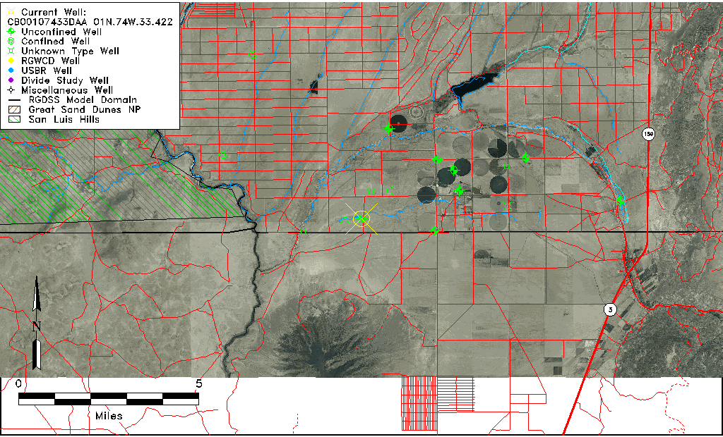
| Common Well ID | CB00107433DAA 01N.74W.33.422 |
| USGS Well ID | 365958105403001 |
| USGS Station Name | CB00107433DAA 01N.74W.33.422 |
| USGS Construction Date | 01/01/1954 |
| USGS Site Type | Well |
| USGS Site Use Information | Unused |
| USGS Groundwater Use Information | Unused |
| Data Source(s) | USGS |
| Location Data |
|---|
| TRS | CB00107433DAA 01N.74W.33.422 |
| USGS TRS 1 | CB00107433DAA 01N.74W.33.422 |
| USGS TRS | NENESES033T0001NR0074WC |
| Longitude/Latitude (NAD83) | -105.66498510 , 37.00126967 |
| Longitude/Latitude Data Source | GWSI decimal LAT/LONG field |
| USGS Longitude/Latitude (NAD83) | -105.6649851 , 37.00126967 |
| Easting, Northing RGDSS-NAD83 (US ft) | 202655.47 , 1980.98 |
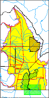
| USGS County | Costilla County |
| Elevation and Depth Data |
|---|
| Ground Elevation (ft NAVD88) | 7504.13000000000 |
| Elevation Data Source | USGS GWSI database |
| USGS Ground Elevation (ft NGVD29) | 7500.00 |
| 1/3-Arc Second NED Ground Elevation (ft NAVD88) | 7506.81 |
| 1-Arc Second NED Ground Elevation (ft NAVD88) | 7507.27 |
| SRTM Ground Elevation (ft NAVD88) | 7506.56 |
| Total Depth (ft) | 230.00 |
| USGS Well Depth (ft) | 230.00 |
| Model Layer | 1 |
| Model Layer Source | Well Depth |
| Depth of Bottom of Layer 1 | 259 |
| Depth of Bottom of Layer 2 | 359 |
| Depth of Bottom of Layer 3 | 462 |
| Depth of Bottom of Layer 4 | 1051 |
| Additional Well Information | Geohydrology, Construction |
| Aquifer Information |
|---|
| Aquifer Type | Unconfined |
| Aquifer Type Source | TD Elevation/Model Layer |
| USGS Primary Aquifer | Cenozoic Erathem |
| USGS Aquifer Type | Unconfined Single Aquifer |
| USGS Hydrologic Unit | Upper Rio Grande |
| USGS Data Available | Water-level (GW.LEV) |
| Water-level Database Information |
|---|
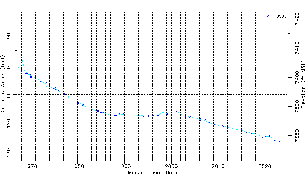
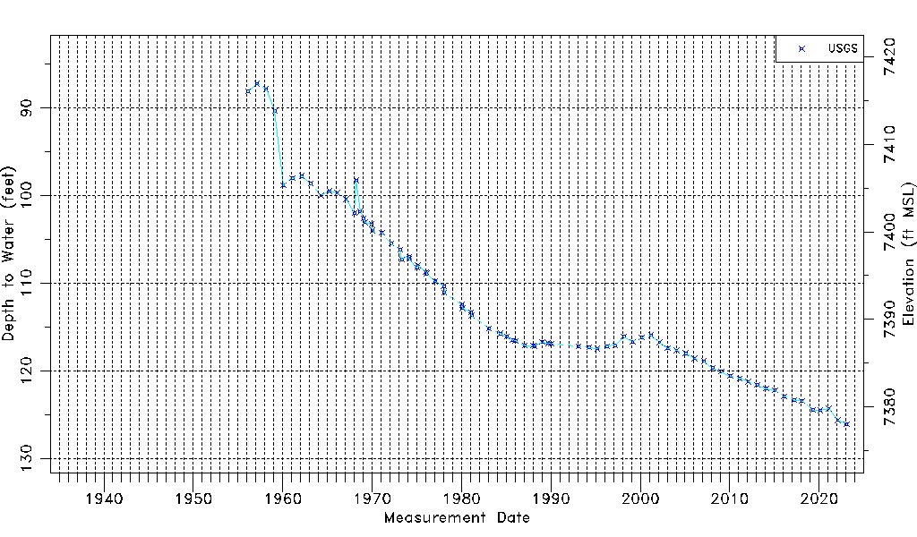
| Water-level Count | 79 |
| Water-level Date Range | 02/21/1956 thru 01/24/2023 |
| Monitored within the last 18 months | Yes, most recently on 01/24/2023 |
| Depth-to-Water Range (ft) | 87.22 to 126.09 |
| Water Table Elevation Range (ft NAVD88) | 7378.04 to 7416.91 |
| Water-Level-Source:Number-of-Measurements | USGS:79 |