| Well Information Table |
|---|
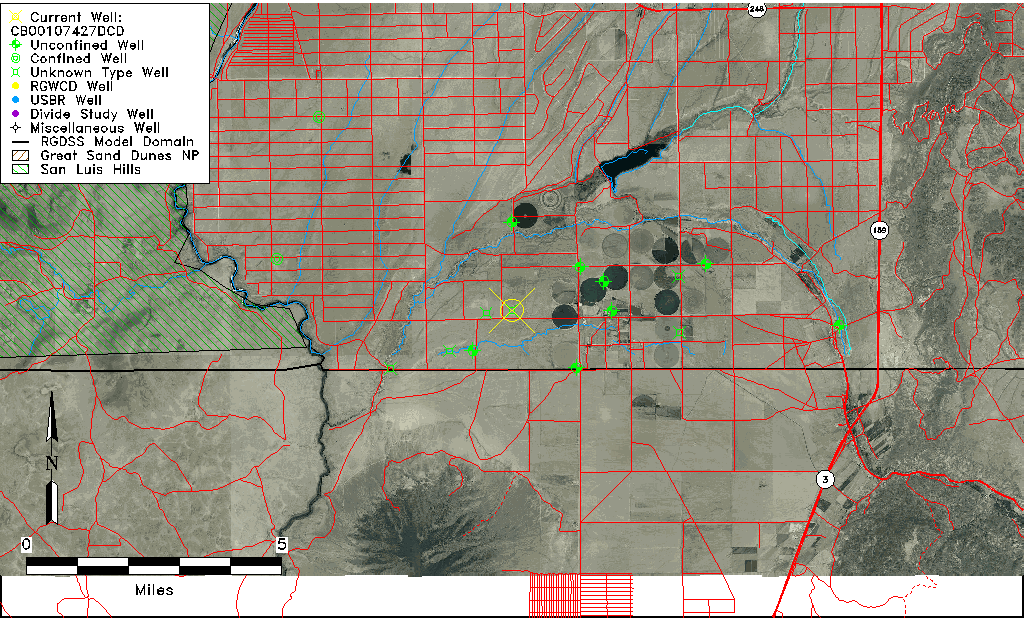
| Common Well ID | CB00107427DCD |
| USGS Well ID | 370028105393501 |
| USGS Station Name | CB00107427DCD |
| USGS Site Type | Well |
| USGS Site Use Information | Unused |
| USGS Groundwater Use Information | Unused |
| Data Source(s) | USGS |
| Location Data |
|---|
| TRS | CB00107427DCD |
| USGS TRS 1 | CB00107427DCD |
| USGS TRS | SESWSES027T0001NR0074WC |
| Longitude/Latitude (NAD83) | -105.65115160 , 37.01265836 |
| Longitude/Latitude Data Source | GWSI decimal LAT/LONG field |
| USGS Longitude/Latitude (NAD83) | -105.6511516 , 37.01265836 |
| Easting, Northing RGDSS-NAD83 (US ft) | 206692.62 , 6126.96 |
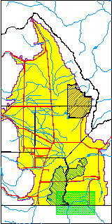
| USGS County | Costilla County |
| Elevation and Depth Data |
|---|
| Ground Elevation (ft NAVD88) | 7559.14000000000 |
| Elevation Data Source | USGS GWSI database |
| USGS Ground Elevation (ft NGVD29) | 7555.00 |
| 1/3-Arc Second NED Ground Elevation (ft NAVD88) | 7557.07 |
| 1-Arc Second NED Ground Elevation (ft NAVD88) | 7557.67 |
| SRTM Ground Elevation (ft NAVD88) | 7557.37 |
| Depth of Bottom of Layer 1 | 304 |
| Depth of Bottom of Layer 2 | 404 |
| Depth of Bottom of Layer 3 | 493 |
| Depth of Bottom of Layer 4 | 1072 |
| Additional Well Information | Geohydrology, Construction |
| Aquifer Information |
|---|
| Aquifer Type | Unknown |
| Aquifer Type Source | None |
| USGS Primary Aquifer | Cenozoic Erathem |
| USGS Aquifer Type | Unconfined Single Aquifer |
| USGS Hydrologic Unit | Upper Rio Grande |
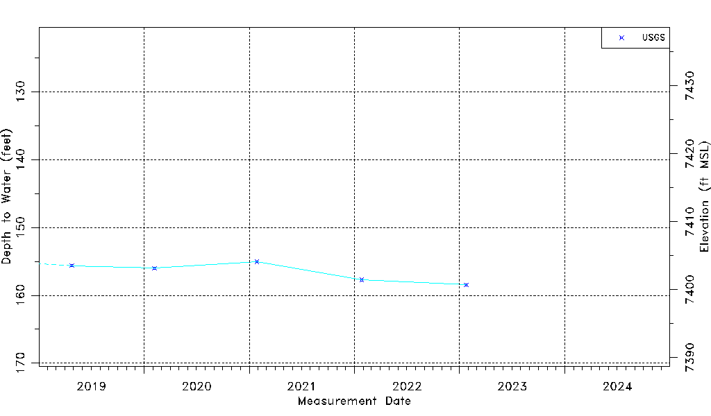
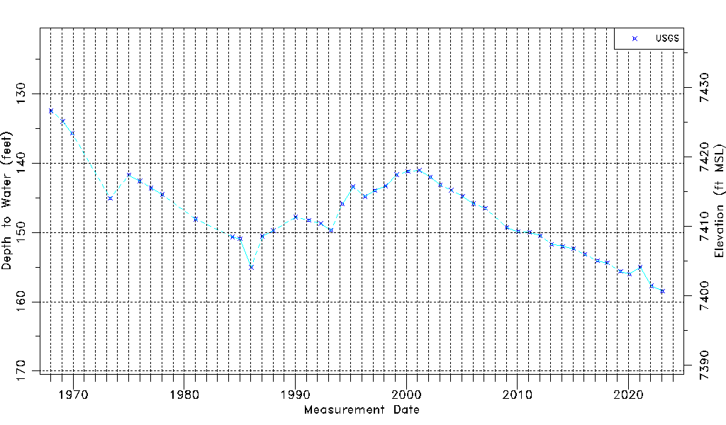
| USGS Data Available | Water-level (GW.LEV) |
| Water-level Database Information |
|---|
| Water-level Count | 47 |
| Water-level Date Range | 01/12/1968 thru 01/24/2023 |
| Monitored within the last 18 months | Yes, most recently on 01/24/2023 |
| Depth-to-Water Range (ft) | 132.47 to 158.46 |
| Water Table Elevation Range (ft NAVD88) | 7400.68 to 7426.67 |
| Water-Level-Source:Number-of-Measurements | USGS:47 |