| Well Information Table |
|---|
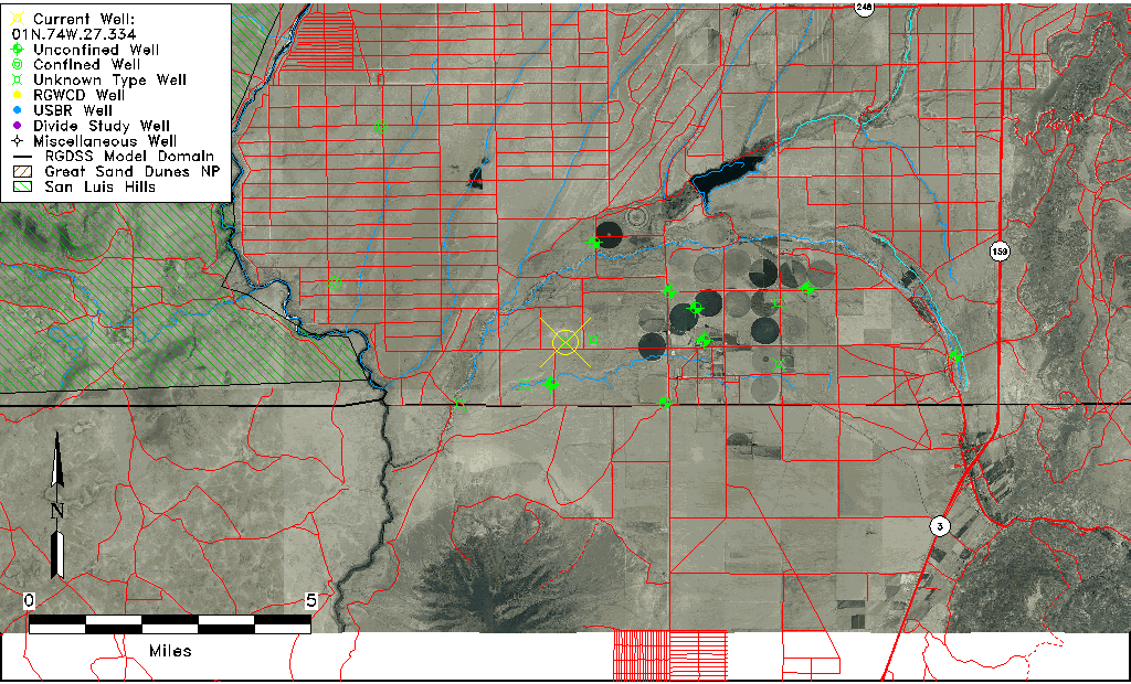
| Common Well ID | 01N.74W.27.334 |
| USGS Well ID | 370043105393501 |
| USGS Station Name | 01N.74W.27.334 |
| USGS Site Type | Well |
| USGS Site Use Information | Unknown |
| USGS Groundwater Use Information | Unknown |
| Data Source(s) | USGS |
| Location Data |
|---|
| TRS | 01N.74W.27.334 |
| USGS TRS 1 | 01N.74W.27.334 |
| USGS TRS | SESWSWS27 T01N R74W |
| Longitude/Latitude (NAD83) | -105.66029070 , 37.01196380 |
| Longitude/Latitude Data Source | GWSI decimal LAT/LONG field |
| USGS Longitude/Latitude (NAD83) | -105.6602907 , 37.01196380 |
| Easting, Northing RGDSS-NAD83 (US ft) | 204025.16 , 5873.54 |
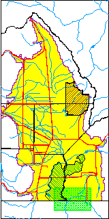
| USGS County | Costilla County |
| USGS Map Name | SKY VALLEY RANCH, CO |
| USGS Map Scale | 24000 |
| Elevation and Depth Data |
|---|
| Ground Elevation (ft NAVD88) | 7544.13000000000 |
| Elevation Data Source | USGS GWSI database |
| USGS Ground Elevation (ft NGVD29) | 7540.00 |
| 1/3-Arc Second NED Ground Elevation (ft NAVD88) | 7545.32 |
| 1-Arc Second NED Ground Elevation (ft NAVD88) | 7547.50 |
| SRTM Ground Elevation (ft NAVD88) | 7545.93 |
| Depth of Bottom of Layer 1 | 290 |
| Depth of Bottom of Layer 2 | 390 |
| Depth of Bottom of Layer 3 | 480 |
| Depth of Bottom of Layer 4 | 1063 |
| Additional Well Information | NONE |
| Aquifer Information |
|---|
| Aquifer Type | Unknown |
| Aquifer Type Source | None |
| USGS Hydrologic Unit | Upper Rio Grande |
| USGS Data Available | Water-level (GW.LEV) |
| Water-level Database Information |
|---|
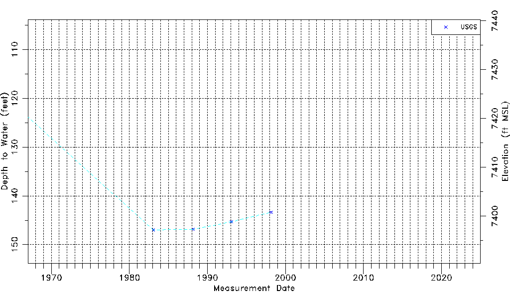
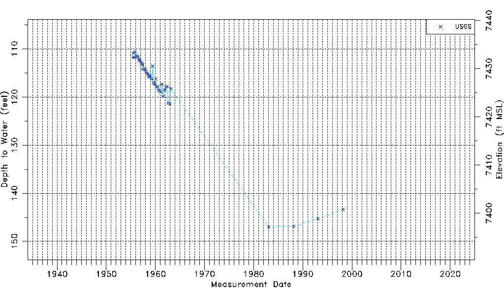
| Water-level Count | 46 |
| Water-level Date Range | 07/14/1955 thru 03/03/1998 |
| Monitored within the last 18 months | No, most recently on 03/03/1998 |
| Depth-to-Water Range (ft) | 110.68 to 146.98 |
| Water Table Elevation Range (ft NAVD88) | 7397.15 to 7433.45 |
| Water-Level-Source:Number-of-Measurements | USGSaguache Creek:46 |