| Well Information Table |
|---|
| Common Well ID | CB00107320DCC |
| USGS Well ID | 370120105351501 |
| USGS Station Name | CB00107320DCC |
| USGS Construction Date | 01/01/1957 |
| USGS Site Type | Well |
| USGS Site Use Information | Withdrawal of Water |
| USGS Groundwater Use Information | Irrigation |
| Data Source(s) | USGS |
| Location Data |
|---|
| TRS | CB00107320DCC |
| USGS TRS 1 | CB00107320DCC |
| USGS TRS | SWSWSES020T0001NR0073WC |
| Longitude/Latitude (NAD83) | -105.58256700 , 37.02585316 |
| Longitude/Latitude Data Source | GWSI decimal LAT/LONG field |
| USGS Longitude/Latitude (NAD83) | -105.5825670 , 37.02585316 |
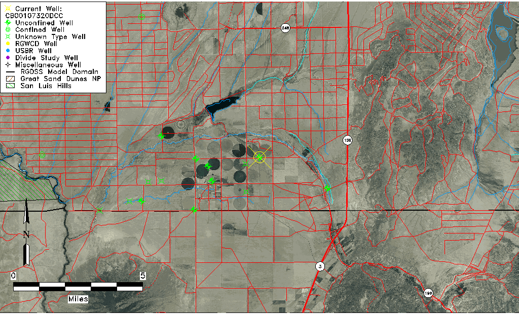
| Easting, Northing RGDSS-NAD83 (US ft) | 226706.16 , 10942.25 |
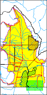
| USGS County | Costilla County |
| Elevation and Depth Data |
|---|
| Ground Elevation (ft NAVD88) | 7632.19000000000 |
| Elevation Data Source | USGS GWSI database |
| USGS Ground Elevation (ft NGVD29) | 7628.00 |
| 1/3-Arc Second NED Ground Elevation (ft NAVD88) | 7632.82 |
| 1-Arc Second NED Ground Elevation (ft NAVD88) | 7632.23 |
| SRTM Ground Elevation (ft NAVD88) | 7627.34 |
| Total Depth (ft) | 320.00 |
| USGS Well Depth (ft) | 320.00 |
| Model Layer | 1 |
| Model Layer Source | Well Depth |
| Depth of Bottom of Layer 1 | 321 |
| Depth of Bottom of Layer 2 | 421 |
| Depth of Bottom of Layer 3 | 534 |
| Depth of Bottom of Layer 4 | 1189 |
| Additional Well Information | Geohydrology, Construction |
| Aquifer Information |
|---|
| Aquifer Type | Unconfined |
| Aquifer Type Source | TD Elevation/Model Layer |
| USGS Primary Aquifer | Cenozoic Erathem |
| USGS Aquifer Type | Unconfined Single Aquifer |
| USGS Hydrologic Unit | Upper Rio Grande |
| USGS Data Available | Water-level (GW.LEV) |
| Water-level Database Information |
|---|
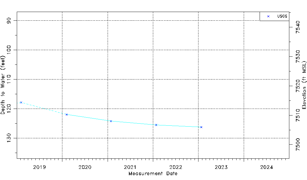
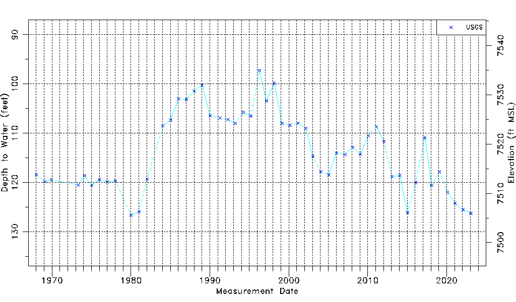
| Water-level Count | 52 |
| Water-level Date Range | 01/12/1968 thru 01/24/2023 |
| Monitored within the last 18 months | Yes, most recently on 01/24/2023 |
| Depth-to-Water Range (ft) | 97.26 to 126.62 |
| Water Table Elevation Range (ft NAVD88) | 7505.57 to 7534.93 |
| Water-Level-Source:Number-of-Measurements | USGS:52 |