| Well Information Table |
|---|
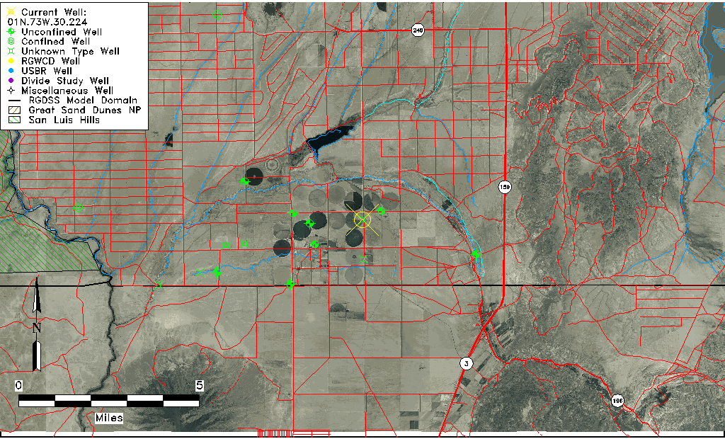
| Common Well ID | 01N.73W.30.224 |
| USGS Well ID | 370120105353001 |
| USGS Station Name | 01N.73W.30.224 |
| USGS Site Type | Well |
| USGS Site Use Information | Unknown |
| USGS Groundwater Use Information | Unknown |
| Data Source(s) | USGS |
| Location Data |
|---|
| TRS | 01N.73W.30.224 |
| USGS TRS 1 | 01N.73W.30.224 |
| USGS TRS | SENENES30 T01N R73W |
| Longitude/Latitude (NAD83) | -105.59223380 , 37.02224206 |
| Longitude/Latitude Data Source | GWSI decimal LAT/LONG field |
| USGS Longitude/Latitude (NAD83) | -105.5922338 , 37.02224206 |
| Easting, Northing RGDSS-NAD83 (US ft) | 223886.31 , 9625.25 |
| USGS County | Costilla County |
| USGS Map Name | GARCIA, CO |
| USGS Map Scale | 24000 |
| Elevation and Depth Data |
|---|
| Ground Elevation (ft NAVD88) | 7620.19000000000 |
| Elevation Data Source | USGS GWSI database |
| USGS Ground Elevation (ft NGVD29) | 7616.00 |
| 1/3-Arc Second NED Ground Elevation (ft NAVD88) | 7617.69 |
| 1-Arc Second NED Ground Elevation (ft NAVD88) | 7619.35 |
| SRTM Ground Elevation (ft NAVD88) | 7618.25 |
| Depth of Bottom of Layer 1 | 315 |
| Depth of Bottom of Layer 2 | 415 |
| Depth of Bottom of Layer 3 | 521 |
| Depth of Bottom of Layer 4 | 1165 |
| Additional Well Information | NONE |
| Aquifer Information |
|---|
| Aquifer Type | Unknown |
| Aquifer Type Source | None |
| USGS Hydrologic Unit | Upper Rio Grande |
| USGS Data Available | Water-level (GW.LEV) |
| Water-level Database Information |
|---|
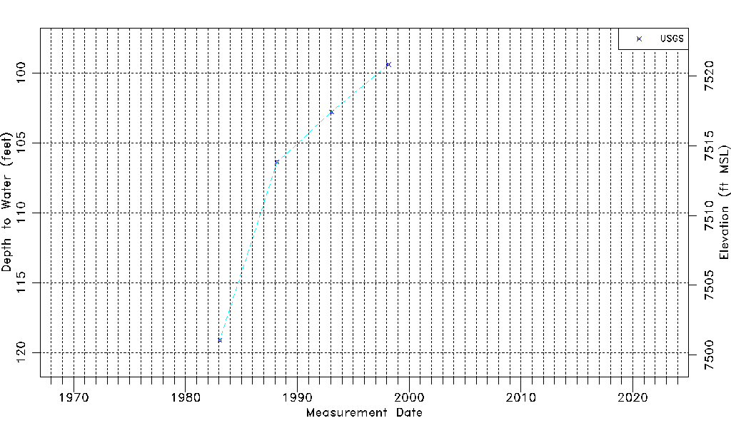
| Water-level Count | 4 |
| Water-level Date Range | 01/25/1983 thru 03/03/1998 |
| Monitored within the last 18 months | No, most recently on 03/03/1998 |
| Depth-to-Water Range (ft) | 99.38 to 119.13 |
| Water Table Elevation Range (ft NAVD88) | 7501.06 to 7520.81 |
| Water-Level-Source:Number-of-Measurements | USGS:4 |