| Well Information Table |
|---|
| Common Well ID | CB00107524CCA |
| USGS Well ID | 370130105442501 |
| USGS Station Name | CB00107524CCA |
| USGS Construction Date | 01/01/1951 |
| USGS Site Type | Well |
| USGS Site Use Information | Unused |
| USGS Groundwater Use Information | Unused |
| Data Source(s) | USGS |
| Location Data |
|---|
| TRS | CB00107524CCA |
| USGS TRS 1 | CB00107524CCA |
| USGS TRS | NESWSWS024T0001NR0075WC |
| Longitude/Latitude (NAD83) | -105.73437590 , 37.02721248 |
| Longitude/Latitude Data Source | GWSI decimal LAT/LONG field |
| USGS Longitude/Latitude (NAD83) | -105.7343759 , 37.02721248 |
| Easting, Northing RGDSS-NAD83 (US ft) | 182404.19 , 11428.08 |
| USGS Topography | Flat Surface |
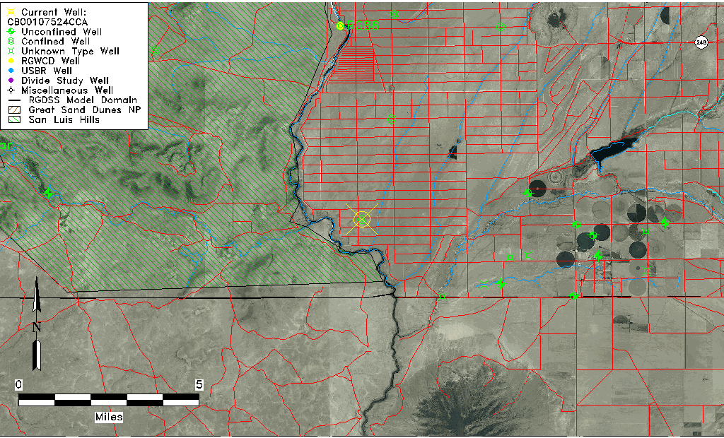
| USGS County | Costilla County |
| Elevation and Depth Data |
|---|
| Ground Elevation (ft NAVD88) | 7580.03000000000 |
| Elevation Data Source | USGS GWSI database |
| USGS Ground Elevation (ft NGVD29) | 7576.00 |
| 1/3-Arc Second NED Ground Elevation (ft NAVD88) | 7562.66 |
| 1-Arc Second NED Ground Elevation (ft NAVD88) | 7558.66 |
| SRTM Ground Elevation (ft NAVD88) | 7554.20 |
| Total Depth (ft) | 310.00 |
| USGS Well Depth (ft) | 310.00 |
| Model Layer | 2 |
| Model Layer Source | Well Depth |
| Depth of Bottom of Layer 1 | 247 |
| Depth of Bottom of Layer 2 | 347 |
| Depth of Bottom of Layer 3 | 444 |
| Depth of Bottom of Layer 4 | 1155 |
| Additional Well Information | Geohydrology, Construction |
| Aquifer Information |
|---|
| Aquifer Type | Confined |
| Aquifer Type Source | TD Elevation/Model Layer |
| USGS Primary Aquifer | Cenozoic Erathem |
| USGS Aquifer Type | Unconfined Single Aquifer |
| USGS Hydrologic Unit | Alamosa-Trinchera |
| USGS Data Available | Water-level (GW.LEV) |
| Water-level Database Information |
|---|
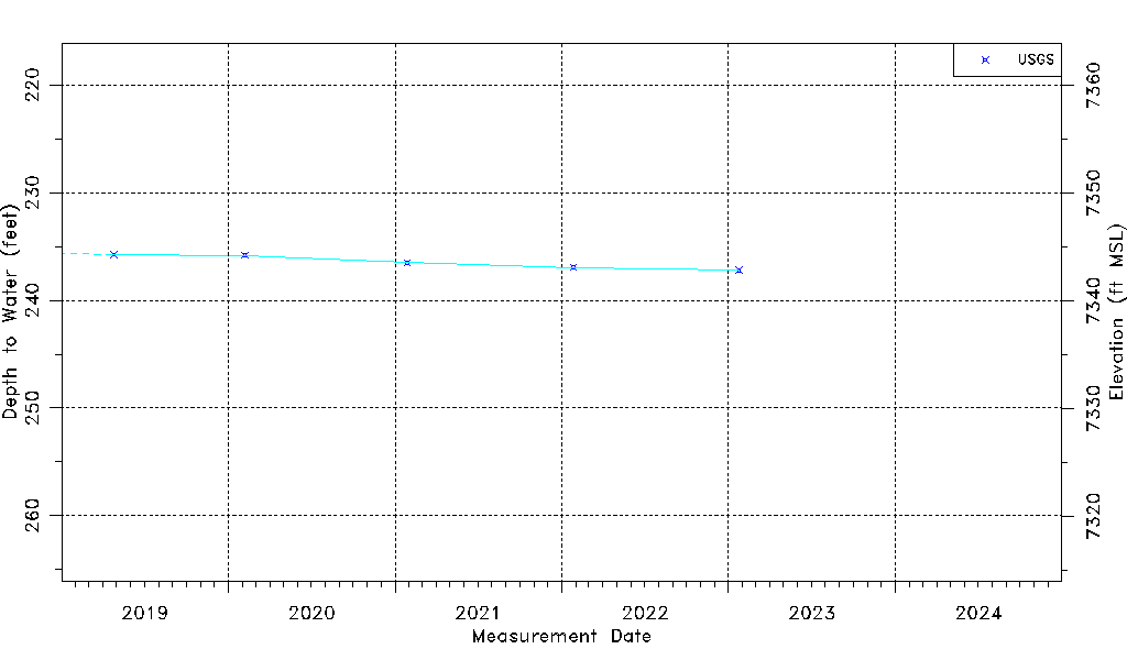
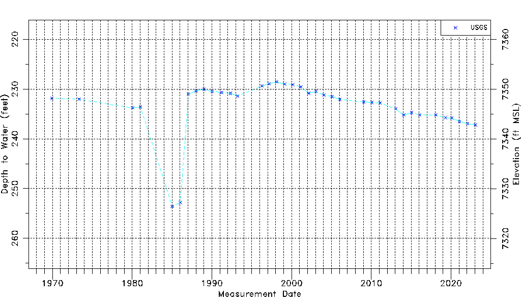
| Water-level Count | 37 |
| Water-level Date Range | 12/02/1969 thru 01/24/2023 |
| Monitored within the last 18 months | Yes, most recently on 01/24/2023 |
| Depth-to-Water Range (ft) | 228.58 to 253.60 |
| Water Table Elevation Range (ft NAVD88) | 7326.43 to 7351.45 |
| Water-Level-Source:Number-of-Measurements | USGS:37 |