| Well Information Table |
|---|
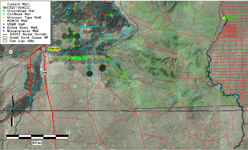
| Common Well ID | NA03201004CCC |
| USGS Well ID | 370215105532701 |
| USGS Station Name | NA03201004CCC |
| USGS Construction Date | 01/01/1974 |
| USGS Site Type | Well |
| USGS Site Use Information | Observation |
| USGS Groundwater Use Information | Unused |
| Data Source(s) | USGS |
| Location Data |
|---|
| TRS | NA03201004CCC |
| USGS TRS 1 | NA03201004CCC |
| USGS TRS | SWSWSWS004T0032NR0010EN |
| Longitude/Latitude (NAD83) | -105.89140730 , 37.03751517 |
| Longitude/Latitude Data Source | GWSI decimal LAT/LONG field |
| USGS Longitude/Latitude (NAD83) | -105.8914073 , 37.03751517 |
| Easting, Northing RGDSS-NAD83 (US ft) | 136586.13 , 15243.25 |
| USGS County | Conejos County |
| Elevation and Depth Data |
|---|
| Ground Elevation (ft NAVD88) | 7729.01000000000 |
| Elevation Data Source | USGS GWSI database |
| USGS Ground Elevation (ft NGVD29) | 7725.00 |
| 1/3-Arc Second NED Ground Elevation (ft NAVD88) | 7752.04 |
| 1-Arc Second NED Ground Elevation (ft NAVD88) | 7730.34 |
| SRTM Ground Elevation (ft NAVD88) | 7732.72 |
| Total Depth (ft) | 21.00 |
| USGS Well Depth (ft) | 21.00 |
| Model Layer | 1 |
| Model Layer Source | Well Depth |
| Depth of Bottom of Layer 1 | 112 |
| Depth of Bottom of Layer 2 | 212 |
| Depth of Bottom of Layer 3 | 315 |
| Depth of Bottom of Layer 4 | 1531 |
| Additional Well Information | Geohydrology, Construction |
| Aquifer Information |
|---|
| Aquifer Type | Unconfined |
| Aquifer Type Source | TD Elevation/Model Layer |
| USGS Primary Aquifer | Alluvium,flood Plain |
| USGS Hydrologic Unit | Alamosa-Trinchera |
| USGS Data Available | Water-level (GW.LEV) |
| Water-level Database Information |
|---|
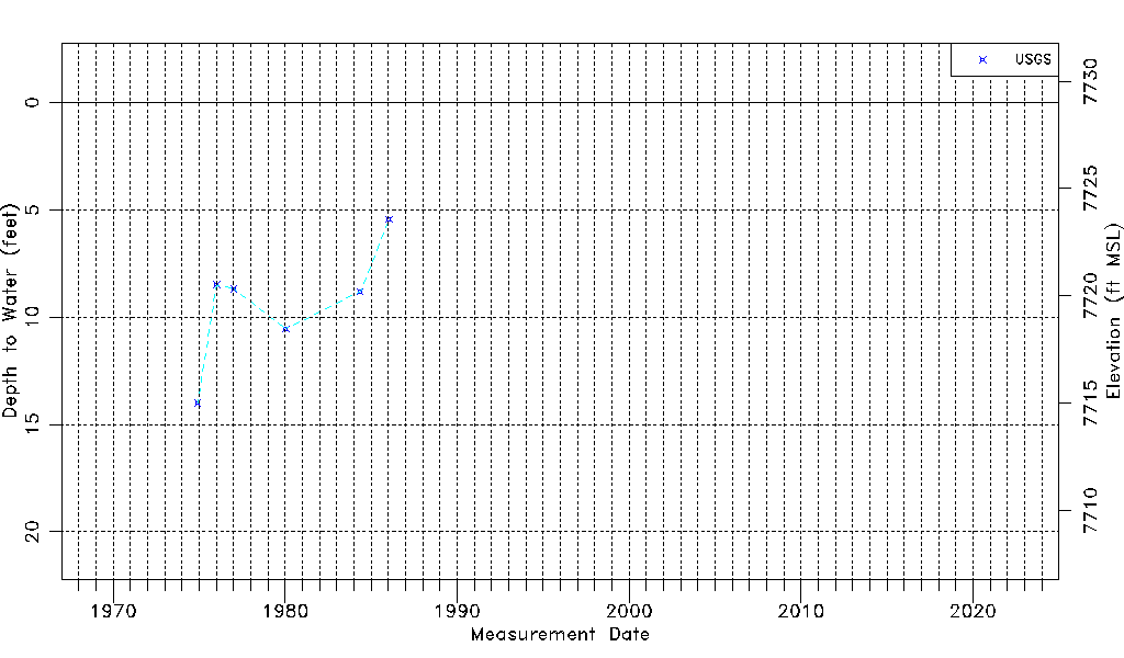
| Water-level Count | 7 |
| Water-level Date Range | 12/01/1974 thru 01/15/1986 |
| Monitored within the last 18 months | No, most recently on 01/15/1986 |
| Depth-to-Water Range (ft) | 5.44 to 14.00 |
| Water Table Elevation Range (ft NAVD88) | 7715.01 to 7723.57 |
| Water-Level-Source:Number-of-Measurements | USGSaguache Creek:7 |