| Well Information Table |
|---|
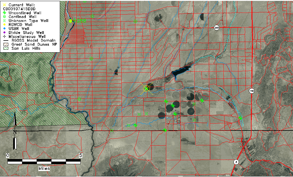
| Common Well ID | CB00107415DBD |
| USGS Well ID | 370225105393501 |
| USGS Station Name | CB00107415DBD |
| USGS Construction Date | 01/01/1955 |
| USGS Site Type | Well |
| USGS Site Use Information | Withdrawal of Water |
| USGS Groundwater Use Information | Irrigation |
| Data Source(s) | USGS |
| Location Data |
|---|
| TRS | CB00107415DBD |
| USGS TRS 1 | CB00107415DBD |
| USGS TRS | SENWSES015T0001NR0074WC |
| Longitude/Latitude (NAD83) | -105.65117980 , 37.03768530 |
| Longitude/Latitude Data Source | GWSI decimal LAT/LONG field |
| USGS Longitude/Latitude (NAD83) | -105.6511798 , 37.03768530 |
| Easting, Northing RGDSS-NAD83 (US ft) | 206681.86 , 15236.01 |
| USGS County | Costilla County |
| Elevation and Depth Data |
|---|
| Ground Elevation (ft NAVD88) | 7532.14000000000 |
| Elevation Data Source | USGS GWSI database |
| USGS Ground Elevation (ft NGVD29) | 7528.00 |
| 1/3-Arc Second NED Ground Elevation (ft NAVD88) | 7533.68 |
| 1-Arc Second NED Ground Elevation (ft NAVD88) | 7531.40 |
| SRTM Ground Elevation (ft NAVD88) | 7534.46 |
| Total Depth (ft) | 260.00 |
| USGS Well Depth (ft) | 260.00 |
| Model Layer | 1 |
| Model Layer Source | Well Depth |
| Depth of Bottom of Layer 1 | 260 |
| Depth of Bottom of Layer 2 | 360 |
| Depth of Bottom of Layer 3 | 460 |
| Depth of Bottom of Layer 4 | 999 |
| Additional Well Information | Geohydrology, Construction |
| Aquifer Information |
|---|
| Aquifer Type | Unconfined |
| Aquifer Type Source | TD Elevation/Model Layer |
| USGS Primary Aquifer | Cenozoic Erathem |
| USGS Aquifer Type | Unconfined Single Aquifer |
| USGS Hydrologic Unit | Upper Rio Grande |
| USGS Data Available | Water-level (GW.LEV) |
| Water-level Database Information |
|---|
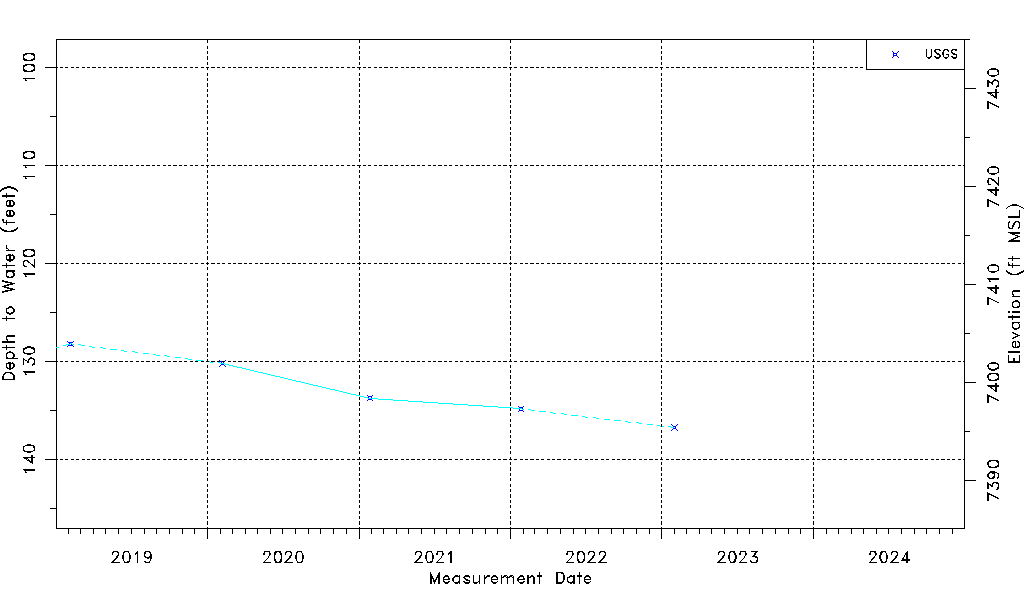
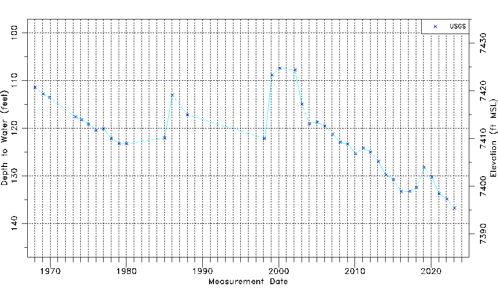
| Water-level Count | 39 |
| Water-level Date Range | 01/12/1968 thru 01/31/2023 |
| Monitored within the last 18 months | Yes, most recently on 01/31/2023 |
| Depth-to-Water Range (ft) | 107.35 to 136.75 |
| Water Table Elevation Range (ft NAVD88) | 7395.39 to 7424.79 |
| Water-Level-Source:Number-of-Measurements | USGS:39 |