| Well Information Table |
|---|
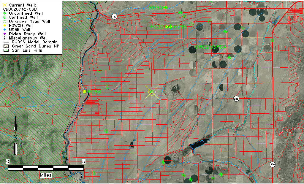
| Common Well ID | CB00207427CBB |
| USGS Well ID | 370600105402901 |
| USGS Station Name | CB00207427CBB |
| USGS Construction Date | 01/01/1956 |
| USGS Site Type | Well |
| USGS Site Use Information | Withdrawal of Water |
| USGS Groundwater Use Information | Unused |
| Data Source(s) | USGS |
| Location Data |
|---|
| TRS | CB00207427CBB |
| USGS TRS 1 | CB00207427CBB |
| USGS TRS | NWNWSWS027T0002NR0074WC |
| Longitude/Latitude (NAD83) | -105.66487550 , 37.10457188 |
| Longitude/Latitude Data Source | GWSI decimal LAT/LONG field |
| USGS Longitude/Latitude (NAD83) | -105.6648755 , 37.10457188 |
| Easting, Northing RGDSS-NAD83 (US ft) | 202682.59 , 39580.14 |
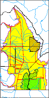
| USGS County | Costilla County |
| Elevation and Depth Data |
|---|
| Ground Elevation (ft NAVD88) | 7643.15000000000 |
| Elevation Data Source | USGS GWSI database |
| USGS Ground Elevation (ft NGVD29) | 7639.00 |
| 1/3-Arc Second NED Ground Elevation (ft NAVD88) | 7643.23 |
| 1-Arc Second NED Ground Elevation (ft NAVD88) | 7642.89 |
| SRTM Ground Elevation (ft NAVD88) | 7642.55 |
| Total Depth (ft) | 365.00 |
| USGS Well Depth (ft) | 365.00 |
| Model Layer | 2 |
| Model Layer Source | Well Depth |
| Depth of Bottom of Layer 1 | 260 |
| Depth of Bottom of Layer 2 | 360 |
| Depth of Bottom of Layer 3 | 599 |
| Depth of Bottom of Layer 4 | 876 |
| Additional Well Information | Geohydrology, Construction |
| Aquifer Information |
|---|
| Aquifer Type | Confined |
| Aquifer Type Source | TD Elevation/Model Layer |
| USGS Primary Aquifer | Cenozoic Erathem |
| USGS Aquifer Type | Unconfined Single Aquifer |
| USGS Hydrologic Unit | Alamosa-Trinchera |
| USGS Data Available | Water-level (GW.LEV) |
| Water-level Database Information |
|---|
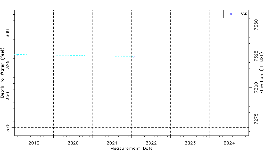
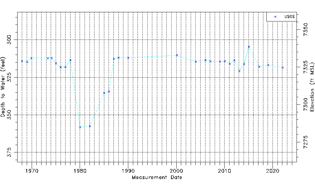
| Water-level Count | 30 |
| Water-level Date Range | 01/12/1968 thru 01/26/2022 |
| Monitored within the last 18 months | No, most recently on 01/26/2022 |
| Depth-to-Water Range (ft) | 304.68 to 358.24 |
| Water Table Elevation Range (ft NAVD88) | 7284.91 to 7338.47 |
| Water-Level-Source:Number-of-Measurements | USGS:30 |