| Well Information Table |
|---|
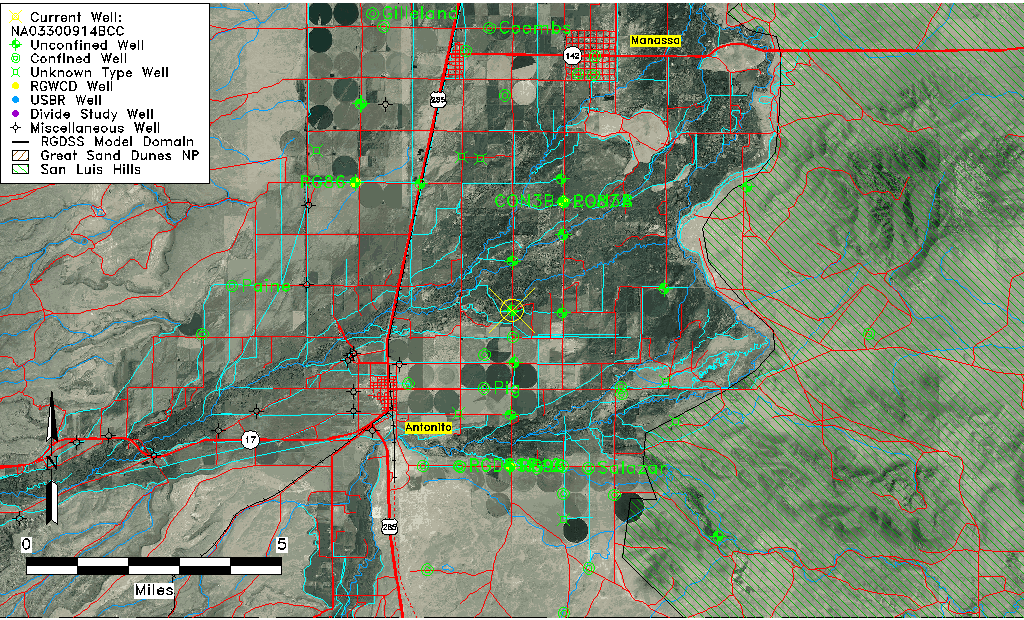
| Common Well ID | NA03300914BCC |
| USGS Well ID | 370606105574801 |
| USGS Station Name | NA03300914BCC |
| USGS Construction Date | 01/01/1974 |
| USGS Site Type | Well |
| USGS Site Use Information | Observation |
| USGS Groundwater Use Information | Unused |
| Data Source(s) | USGS |
| Location Data |
|---|
| TRS | NA03300914BCC |
| USGS TRS 1 | NA03300914BCC |
| USGS TRS | SWSWNWS014T0033NR0009EN |
| Longitude/Latitude (NAD83) | -105.96450437 , 37.10145967 |
| Longitude/Latitude Data Source | Davis Engineering Survey |
| USGS Longitude/Latitude (NAD83) | -105.9645488 , 37.10142910 |
| Easting, Northing RGDSS-NAD83 (US ft) | 115327.15 , 38574.53 |
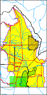
| USGS County | Conejos County |
| Elevation and Depth Data |
|---|
| Ground Elevation (ft NAVD88) | 7798.79000000000 |
| Elevation Data Source | Davis Engineering Survey |
| USGS Ground Elevation (ft NGVD29) | 7793.00 |
| 1/3-Arc Second NED Ground Elevation (ft NAVD88) | 7797.95 |
| 1-Arc Second NED Ground Elevation (ft NAVD88) | 7797.25 |
| SRTM Ground Elevation (ft NAVD88) | 7803.38 |
| Total Depth (ft) | 17.00 |
| USGS Well Depth (ft) | 17.00 |
| Model Layer | 1 |
| Model Layer Source | Well Depth |
| Depth of Bottom of Layer 1 | 36 |
| Depth of Bottom of Layer 2 | 187 |
| Depth of Bottom of Layer 3 | 333 |
| Depth of Bottom of Layer 4 | 1610 |
| Additional Well Information | Geohydrology, Construction |
| Aquifer Information |
|---|
| Aquifer Type | Unconfined |
| Aquifer Type Source | TD Elevation/Model Layer |
| USGS Primary Aquifer | Alluvium,flood Plain |
| USGS Hydrologic Unit | Conejos |
| USGS Data Available | Water-level (GW.LEV) |
| Water-level Database Information |
|---|
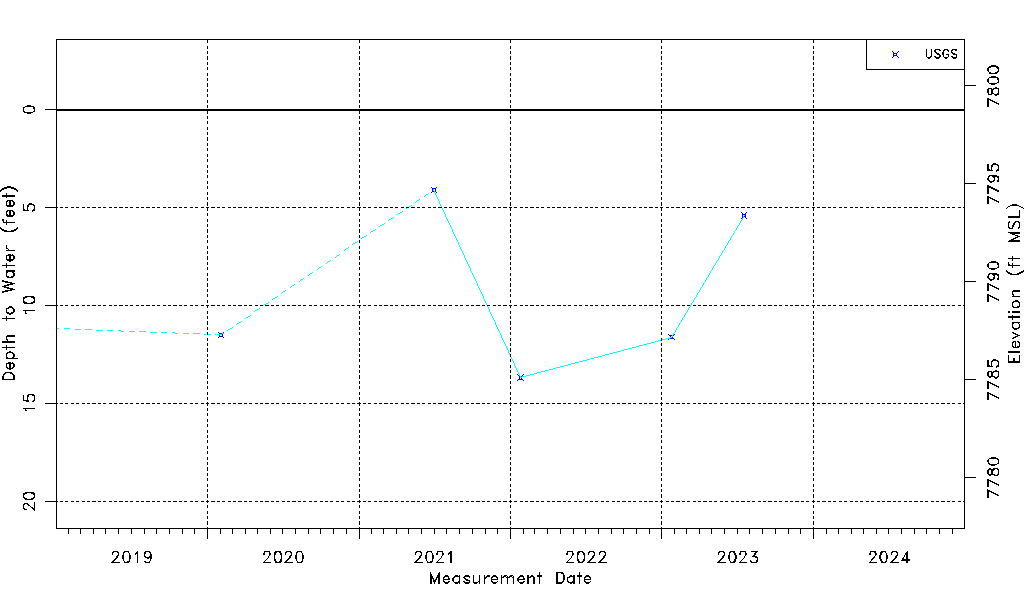
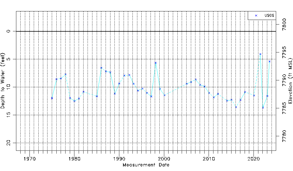
| Water-level Count | 43 |
| Water-level Date Range | 01/01/1975 thru 07/18/2023 |
| Monitored within the last 18 months | Yes, most recently on 07/18/2023 |
| Depth-to-Water Range (ft) | 4.09 to 13.69 |
| Water Table Elevation Range (ft NAVD88) | 7785.10 to 7794.70 |
| Water-Level-Source:Number-of-Measurements | USGS:43 |