| Well Information Table |
|---|
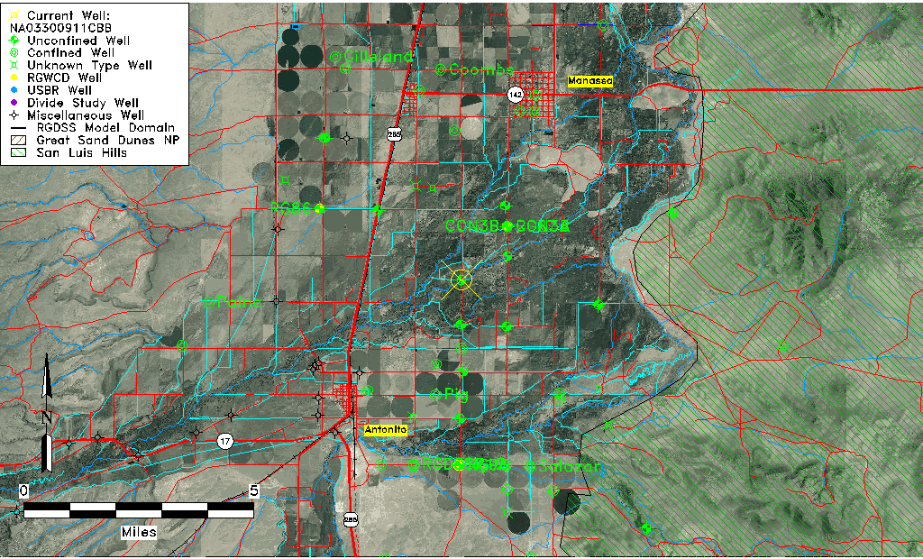
| Common Well ID | NA03300911CBB |
| USGS Well ID | 370656105574801 |
| USGS Station Name | NA03300911CBB |
| USGS Construction Date | 01/01/1974 |
| USGS Site Type | Well |
| USGS Site Use Information | Observation |
| USGS Groundwater Use Information | Unused |
| Data Source(s) | USGS |
| Location Data |
|---|
| TRS | NA03300911CBB |
| USGS TRS 1 | NA03300911CBB |
| USGS TRS | NWNWSWS011T0033NR0009EN |
| Longitude/Latitude (NAD83) | -105.96437125 , 37.11547601 |
| Longitude/Latitude Data Source | Davis Engineering Survey |
| USGS Longitude/Latitude (NAD83) | -105.9644101 , 37.11542878 |
| Easting, Northing RGDSS-NAD83 (US ft) | 115381.43 , 43676.24 |
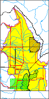
| USGS County | Conejos County |
| Elevation and Depth Data |
|---|
| Ground Elevation (ft NAVD88) | 7783.37000000000 |
| Elevation Data Source | Davis Engineering Survey |
| USGS Ground Elevation (ft NGVD29) | 7780.00 |
| 1/3-Arc Second NED Ground Elevation (ft NAVD88) | 7784.12 |
| 1-Arc Second NED Ground Elevation (ft NAVD88) | 7784.68 |
| SRTM Ground Elevation (ft NAVD88) | 7801.22 |
| Total Depth (ft) | 35.00 |
| USGS Well Depth (ft) | 35.00 |
| Model Layer | 1 |
| Model Layer Source | Well Depth |
| Depth of Bottom of Layer 1 | 34 |
| Depth of Bottom of Layer 2 | 209 |
| Depth of Bottom of Layer 3 | 350 |
| Depth of Bottom of Layer 4 | 1590 |
| Additional Well Information | Geohydrology, Construction |
| Aquifer Information |
|---|
| Aquifer Type | Unconfined |
| Aquifer Type Source | TD Elevation/Model Layer |
| USGS Primary Aquifer | Alluvium,flood Plain |
| USGS Hydrologic Unit | Conejos |
| USGS Data Available | Water-level (GW.LEV) |
| Water-level Database Information |
|---|
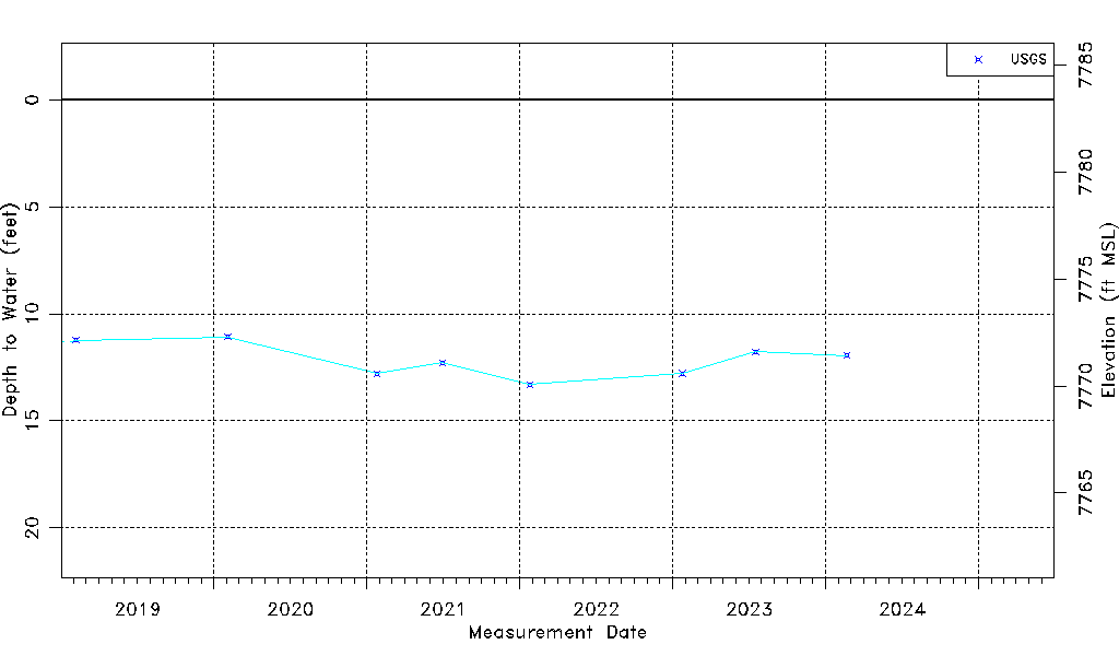
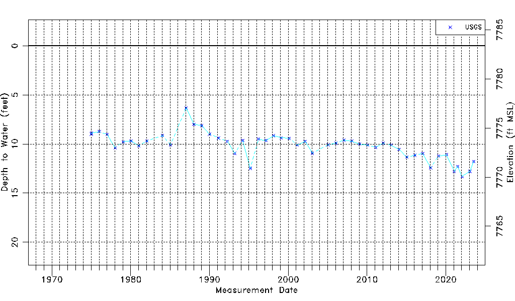
| Water-level Count | 49 |
| Water-level Date Range | 01/01/1975 thru 07/18/2023 |
| Monitored within the last 18 months | Yes, most recently on 07/18/2023 |
| Depth-to-Water Range (ft) | 6.35 to 13.31 |
| Water Table Elevation Range (ft NAVD88) | 7770.06 to 7777.02 |
| Water-Level-Source:Number-of-Measurements | USGS:49 |