| Well Information Table |
|---|
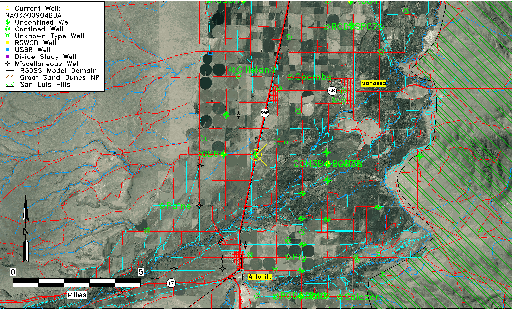
| Common Well ID | NA03300904BBA |
| USGS Well ID | 370754106000301 |
| USGS Station Name | NA03300904BBA |
| USGS Construction Date | 01/01/1967 |
| USGS Site Type | Well |
| USGS Site Use Information | Observation |
| USGS Groundwater Use Information | Unused |
| Data Source(s) | USGS |
| Location Data |
|---|
| TRS | NA03300904BBA |
| USGS TRS 1 | NA03300904BBA |
| USGS TRS | NENWNWS004T0033NR0009EN |
| Longitude/Latitude (NAD83) | -105.99733623 , 37.13733617 |
| Longitude/Latitude Data Source | Davis Engineering Survey |
| USGS Longitude/Latitude (NAD83) | -105.9973001 , 37.13737228 |
| Easting, Northing RGDSS-NAD83 (US ft) | 105799.10 , 51664.04 |
| USGS Topography | Valley flat |
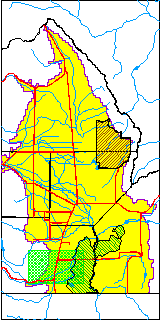
| USGS County | Conejos County |
| USGS Map Name | GOSHAWK DAM |
| USGS Map Scale | 24000 |
| Elevation and Depth Data |
|---|
| Ground Elevation (ft NAVD88) | 7805.29000000000 |
| Elevation Data Source | Davis Engineering Survey |
| USGS Ground Elevation (ft NGVD29) | 7801.00 |
| 1/3-Arc Second NED Ground Elevation (ft NAVD88) | 7803.65 |
| 1-Arc Second NED Ground Elevation (ft NAVD88) | 7805.29 |
| SRTM Ground Elevation (ft NAVD88) | 7819.94 |
| Total Depth (ft) | 16.00 |
| USGS Well Depth (ft) | 16.00 |
| Model Layer | 1 |
| Model Layer Source | Well Depth |
| Depth of Bottom of Layer 1 | 36 |
| Depth of Bottom of Layer 2 | 204 |
| Depth of Bottom of Layer 3 | 287 |
| Depth of Bottom of Layer 4 | 1496 |
| Additional Well Information | Geohydrology, Construction |
| Aquifer Information |
|---|
| Aquifer Type | Unconfined |
| Aquifer Type Source | TD Elevation/Model Layer |
| USGS Primary Aquifer | Cenozoic Erathem |
| USGS Aquifer Type | Unconfined Single Aquifer |
| USGS Hydrologic Unit | Alamosa-Trinchera |
| USGS Data Available | Water-level (GW.LEV) |
| Water-level Database Information |
|---|
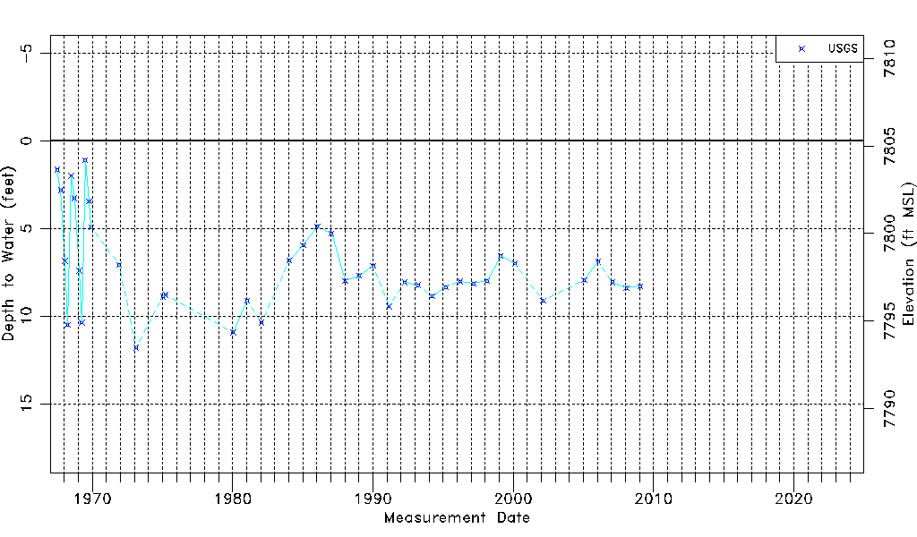
| Water-level Count | 41 |
| Water-level Date Range | 07/03/1967 thru 01/28/2009 |
| Monitored within the last 18 months | No, most recently on 01/28/2009 |
| Depth-to-Water Range (ft) | 1.11 to 11.80 |
| Water Table Elevation Range (ft NAVD88) | 7793.49 to 7804.18 |
| Water-Level-Source:Number-of-Measurements | USGSaguache Creek:41 |