| Well Information Table |
|---|
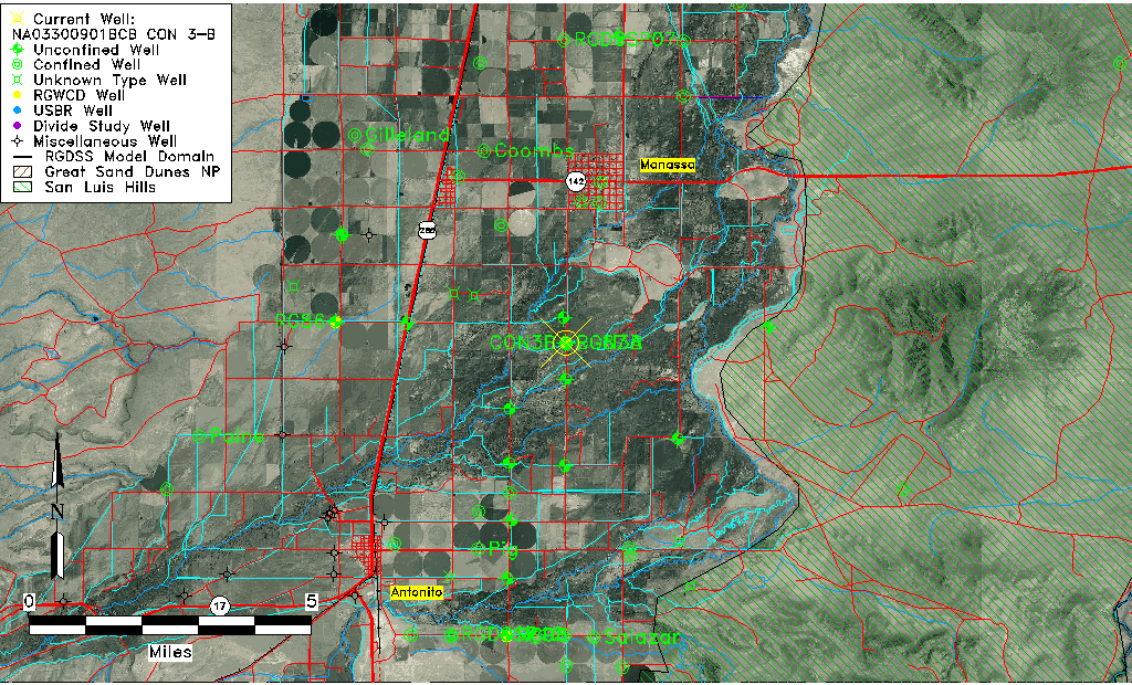
| Common Well ID | NA03300901BCB CON 3-B |
| RGWCD Well ID | CON3B |
| RGWCD Confined Aquifer Well ID | CON3B |
| USGS Well ID | 370757105564702 |
| USGS Station Name | NA03300901BCB CON 3-B |
| USGS Construction Date | 11/15/2017 |
| USGS Site Type | Well |
| USGS Site Use Information | Unknown |
| USGS Groundwater Use Information | Unknown |
| Data Source(s) | USGS, RGWCD |
| Location Data |
|---|
| TRS | NA03300901BCB CON 3-B |
| RGWCD TRS | NA03300901BCB2 |
| USGS TRS 1 | NA03300901BCB CON 3-B |
| USGS TRS | SWNWS01 T033N R009EN |
| Longitude/Latitude (NAD83) | -105.94637658 , 37.13236127 |
| Longitude/Latitude Data Source | Davis Engineering Survey |
| RGWCD Longitude/Latitude (NAD83) | -105:56:46.9554 , 37:07:56.4864 |
| USGS Longitude/Latitude (NAD83) | -105.9463750 , 37.13236667 |
| Easting, Northing RGDSS-NAD83 (US ft) | 120644.35 , 49806.90 |
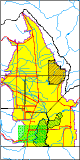
| USGS County | Conejos County |
| USGS Map Name | MANASSA, CO |
| USGS Map Scale | 24000 |
| Elevation and Depth Data |
|---|
| Ground Elevation (ft NAVD88) | 7750.31000000000 |
| Elevation Data Source | Davis Engineering Survey |
| RGWCD Measuring Point Elevation (ft NAVD88) | 7750.308 |
| RGWCD Well Riser Height (ft) | 0.000 |
| RGWCD Ground Surface (ft NAVD88) | 7750.31 |
| USGS Ground Elevation (ft NAVD88) | 7747.00 |
| 1/3-Arc Second NED Ground Elevation (ft NAVD88) | 7748.14 |
| 1-Arc Second NED Ground Elevation (ft NAVD88) | 7747.26 |
| SRTM Ground Elevation (ft NAVD88) | 7752.70 |
| Total Depth (ft) | 225.00 |
| Depth to Top of Screen (ft) | 170.0 |
| Depth to Bottom of Screen (ft) | 210.00 |
| USGS Hole Depth (ft) | 225.00 |
| USGS Well Depth (ft) | 210.00 |
| Model Layer | 3 |
| Model Layer Source | RGWCD |
| Depth of Bottom of Layer 1 | 37 |
| Depth of Bottom of Layer 2 | 220 |
| Depth of Bottom of Layer 3 | 380 |
| Depth of Bottom of Layer 4 | 1527 |
| Additional Well Information | NONE |
| Aquifer Information |
|---|
| Aquifer Type | Confined |
| Aquifer Type Source | RGWCD_AQ |
| USGS Primary Aquifer | Cenozoic Erathem |
| USGS Aquifer Type | Confined Single Aquifer |
| USGS Hydrologic Unit | Conejos |
| USGS Data Available | Discharge (GW.DISC) |
| Water-level Database Information |
|---|
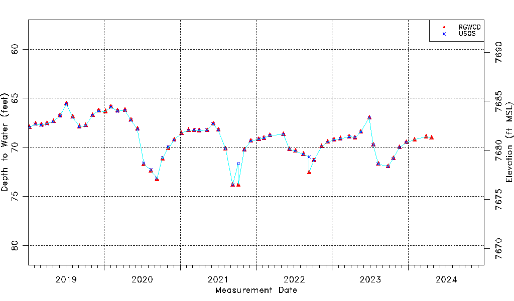
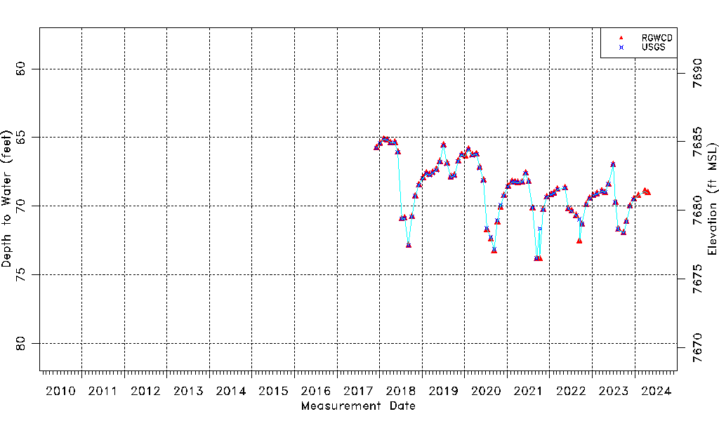
| Water-level Count | 112 |
| Water-level Date Range | 12/05/2017 thru 03/27/2024 |
| Monitored within the last 18 months | Yes, most recently on 03/27/2024 |
| Depth-to-Water Range (ft) | 65.13 to 73.84 |
| Water Table Elevation Range (ft NAVD88) | 7676.47 to 7685.18 |
| Water-Level-Source:Number-of-Measurements | RGWCD:75 USGS:71 |