| Well Information Table |
|---|
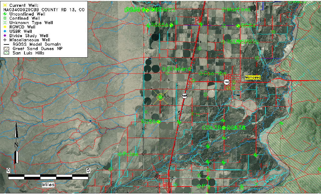
| Common Well ID | NA03400929CBB COUNTY RD 13, CO |
| USGS Well ID | 370936106010501 |
| USGS Station Name | NA03400929CBB COUNTY RD 13, CO |
| USGS Construction Date | 08/13/1993 |
| USGS Site Type | Well |
| USGS Site Use Information | Observation |
| USGS Groundwater Use Information | Unused |
| Data Source(s) | USGS |
| Location Data |
|---|
| TRS | NA03400929CBB COUNTY RD 13, CO |
| USGS TRS 1 | NA03400929CBB COUNTY RD 13, CO |
| USGS TRS | NWNWSWS 29T 34NR 9E |
| Longitude/Latitude (NAD83) | -106.01805560 , 37.16000000 |
| Longitude/Latitude Data Source | GWSI decimal LAT/LONG field |
| USGS Longitude/Latitude (NAD83) | -106.0180556 , 37.16000000 |
| Easting, Northing RGDSS-NAD83 (US ft) | 99790.89 , 59934.72 |
| USGS Topography | Valley flat |
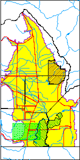
| USGS County | Conejos County |
| USGS Map Name | GOSHAWK DAM |
| USGS Map Scale | 2400 |
| Elevation and Depth Data |
|---|
| Ground Elevation (ft NAVD88) | 7789.00000000000 |
| Elevation Data Source | USGS GWSI database |
| USGS Ground Elevation (ft NAVD88) | 7789.00 |
| 1/3-Arc Second NED Ground Elevation (ft NAVD88) | 7787.35 |
| 1-Arc Second NED Ground Elevation (ft NAVD88) | 7786.63 |
| SRTM Ground Elevation (ft NAVD88) | 7785.43 |
| Total Depth (ft) | 24.85 |
| USGS Hole Depth (ft) | 25.00 |
| USGS Well Depth (ft) | 24.85 |
| Model Layer | 1 |
| Model Layer Source | Well Depth |
| Depth of Bottom of Layer 1 | 51 |
| Depth of Bottom of Layer 2 | 146 |
| Depth of Bottom of Layer 3 | 229 |
| Depth of Bottom of Layer 4 | 1398 |
| Additional Well Information | Logs, Geohydrology, Construction, Aquifer |
| Aquifer Information |
|---|
| Aquifer Type | Unconfined |
| Aquifer Type Source | TD Elevation/Model Layer |
| USGS Primary Aquifer | Cenozoic Erathem |
| USGS Aquifer Type | Unconfined Single Aquifer |
| USGS Hydrologic Unit | Alamosa-Trinchera |
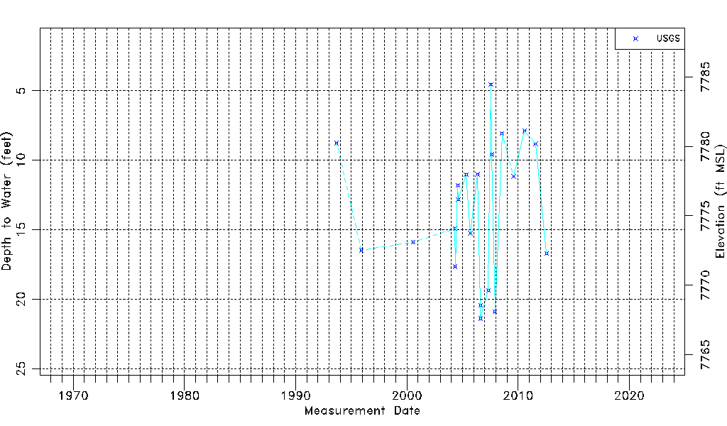
| USGS Data Available | Water-level (GW.LEV) |
| Water-level Database Information |
|---|
| Water-level Count | 21 |
| Water-level Date Range | 09/12/1993 thru 07/24/2012 |
| Monitored within the last 18 months | No, most recently on 07/24/2012 |
| Depth-to-Water Range (ft) | 4.54 to 21.39 |
| Water Table Elevation Range (ft NAVD88) | 7767.61 to 7784.46 |
| Water-Level-Source:Number-of-Measurements | USGSaguache Creek:21 |