| Well Information Table |
|---|
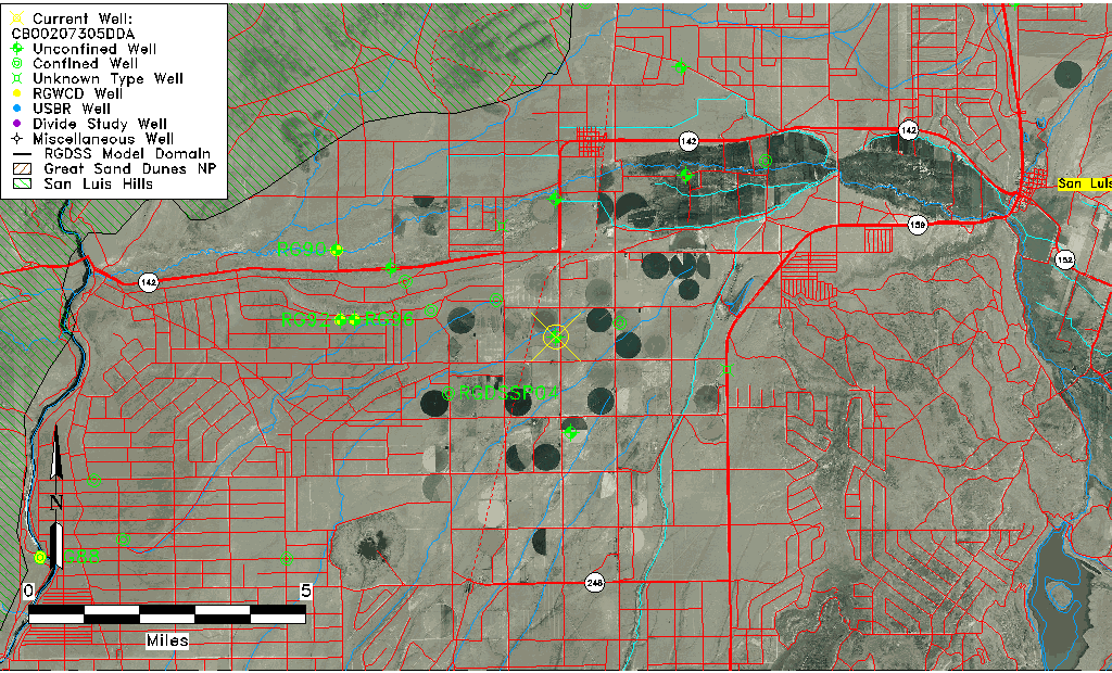
| Common Well ID | CB00207305DDA |
| USGS Well ID | 370945105343501 |
| USGS Station Name | CB00207305DDA |
| USGS Construction Date | 01/01/1951 |
| USGS Site Type | Well |
| USGS Site Use Information | Withdrawal of Water |
| USGS Groundwater Use Information | Irrigation |
| Data Source(s) | USGS |
| Location Data |
|---|
| TRS | CB00207305DDA |
| USGS TRS 1 | CB00207305DDA |
| USGS TRS | NESESES005T0002NR0073WC |
| Longitude/Latitude (NAD83) | -105.57695780 , 37.16251524 |
| Longitude/Latitude Data Source | GWSI decimal LAT/LONG field |
| USGS Longitude/Latitude (NAD83) | -105.5769578 , 37.16251524 |
| Easting, Northing RGDSS-NAD83 (US ft) | 228290.91 , 60684.96 |
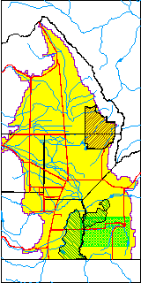
| USGS County | Costilla County |
| Elevation and Depth Data |
|---|
| Ground Elevation (ft NAVD88) | 7738.25000000000 |
| Elevation Data Source | USGS GWSI database |
| USGS Ground Elevation (ft NGVD29) | 7734.00 |
| 1/3-Arc Second NED Ground Elevation (ft NAVD88) | 7734.19 |
| 1-Arc Second NED Ground Elevation (ft NAVD88) | 7733.00 |
| SRTM Ground Elevation (ft NAVD88) | 7739.84 |
| Total Depth (ft) | 200.00 |
| USGS Well Depth (ft) | 200.00 |
| Model Layer | 1 |
| Model Layer Source | Well Depth |
| Depth of Bottom of Layer 1 | 297 |
| Depth of Bottom of Layer 2 | 397 |
| Depth of Bottom of Layer 3 | 739 |
| Depth of Bottom of Layer 4 | 1141 |
| Additional Well Information | Geohydrology, Construction |
| Aquifer Information |
|---|
| Aquifer Type | Unconfined |
| Aquifer Type Source | TD Elevation/Model Layer |
| USGS Primary Aquifer | Cenozoic Erathem |
| USGS Hydrologic Unit | Alamosa-Trinchera |
| USGS Data Available | Water-level (GW.LEV) |
| Water-level Database Information |
|---|
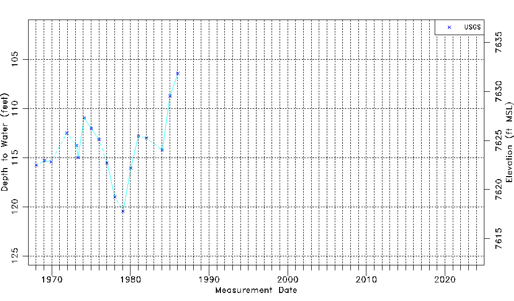
| Water-level Count | 18 |
| Water-level Date Range | 01/16/1968 thru 01/15/1986 |
| Monitored within the last 18 months | No, most recently on 01/15/1986 |
| Depth-to-Water Range (ft) | 106.43 to 120.45 |
| Water Table Elevation Range (ft NAVD88) | 7617.80 to 7631.82 |
| Water-Level-Source:Number-of-Measurements | USGSaguache Creek:18 |