| Well Information Table |
|---|
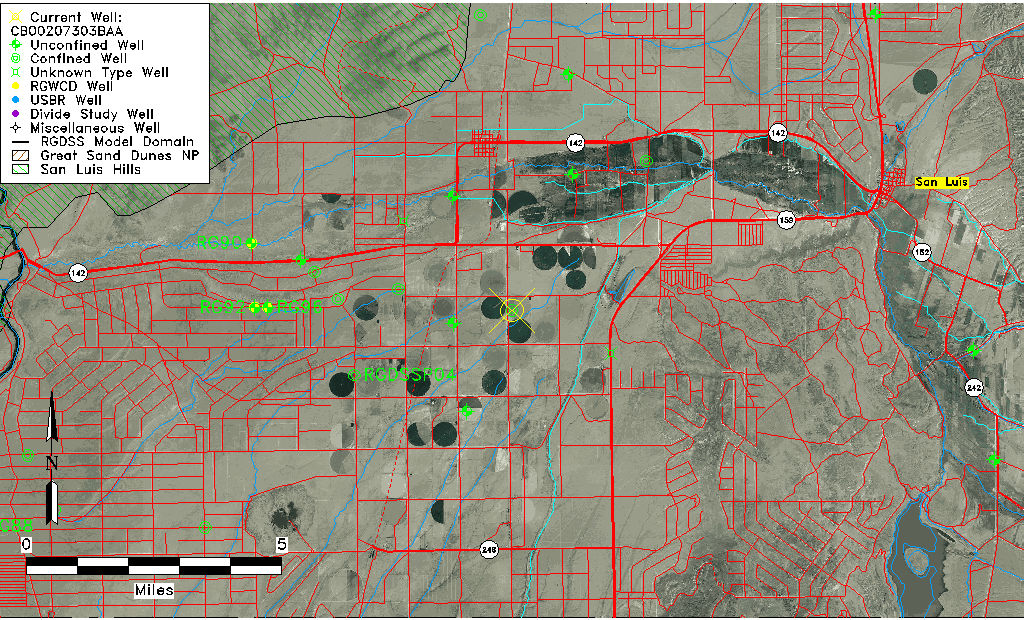
| Common Well ID | CB00207303BAA |
| USGS Well ID | 370958105332001 |
| USGS Station Name | CB00207303BAA |
| USGS Construction Date | 01/01/1961 |
| USGS Site Type | Well |
| USGS Site Use Information | Withdrawal of Water |
| USGS Groundwater Use Information | Irrigation |
| Data Source(s) | USGS |
| Location Data |
|---|
| TRS | CB00207303BAA |
| USGS TRS 1 | CB00207303BAA |
| USGS TRS | NENENWS003T0002NR0073WC |
| Longitude/Latitude (NAD83) | -105.55612400 , 37.16612640 |
| Longitude/Latitude Data Source | GWSI decimal LAT/LONG field |
| USGS Longitude/Latitude (NAD83) | -105.5561240 , 37.16612640 |
| Easting, Northing RGDSS-NAD83 (US ft) | 234358.18 , 62006.30 |
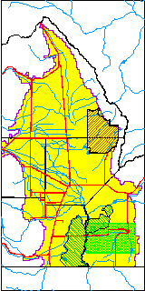
| USGS County | Costilla County |
| Elevation and Depth Data |
|---|
| Ground Elevation (ft NAVD88) | 7762.26000000000 |
| Elevation Data Source | USGS GWSI database |
| USGS Ground Elevation (ft NGVD29) | 7758.00 |
| 1/3-Arc Second NED Ground Elevation (ft NAVD88) | 7756.58 |
| 1-Arc Second NED Ground Elevation (ft NAVD88) | 7758.77 |
| SRTM Ground Elevation (ft NAVD88) | 7759.21 |
| Total Depth (ft) | 485.00 |
| USGS Well Depth (ft) | 485.00 |
| Model Layer | 3 |
| Model Layer Source | Well Depth |
| Depth of Bottom of Layer 1 | 306 |
| Depth of Bottom of Layer 2 | 406 |
| Depth of Bottom of Layer 3 | 763 |
| Depth of Bottom of Layer 4 | 1171 |
| Additional Well Information | Geohydrology, Construction |
| Aquifer Information |
|---|
| Aquifer Type | Confined |
| Aquifer Type Source | TD Elevation/Model Layer |
| USGS Primary Aquifer | Cenozoic Erathem |
| USGS Hydrologic Unit | Upper Rio Grande |
| USGS Data Available | Water-level (GW.LEV) |
| Water-level Database Information |
|---|
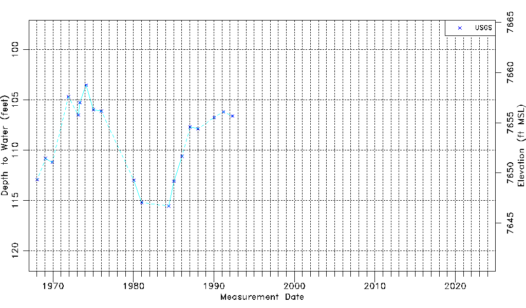
| Water-level Count | 19 |
| Water-level Date Range | 01/16/1968 thru 04/24/1992 |
| Monitored within the last 18 months | No, most recently on 04/24/1992 |
| Depth-to-Water Range (ft) | 103.52 to 115.56 |
| Water Table Elevation Range (ft NAVD88) | 7646.70 to 7658.74 |
| Water-Level-Source:Number-of-Measurements | USGS:19 |