| Well Information Table |
|---|
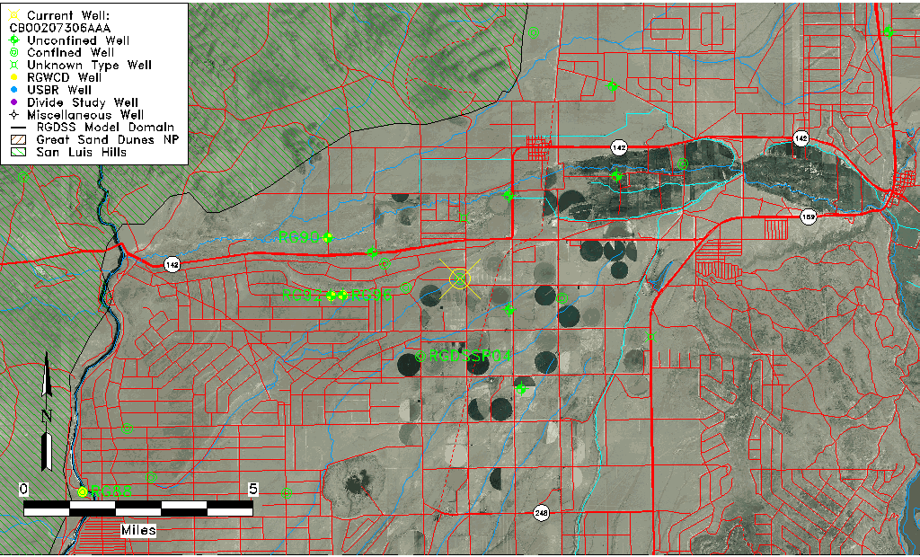
| Common Well ID | CB00207306AAA |
| USGS Well ID | 371020105354501 |
| USGS Station Name | CB00207306AAA |
| USGS Construction Date | 01/01/1960 |
| USGS Site Type | Well |
| USGS Site Use Information | Withdrawal of Water |
| USGS Groundwater Use Information | Irrigation |
| Data Source(s) | USGS |
| Location Data |
|---|
| TRS | CB00207306AAA |
| USGS TRS 1 | CB00207306AAA |
| USGS TRS | NENENES006T0002NR0073WC |
| Longitude/Latitude (NAD83) | -105.59640280 , 37.17223696 |
| Longitude/Latitude Data Source | GWSI decimal LAT/LONG field |
| USGS Longitude/Latitude (NAD83) | -105.5964028 , 37.17223696 |
| Easting, Northing RGDSS-NAD83 (US ft) | 222623.58 , 64218.13 |
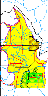
| USGS County | Costilla County |
| Elevation and Depth Data |
|---|
| Ground Elevation (ft NAVD88) | 7732.24000000000 |
| Elevation Data Source | USGS GWSI database |
| USGS Ground Elevation (ft NGVD29) | 7728.00 |
| 1/3-Arc Second NED Ground Elevation (ft NAVD88) | 7725.09 |
| 1-Arc Second NED Ground Elevation (ft NAVD88) | 7728.69 |
| SRTM Ground Elevation (ft NAVD88) | 7726.55 |
| Total Depth (ft) | 410.00 |
| USGS Well Depth (ft) | 410.00 |
| Model Layer | 3 |
| Model Layer Source | Well Depth |
| Depth of Bottom of Layer 1 | 302 |
| Depth of Bottom of Layer 2 | 402 |
| Depth of Bottom of Layer 3 | 755 |
| Depth of Bottom of Layer 4 | 1165 |
| Additional Well Information | Geohydrology, Construction |
| Aquifer Information |
|---|
| Aquifer Type | Confined |
| Aquifer Type Source | TD Elevation/Model Layer |
| USGS Primary Aquifer | Cenozoic Erathem |
| USGS Hydrologic Unit | Alamosa-Trinchera |
| USGS Data Available | Water-level (GW.LEV) |
| Water-level Database Information |
|---|
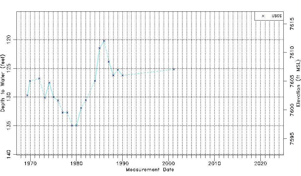
| Water-level Count | 21 |
| Water-level Date Range | 05/13/1969 thru 03/06/2001 |
| Monitored within the last 18 months | No, most recently on 03/06/2001 |
| Depth-to-Water Range (ft) | 120.22 to 134.96 |
| Water Table Elevation Range (ft NAVD88) | 7597.28 to 7612.02 |
| Water-Level-Source:Number-of-Measurements | USGS:21 |