| Well Information Table |
|---|
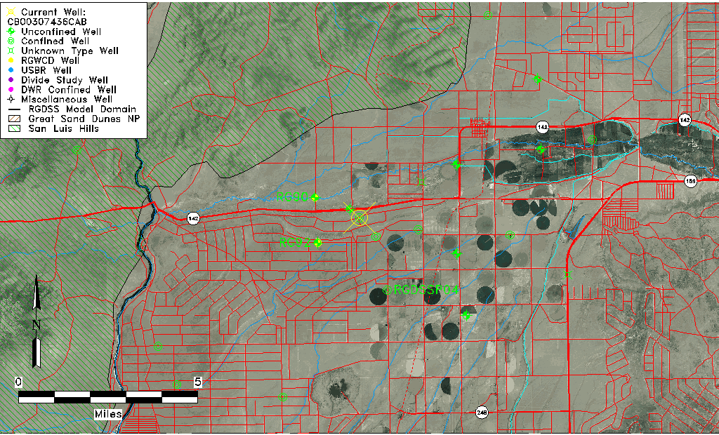
| Common Well ID | CB00307436CAB |
| USGS Well ID | 371045105373501 |
| USGS Station Name | CB00307436CAB |
| USGS Construction Date | 01/01/1965 |
| USGS Site Type | Well |
| USGS Site Use Information | Unused |
| USGS Groundwater Use Information | Unused |
| Data Source(s) | USGS |
| Location Data |
|---|
| TRS | CB00307436CAB |
| USGS TRS 1 | CB00307436CAB |
| USGS TRS | NWNESWS036T0003NR0074WC |
| Longitude/Latitude (NAD83) | -105.62609790 , 37.17704209 |
| Longitude/Latitude Data Source | GWSI decimal LAT/LONG field |
| USGS Longitude/Latitude (NAD83) | -105.6260979 , 37.17704209 |
| Easting, Northing RGDSS-NAD83 (US ft) | 213973.48 , 65961.24 |
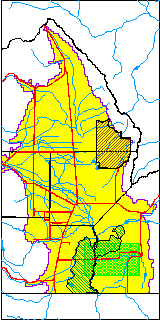
| USGS County | Costilla County |
| Elevation and Depth Data |
|---|
| Ground Elevation (ft NAVD88) | 7620.20000000000 |
| Elevation Data Source | USGS GWSI database |
| USGS Ground Elevation (ft NGVD29) | 7616.00 |
| 1/3-Arc Second NED Ground Elevation (ft NAVD88) | 7594.58 |
| 1-Arc Second NED Ground Elevation (ft NAVD88) | 7597.04 |
| SRTM Ground Elevation (ft NAVD88) | 7605.86 |
| Total Depth (ft) | 253.00 |
| USGS Well Depth (ft) | 253.00 |
| Model Layer | 2 |
| Model Layer Source | Well Depth |
| Depth of Bottom of Layer 1 | 203 |
| Depth of Bottom of Layer 2 | 303 |
| Depth of Bottom of Layer 3 | 647 |
| Depth of Bottom of Layer 4 | 1067 |
| Additional Well Information | Geohydrology, Construction |
| Aquifer Information |
|---|
| Aquifer Type | Confined |
| Aquifer Type Source | TD Elevation/Model Layer |
| USGS Primary Aquifer | Cenozoic Erathem |
| USGS Aquifer Type | Unconfined Single Aquifer |
| USGS Hydrologic Unit | Alamosa-Trinchera |
| USGS Data Available | Water-level (GW.LEV) |
| Water-level Database Information |
|---|
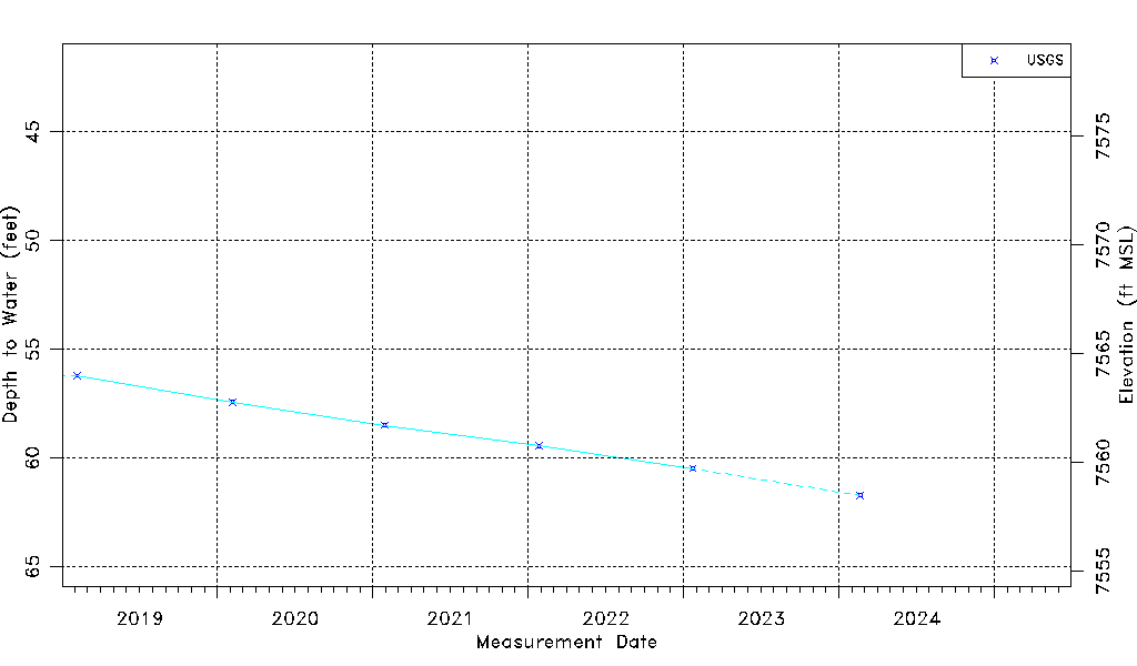
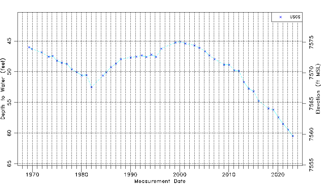
| Water-level Count | 47 |
| Water-level Date Range | 05/13/1969 thru 01/23/2023 |
| Monitored within the last 18 months | Yes, most recently on 01/23/2023 |
| Depth-to-Water Range (ft) | 45.11 to 60.49 |
| Water Table Elevation Range (ft NAVD88) | 7559.71 to 7575.09 |
| Water-Level-Source:Number-of-Measurements | USGS:47 |