| Well Information Table |
|---|
| Common Well ID | CB00307323CDB DUP1 |
| USGS Well ID | 371148105322801 |
| USGS Station Name | CB00307323CDB DUP1 |
| USGS Site Type | Well |
| USGS Site Use Information | Observation |
| USGS Groundwater Use Information | Unused |
| Data Source(s) | USGS |
| Location Data |
|---|
| TRS | CB00307323CDB DUP1 |
| USGS TRS 1 | CB00307323CDB DUP1 |
| USGS TRS | NWSESWS023T0003NR0073WC |
| Longitude/Latitude (NAD83) | -105.53445760 , 37.20473638 |
| Longitude/Latitude Data Source | GWSI decimal LAT/LONG field |
| USGS Longitude/Latitude (NAD83) | -105.5344576 , 37.20473638 |
| Easting, Northing RGDSS-NAD83 (US ft) | 240648.48 , 76068.01 |
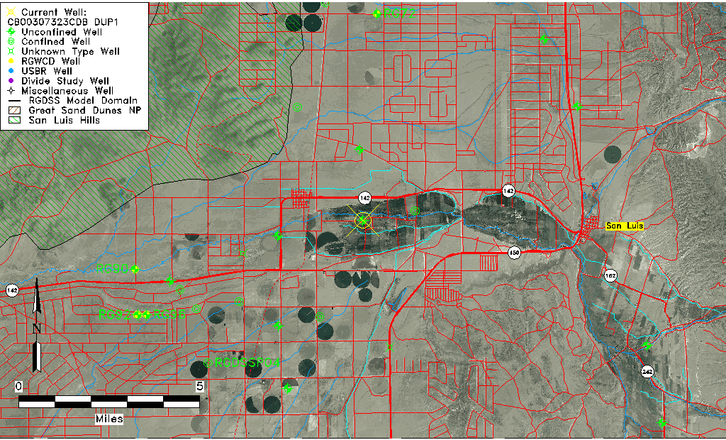
| USGS County | Costilla County |
| USGS Map Name | SAN ACACIO |
| USGS Map Scale | 24000 |
| Elevation and Depth Data |
|---|
| Ground Elevation (ft NAVD88) | 7747.26000000000 |
| Elevation Data Source | USGS GWSI database |
| USGS Ground Elevation (ft NGVD29) | 7743.00 |
| 1/3-Arc Second NED Ground Elevation (ft NAVD88) | 7752.96 |
| 1-Arc Second NED Ground Elevation (ft NAVD88) | 7750.95 |
| SRTM Ground Elevation (ft NAVD88) | 7745.74 |
| Total Depth (ft) | 8.00 |
| USGS Well Depth (ft) | 8.00 |
| Model Layer | 1 |
| Model Layer Source | Well Depth |
| Depth of Bottom of Layer 1 | 254 |
| Depth of Bottom of Layer 2 | 354 |
| Depth of Bottom of Layer 3 | 764 |
| Depth of Bottom of Layer 4 | 1280 |
| Additional Well Information | Geohydrology, Construction |
| Aquifer Information |
|---|
| Aquifer Type | Unconfined |
| Aquifer Type Source | TD Elevation/Model Layer |
| USGS Primary Aquifer | Cenozoic Erathem |
| USGS Hydrologic Unit | Alamosa-Trinchera |
| USGS Data Available | Water-level (GW.LEV) |
| Water-level Database Information |
|---|
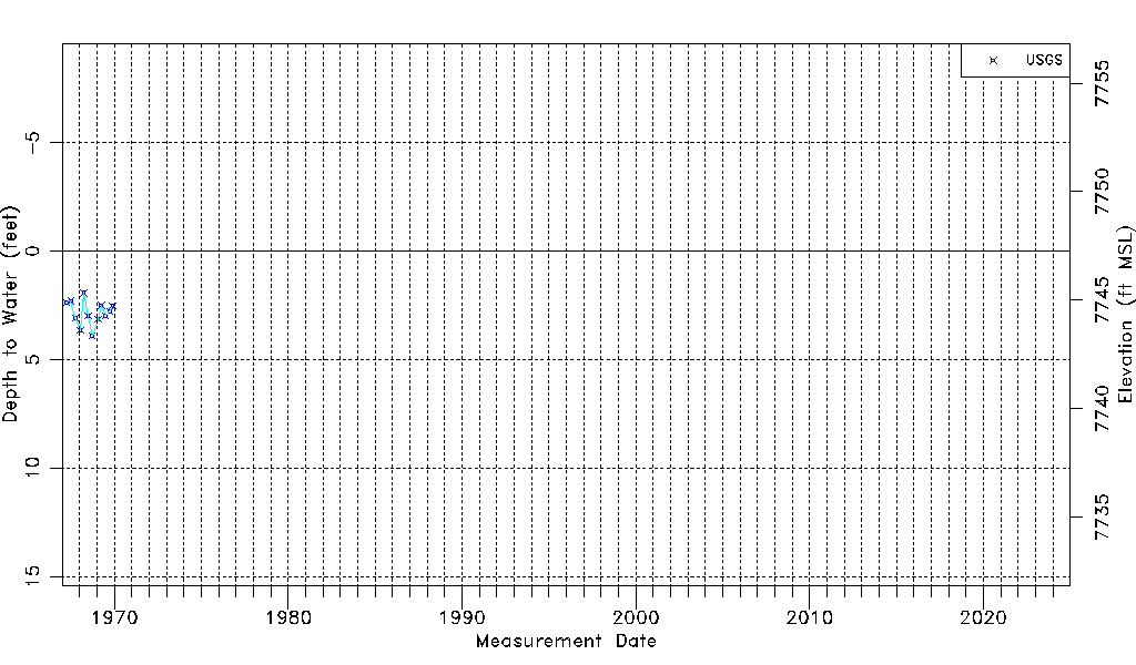
| Water-level Count | 12 |
| Water-level Date Range | 03/31/1967 thru 11/26/1969 |
| Monitored within the last 18 months | No, most recently on 11/26/1969 |
| Depth-to-Water Range (ft) | 1.93 to 3.91 |
| Water Table Elevation Range (ft NAVD88) | 7743.35 to 7745.33 |
| Water-Level-Source:Number-of-Measurements | USGS:12 |