| Well Information Table |
|---|
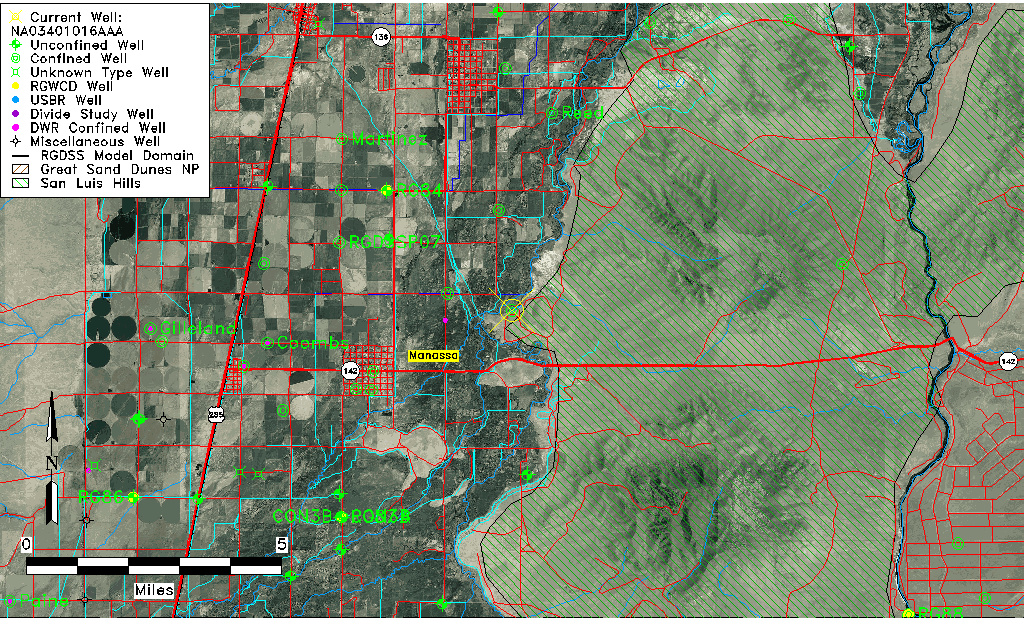
| Common Well ID | NA03401016AAA |
| USGS Well ID | 371236105543001 |
| USGS Station Name | NA03401016AAA |
| USGS Site Type | Well |
| USGS Site Use Information | Unused |
| USGS Groundwater Use Information | Unused |
| Data Source(s) | USGS |
| Location Data |
|---|
| TRS | NA03401016AAA |
| USGS TRS 1 | NA03401016AAA |
| USGS TRS | NENENES016T0034NR0010EN |
| Longitude/Latitude (NAD83) | -105.90891030 , 37.21001050 |
| Longitude/Latitude Data Source | GWSI decimal LAT/LONG field |
| USGS Longitude/Latitude (NAD83) | -105.9089103 , 37.21001050 |
| Easting, Northing RGDSS-NAD83 (US ft) | 131632.84 , 78041.66 |
| USGS Topography | Valley flat |
| USGS County | Conejos County |
| USGS Map Name | MANASSA N.E. |
| Elevation and Depth Data |
|---|
| Ground Elevation (ft NAVD88) | 7653.95000000000 |
| Elevation Data Source | USGS GWSI database |
| USGS Ground Elevation (ft NGVD29) | 7650.00 |
| 1/3-Arc Second NED Ground Elevation (ft NAVD88) | 7634.34 |
| 1-Arc Second NED Ground Elevation (ft NAVD88) | 7633.95 |
| SRTM Ground Elevation (ft NAVD88) | 7625.18 |
| Total Depth (ft) | 575.00 |
| USGS Well Depth (ft) | 575.00 |
| Model Layer | 4 |
| Model Layer Source | Well Depth |
| Depth of Bottom of Layer 1 | 55 |
| Depth of Bottom of Layer 2 | 207 |
| Depth of Bottom of Layer 3 | 413 |
| Depth of Bottom of Layer 4 | 1444 |
| Additional Well Information | Geohydrology, Construction |
| Aquifer Information |
|---|
| Aquifer Type | Confined |
| Aquifer Type Source | TD Elevation/Model Layer |
| USGS Primary Aquifer | Cenozoic Erathem |
| USGS Hydrologic Unit | Conejos |
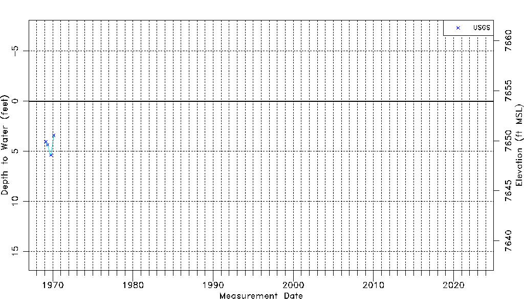
| USGS Data Available | Water-level (GW.LEV) |
| Water-level Database Information |
|---|
| Water-level Count | 4 |
| Water-level Date Range | 02/19/1969 thru 02/19/1970 |
| Monitored within the last 18 months | No, most recently on 02/19/1970 |
| Depth-to-Water Range (ft) | 3.41 to 5.38 |
| Water Table Elevation Range (ft NAVD88) | 7648.57 to 7650.54 |
| Water-Level-Source:Number-of-Measurements | USGS:4 |