| Well Information Table |
|---|
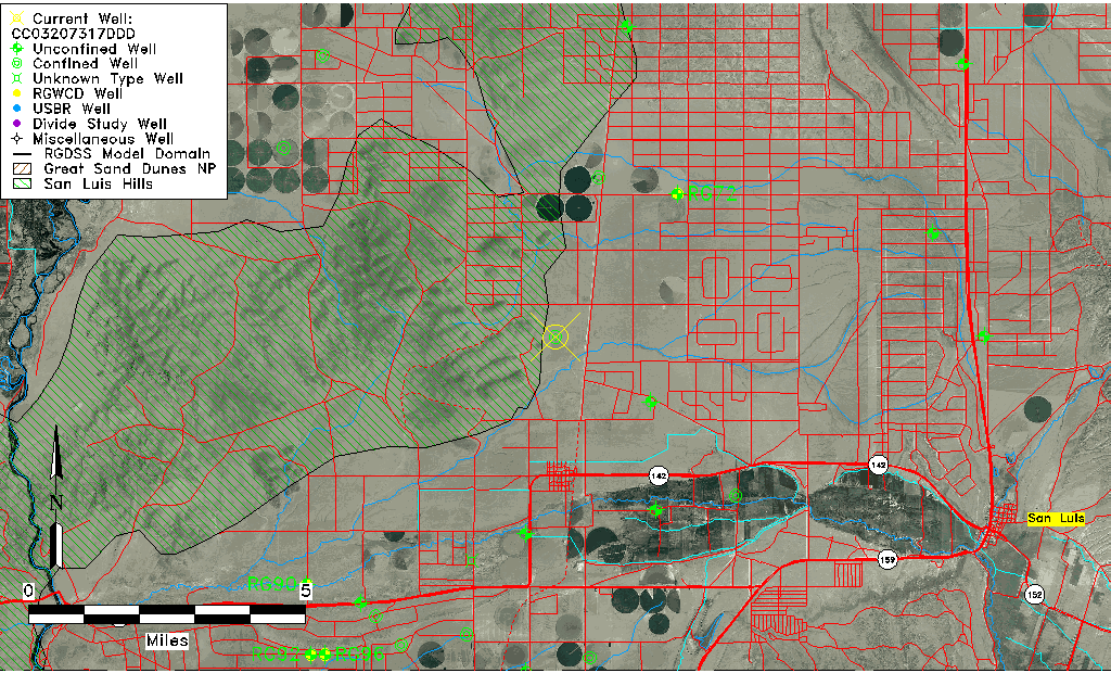
| Common Well ID | CC03207317DDD |
| USGS Well ID | 371500105340001 |
| USGS Station Name | CC03207317DDD |
| USGS Site Type | Well |
| USGS Site Use Information | Withdrawal of Water |
| USGS Groundwater Use Information | Stock |
| Data Source(s) | USGS |
| Location Data |
|---|
| TRS | CC03207317DDD |
| USGS TRS 1 | CC03207317DDD |
| USGS TRS | SESESES017T0032SR0073WS |
| Longitude/Latitude (NAD83) | -105.56723670 , 37.25001230 |
| Longitude/Latitude Data Source | GWSI decimal LAT/LONG field |
| USGS Longitude/Latitude (NAD83) | -105.5672367 , 37.25001230 |
| Easting, Northing RGDSS-NAD83 (US ft) | 231086.52 , 92534.99 |
| USGS Topography | Flat Surface |
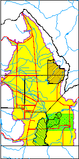
| USGS County | Costilla County |
| Elevation and Depth Data |
|---|
| Ground Elevation (ft NAVD88) | 7754.21000000000 |
| Elevation Data Source | USGS GWSI database |
| USGS Ground Elevation (ft NGVD29) | 7750.00 |
| 1/3-Arc Second NED Ground Elevation (ft NAVD88) | 7752.36 |
| 1-Arc Second NED Ground Elevation (ft NAVD88) | 7754.30 |
| SRTM Ground Elevation (ft NAVD88) | 7752.62 |
| Total Depth (ft) | 450.00 |
| USGS Well Depth (ft) | 450.00 |
| Model Layer | 3 |
| Model Layer Source | Well Depth |
| Depth of Bottom of Layer 1 | 268 |
| Depth of Bottom of Layer 2 | 368 |
| Depth of Bottom of Layer 3 | 783 |
| Depth of Bottom of Layer 4 | 1397 |
| Additional Well Information | Geohydrology, Construction |
| Aquifer Information |
|---|
| Aquifer Type | Confined |
| Aquifer Type Source | TD Elevation/Model Layer |
| USGS Primary Aquifer | Cenozoic Erathem |
| USGS Hydrologic Unit | Alamosa-Trinchera |
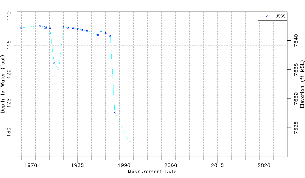
| USGS Data Available | Water-level (GW.LEV) |
| Water-level Database Information |
|---|
| Water-level Count | 19 |
| Water-level Date Range | 12/01/1967 thru 03/14/1991 |
| Monitored within the last 18 months | No, most recently on 03/14/1991 |
| Depth-to-Water Range (ft) | 111.69 to 131.76 |
| Water Table Elevation Range (ft NAVD88) | 7622.45 to 7642.52 |
| Water-Level-Source:Number-of-Measurements | USGS:19 |