| Well Information Table |
|---|
| Common Well ID | NA03500813DCD |
| USGS Well ID | 371612106023501 |
| USGS Station Name | NA03500813DCD |
| USGS Site Type | Well |
| USGS Site Use Information | Unused |
| USGS Groundwater Use Information | Unused |
| Data Source(s) | USGS |
| Location Data |
|---|
| TRS | NA03500813DCD |
| USGS TRS 1 | NA03500813DCD |
| USGS TRS | SESWSES013T0035NR0008EN |
| Longitude/Latitude (NAD83) | -106.04364496 , 37.27183842 |
| Longitude/Latitude Data Source | Davis Engineering Survey |
| USGS Longitude/Latitude (NAD83) | -106.0422477 , 37.26914680 |
| Easting, Northing RGDSS-NAD83 (US ft) | 92494.50 , 100672.11 |
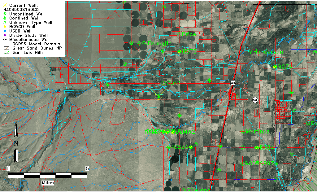
| USGS County | Conejos County |
| Elevation and Depth Data |
|---|
| Ground Elevation (ft NAVD88) | 7681.22000000000 |
| Elevation Data Source | USGS GWSI database |
| USGS Ground Elevation (ft NGVD29) | 7677.00 |
| 1/3-Arc Second NED Ground Elevation (ft NAVD88) | 7681.47 |
| 1-Arc Second NED Ground Elevation (ft NAVD88) | 7681.23 |
| SRTM Ground Elevation (ft NAVD88) | 7678.95 |
| Total Depth (ft) | 22.00 |
| USGS Well Depth (ft) | 22.00 |
| Model Layer | 1 |
| Model Layer Source | Well Depth |
| Depth of Bottom of Layer 1 | 36 |
| Depth of Bottom of Layer 2 | 102 |
| Depth of Bottom of Layer 3 | 146 |
| Depth of Bottom of Layer 4 | 1170 |
| Additional Well Information | Geohydrology, Construction |
| Aquifer Information |
|---|
| Aquifer Type | Unconfined |
| Aquifer Type Source | TD Elevation/Model Layer |
| USGS Primary Aquifer | Cenozoic Erathem |
| USGS Aquifer Type | Unconfined Single Aquifer |
| USGS Hydrologic Unit | Alamosa-Trinchera |
| USGS Data Available | Water-level (GW.LEV) |
| Water-level Database Information |
|---|
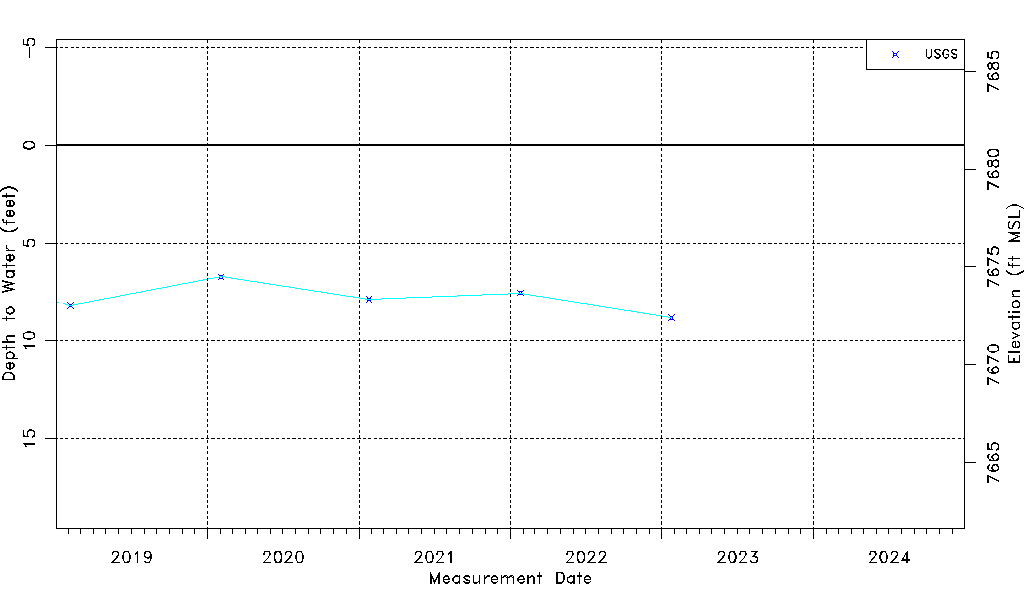
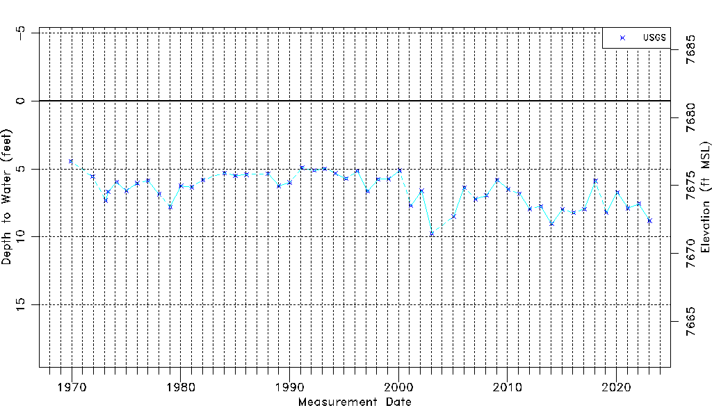
| Water-level Count | 51 |
| Water-level Date Range | 12/01/1969 thru 01/24/2023 |
| Monitored within the last 18 months | Yes, most recently on 01/24/2023 |
| Depth-to-Water Range (ft) | 4.42 to 9.73 |
| Water Table Elevation Range (ft NAVD88) | 7671.49 to 7676.80 |
| Water-Level-Source:Number-of-Measurements | USGS:51 |