| Well Information Table |
|---|
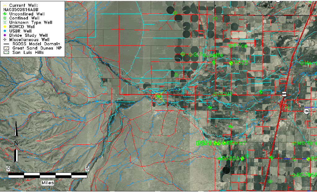
| Common Well ID | NA03500816ABB |
| USGS Well ID | 371655106060701 |
| USGS Station Name | NA03500816ABB |
| USGS Site Type | Well |
| USGS Site Use Information | Destroyed |
| USGS Groundwater Use Information | Unused |
| Data Source(s) | USGS |
| Location Data |
|---|
| TRS | NA03500816ABB |
| USGS TRS 1 | NA03500816ABB |
| USGS TRS | NWNWNES016T0035NR0008EN |
| Longitude/Latitude (NAD83) | -106.10252730 , 37.28195174 |
| Longitude/Latitude Data Source | GWSI decimal LAT/LONG field |
| USGS Longitude/Latitude (NAD83) | -106.1025273 , 37.28195174 |
| Easting, Northing RGDSS-NAD83 (US ft) | 75382.14 , 104425.76 |
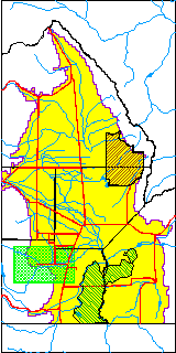
| USGS County | Conejos County |
| Elevation and Depth Data |
|---|
| Ground Elevation (ft NAVD88) | 7800.33000000000 |
| Elevation Data Source | USGS GWSI database |
| USGS Ground Elevation (ft NGVD29) | 7796.00 |
| 1/3-Arc Second NED Ground Elevation (ft NAVD88) | 7798.97 |
| 1-Arc Second NED Ground Elevation (ft NAVD88) | 7798.85 |
| SRTM Ground Elevation (ft NAVD88) | 7795.45 |
| Total Depth (ft) | 30.00 |
| USGS Well Depth (ft) | 30.00 |
| Model Layer | 1 |
| Model Layer Source | Well Depth |
| Depth of Bottom of Layer 1 | 41 |
| Depth of Bottom of Layer 2 | 148 |
| Depth of Bottom of Layer 3 | 169 |
| Depth of Bottom of Layer 4 | 421 |
| Additional Well Information | Geohydrology, Construction |
| Aquifer Information |
|---|
| Aquifer Type | Unconfined |
| Aquifer Type Source | TD Elevation/Model Layer |
| USGS Primary Aquifer | Cenozoic Erathem |
| USGS Hydrologic Unit | Alamosa-Trinchera |
| USGS Data Available | Water-level (GW.LEV) |
| Water-level Database Information |
|---|
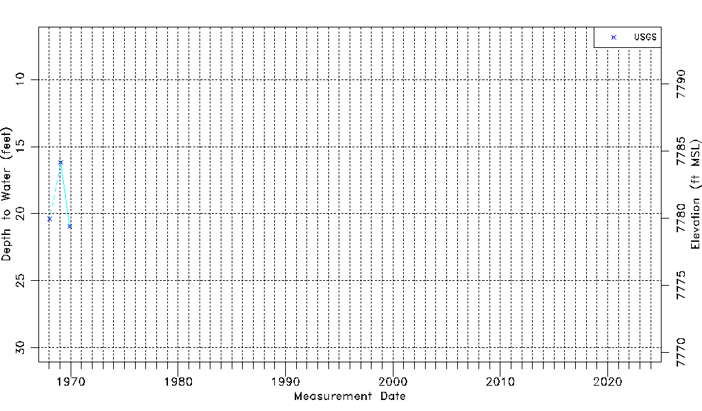
| Water-level Count | 3 |
| Water-level Date Range | 01/16/1968 thru 12/01/1969 |
| Monitored within the last 18 months | No, most recently on 12/01/1969 |
| Depth-to-Water Range (ft) | 16.17 to 20.95 |
| Water Table Elevation Range (ft NAVD88) | 7779.38 to 7784.16 |
| Water-Level-Source:Number-of-Measurements | USGSaguache Creek:3 |