| Well Information Table |
|---|
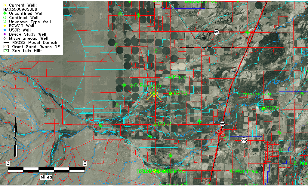
| Common Well ID | NA03600905BBB |
| USGS Well ID | 371847106021901 |
| USGS Station Name | NA03600905BBB |
| USGS Construction Date | 01/01/1974 |
| USGS Site Type | Well |
| USGS Site Use Information | Unused |
| USGS Groundwater Use Information | Unused |
| Data Source(s) | USGS |
| Location Data |
|---|
| TRS | NA03600905BBB |
| USGS TRS 1 | NA03600905BBB |
| USGS TRS | NENENES001T0035NR0008EN |
| Longitude/Latitude (NAD83) | -106.03919210 , 37.31306260 |
| Longitude/Latitude Data Source | GWSI decimal LAT/LONG field |
| USGS Longitude/Latitude (NAD83) | -106.0391921 , 37.31306260 |
| Easting, Northing RGDSS-NAD83 (US ft) | 93847.89 , 115672.96 |
| USGS Topography | Valley flat |
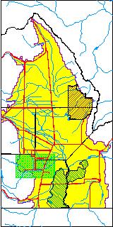
| USGS County | Alamosa County |
| Elevation and Depth Data |
|---|
| Ground Elevation (ft NAVD88) | 7668.19000000000 |
| Elevation Data Source | USGS GWSI database |
| USGS Ground Elevation (ft NGVD29) | 7664.00 |
| 1/3-Arc Second NED Ground Elevation (ft NAVD88) | 7669.95 |
| 1-Arc Second NED Ground Elevation (ft NAVD88) | 7670.00 |
| SRTM Ground Elevation (ft NAVD88) | 7667.71 |
| Total Depth (ft) | 27.00 |
| USGS Well Depth (ft) | 27.00 |
| Model Layer | 1 |
| Model Layer Source | Well Depth |
| Depth of Bottom of Layer 1 | 30 |
| Depth of Bottom of Layer 2 | 165 |
| Depth of Bottom of Layer 3 | 241 |
| Depth of Bottom of Layer 4 | 1726 |
| Additional Well Information | Production, Logs, Geohydrology, Construction |
| Aquifer Information |
|---|
| Aquifer Type | Unconfined |
| Aquifer Type Source | TD Elevation/Model Layer |
| USGS Primary Aquifer | Cenozoic Erathem |
| USGS Hydrologic Unit | Alamosa-Trinchera |
| USGS Data Available | Geohydrologic |
| Water-level Database Information |
|---|
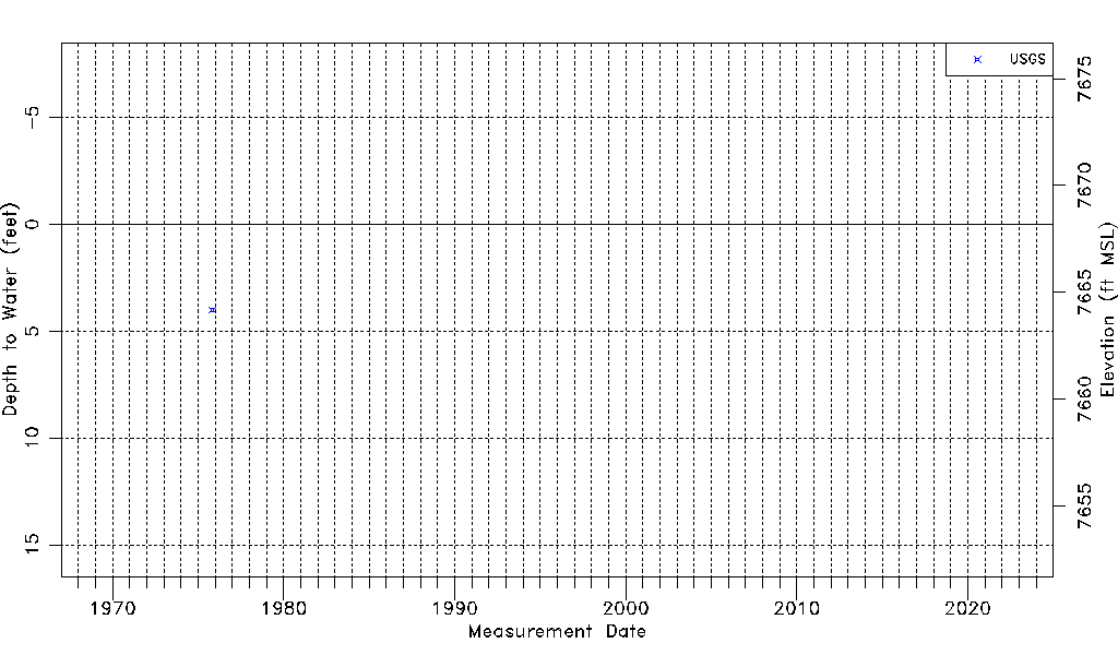
| Water-level Count | 1 |
| Water-level Date Range | 11/01/1975 thru 11/01/1975 |
| Monitored within the last 18 months | No, most recently on 11/01/1975 |
| Depth-to-Water Range (ft) | 4.00 to 4.00 |
| Water Table Elevation Range (ft NAVD88) | 7664.19 to 7664.19 |
| Water-Level-Source:Number-of-Measurements | USGSaguache Creek:1 |