| Well Information Table |
|---|
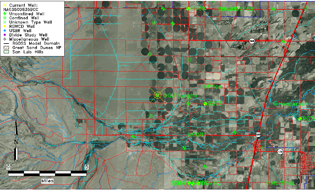
| Common Well ID | NA03600835BCC |
| USGS Well ID | 371914106042901 |
| USGS Station Name | NA03600835BCC |
| USGS Construction Date | 08/13/1993 |
| USGS Site Type | Well |
| USGS Site Use Information | Observation |
| USGS Groundwater Use Information | Unused |
| Data Source(s) | USGS |
| Location Data |
|---|
| TRS | NA03600835BCC |
| USGS TRS 1 | NA03600835BCC |
| USGS TRS | SWSWNWS 35T 36NR 8E |
| Longitude/Latitude (NAD83) | -106.07472220 , 37.32055556 |
| Longitude/Latitude Data Source | GWSI decimal LAT/LONG field |
| USGS Longitude/Latitude (NAD83) | -106.0747222 , 37.32055556 |
| Easting, Northing RGDSS-NAD83 (US ft) | 83529.33 , 118442.43 |
| USGS Topography | Valley flat |
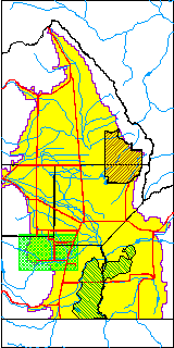
| USGS County | Conejos County |
| USGS Map Name | CAPULIN |
| USGS Map Scale | 2400 |
| Elevation and Depth Data |
|---|
| Ground Elevation (ft NAVD88) | 7738.00000000000 |
| Elevation Data Source | USGS GWSI database |
| USGS Ground Elevation (ft NAVD88) | 7738.00 |
| 1/3-Arc Second NED Ground Elevation (ft NAVD88) | 7736.97 |
| 1-Arc Second NED Ground Elevation (ft NAVD88) | 7737.03 |
| SRTM Ground Elevation (ft NAVD88) | 7732.94 |
| Total Depth (ft) | 44.63 |
| USGS Hole Depth (ft) | 45.00 |
| USGS Well Depth (ft) | 44.63 |
| Model Layer | 2 |
| Model Layer Source | Well Depth |
| Depth of Bottom of Layer 1 | 27 |
| Depth of Bottom of Layer 2 | 221 |
| Depth of Bottom of Layer 3 | 285 |
| Depth of Bottom of Layer 4 | 1405 |
| Additional Well Information | Logs, Geohydrology, Construction, Aquifer |
| Aquifer Information |
|---|
| Aquifer Type | Confined |
| Aquifer Type Source | TD Elevation/Model Layer |
| USGS Primary Aquifer | Cenozoic Erathem |
| USGS Aquifer Type | Unconfined Single Aquifer |
| USGS Hydrologic Unit | Alamosa-Trinchera |
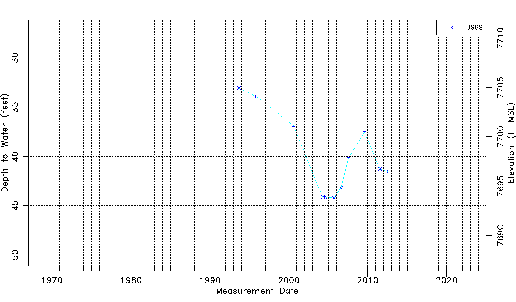
| USGS Data Available | Water-level (GW.LEV) |
| Water-level Database Information |
|---|
| Water-level Count | 11 |
| Water-level Date Range | 09/16/1993 thru 07/27/2012 |
| Monitored within the last 18 months | No, most recently on 07/27/2012 |
| Depth-to-Water Range (ft) | 33.03 to 44.20 |
| Water Table Elevation Range (ft NAVD88) | 7693.80 to 7704.97 |
| Water-Level-Source:Number-of-Measurements | USGS:11 |