| Well Information Table |
|---|
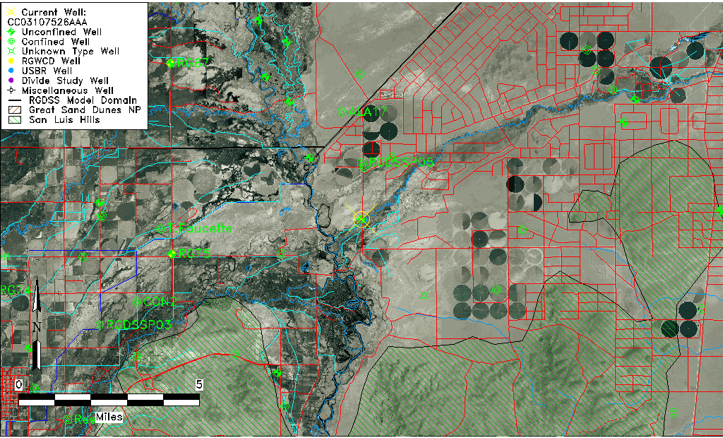
| Common Well ID | CC03107526AAA |
| USGS Well ID | 371940105432501 |
| USGS Station Name | CC03107526AAA |
| USGS Construction Date | 01/01/1968 |
| USGS Site Type | Well |
| USGS Site Use Information | Anode |
| USGS Groundwater Use Information | Unused |
| Data Source(s) | USGS |
| Location Data |
|---|
| TRS | CC03107526AAA |
| USGS TRS 1 | CC03107526AAA |
| USGS TRS | NENENES026T0031SR0075WS |
| Longitude/Latitude (NAD83) | -105.72417612 , 37.32778423 |
| Longitude/Latitude Data Source | Davis Engineering Survey |
| USGS Longitude/Latitude (NAD83) | -105.7247956 , 37.33014806 |
| Easting, Northing RGDSS-NAD83 (US ft) | 185437.19 , 120829.45 |
| USGS Topography | Valley flat |
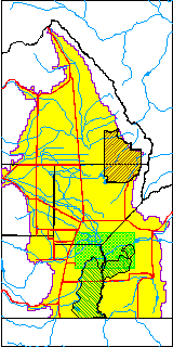
| USGS County | Costilla County |
| USGS Map Name | LASAUSES |
| USGS Map Scale | 24000 |
| Elevation and Depth Data |
|---|
| Ground Elevation (ft NAVD88) | 7521.00000000000 |
| Elevation Data Source | USGS GWSI database |
| USGS Ground Elevation (ft NGVD29) | 7517.00 |
| 1/3-Arc Second NED Ground Elevation (ft NAVD88) | 7518.68 |
| 1-Arc Second NED Ground Elevation (ft NAVD88) | 7517.23 |
| SRTM Ground Elevation (ft NAVD88) | 7513.20 |
| Total Depth (ft) | 13.00 |
| USGS Well Depth (ft) | 13.00 |
| Model Layer | 1 |
| Model Layer Source | Well Depth |
| Depth of Bottom of Layer 1 | 38 |
| Depth of Bottom of Layer 2 | 168 |
| Depth of Bottom of Layer 3 | 563 |
| Depth of Bottom of Layer 4 | 1965 |
| Additional Well Information | Geohydrology, Construction |
| Aquifer Information |
|---|
| Aquifer Type | Unconfined |
| Aquifer Type Source | TD Elevation/Model Layer |
| USGS Primary Aquifer | Cenozoic Erathem |
| USGS Aquifer Type | Unconfined Single Aquifer |
| USGS Hydrologic Unit | Alamosa-Trinchera |
| USGS Data Available | Water-level (GW.LEV) |
| Water-level Database Information |
|---|
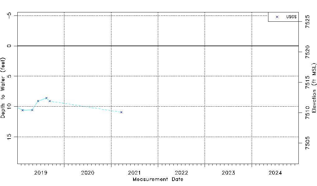
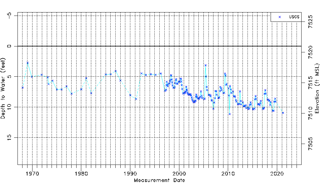
| Water-level Count | 187 |
| Water-level Date Range | 01/16/1968 thru 03/22/2021 |
| Monitored within the last 18 months | No, most recently on 03/22/2021 |
| Depth-to-Water Range (ft) | 2.74 to 11.12 |
| Water Table Elevation Range (ft NAVD88) | 7509.88 to 7518.26 |
| Water-Level-Source:Number-of-Measurements | USGSaguache Creek:187 |