| Well Information Table |
|---|
| Common Well ID | NA03601026CCC USGS 371941105511901 |
| USGS Well ID | 371941105511901 |
| USGS Station Name | NA03601026CCC USGS 371941105511901 |
| USGS Site Type | Well |
| USGS Site Use Information | Withdrawal of Water |
| USGS Groundwater Use Information | Irrigation |
| Data Source(s) | USGS |
| Location Data |
|---|
| TRS | NA03601026CCC USGS 371941105511901 |
| USGS TRS 1 | NA03601026CCC USGS 371941105511901 |
| Longitude/Latitude (NAD83) | -105.85585420 , 37.32806370 |
| Longitude/Latitude Data Source | GWSI decimal LAT/LONG field |
| USGS Longitude/Latitude (NAD83) | -105.8558542 , 37.32806370 |
| Easting, Northing RGDSS-NAD83 (US ft) | 147161.85 , 120978.60 |
| USGS Topography | Valley flat |
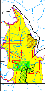
| USGS County | Conejos County |
| USGS Map Name | PIKES STOCKADE |
| USGS Map Scale | 24000 |
| Elevation and Depth Data |
|---|
| Ground Elevation (ft NAVD88) | 7555.97000000000 |
| Elevation Data Source | USGS GS corrected using NED3 |
| USGS Ground Elevation (ft NAVD88) | 7556.00 |
| 1/3-Arc Second NED Ground Elevation (ft NAVD88) | 7555.97 |
| 1-Arc Second NED Ground Elevation (ft NAVD88) | 7556.54 |
| SRTM Ground Elevation (ft NAVD88) | 7555.77 |
| Depth of Bottom of Layer 1 | 33 |
| Depth of Bottom of Layer 2 | 426 |
| Depth of Bottom of Layer 3 | 686 |
| Depth of Bottom of Layer 4 | 2102 |
| Additional Well Information | NONE |
| Aquifer Information |
|---|
| Aquifer Type | Unknown |
| Aquifer Type Source | None |
| USGS Hydrologic Unit | Alamosa-Trinchera |
| USGS Data Available | Water-level (GW.LEV) |
| Water-level Database Information |
|---|
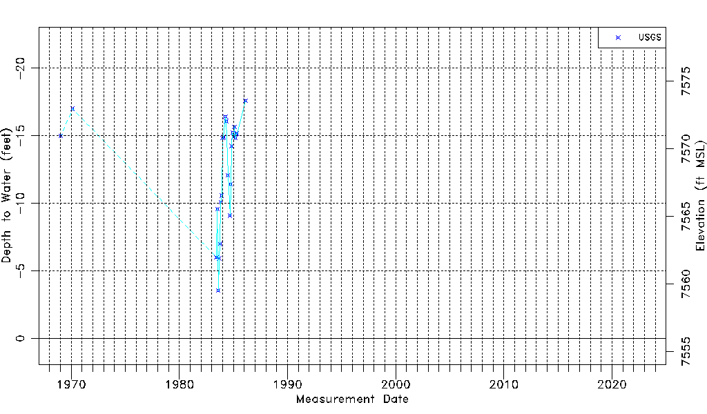
| Water-level Count | 24 |
| Water-level Date Range | 01/20/1969 thru 02/13/1986 |
| Monitored within the last 18 months | No, most recently on 02/13/1986 |
| Depth-to-Water Range (ft) | -17.58 to -3.54 |
| Water Table Elevation Range (ft NAVD88) | 7559.51 to 7573.55 |
| Water-Level-Source:Number-of-Measurements | USGSaguache Creek:24 |