| Well Information Table |
|---|
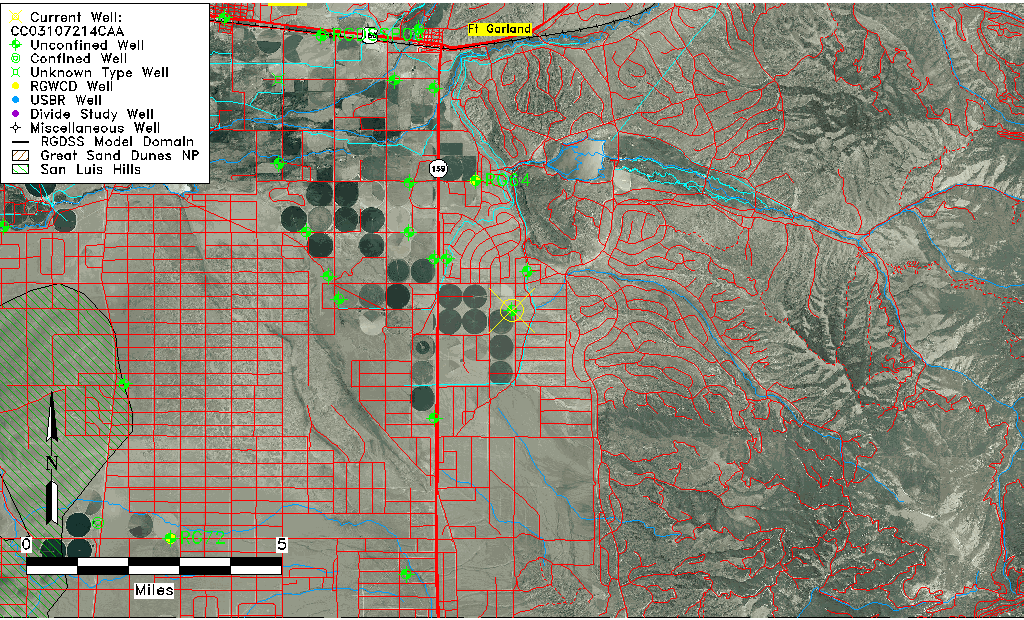
| Common Well ID | CC03107214CAA |
| USGS Well ID | 372106105241701 |
| USGS Station Name | CC03107214CAA |
| USGS Site Type | Well |
| USGS Site Use Information | Observation |
| USGS Groundwater Use Information | Unused |
| Data Source(s) | USGS |
| Location Data |
|---|
| TRS | CC03107214CAA |
| USGS TRS 1 | CC03107214CAA |
| USGS TRS | NENESWS014T0031NR0072EC |
| Longitude/Latitude (NAD83) | -105.40573400 , 37.35173290 |
| Longitude/Latitude Data Source | GWSI decimal LAT/LONG field |
| USGS Longitude/Latitude (NAD83) | -105.4057340 , 37.35173290 |
| Easting, Northing RGDSS-NAD83 (US ft) | 277973.06 , 129652.05 |
| USGS Topography | Valley flat |
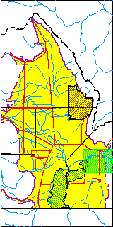
| USGS County | Costilla County |
| USGS Map Name | FORT GARLAND S W |
| USGS Map Scale | 24000 |
| Elevation and Depth Data |
|---|
| Ground Elevation (ft NAVD88) | 7994.40000000000 |
| Elevation Data Source | USGS GWSI database |
| USGS Ground Elevation (ft NGVD29) | 7990.00 |
| 1/3-Arc Second NED Ground Elevation (ft NAVD88) | 7995.58 |
| 1-Arc Second NED Ground Elevation (ft NAVD88) | 7995.66 |
| SRTM Ground Elevation (ft NAVD88) | 8004.08 |
| Total Depth (ft) | 414.00 |
| USGS Well Depth (ft) | 414.00 |
| Model Layer | 1 |
| Model Layer Source | Well Depth |
| Depth of Bottom of Layer 1 | 483 |
| Depth of Bottom of Layer 2 | 583 |
| Depth of Bottom of Layer 3 | 620 |
| Depth of Bottom of Layer 4 | 712 |
| Additional Well Information | Construction |
| Aquifer Information |
|---|
| Aquifer Type | Unconfined |
| Aquifer Type Source | TD Elevation/Model Layer |
| USGS Hydrologic Unit | Alamosa-Trinchera |
| USGS Data Available | Water-level (GW.LEV) |
| Water-level Database Information |
|---|
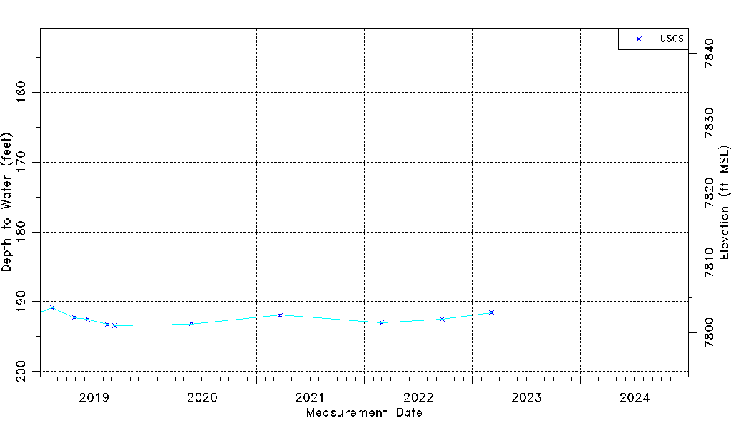
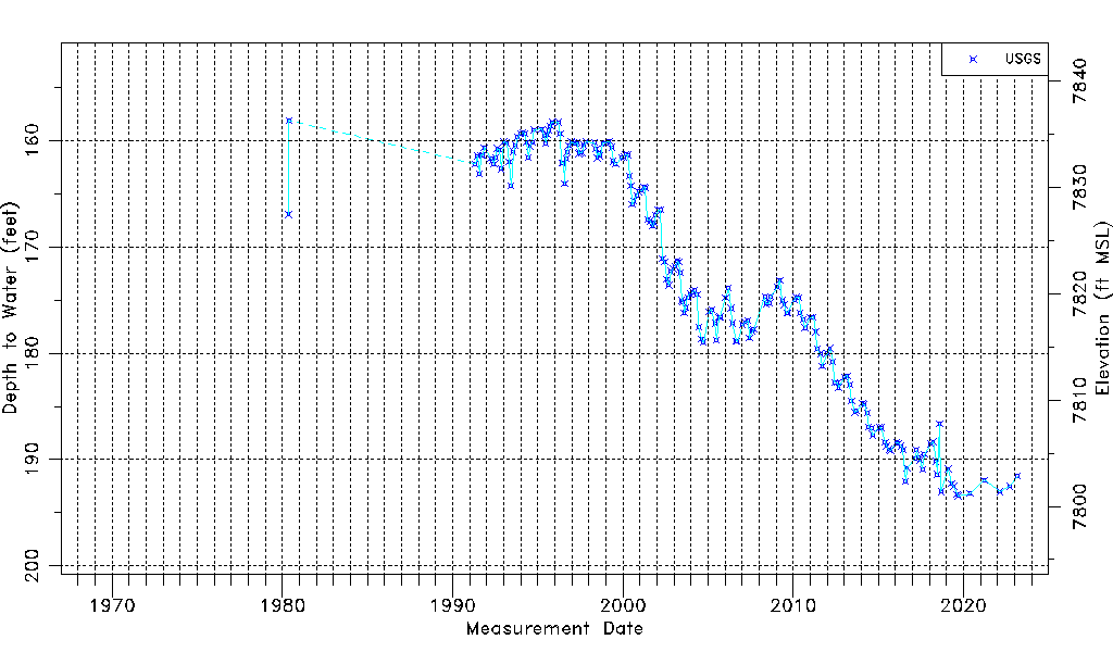
| Water-level Count | 199 |
| Water-level Date Range | 05/14/1980 thru 03/06/2023 |
| Monitored within the last 18 months | Yes, most recently on 03/06/2023 |
| Depth-to-Water Range (ft) | 158.11 to 193.44 |
| Water Table Elevation Range (ft NAVD88) | 7800.96 to 7836.29 |
| Water-Level-Source:Number-of-Measurements | USGS:199 |