| Well Information Table |
|---|
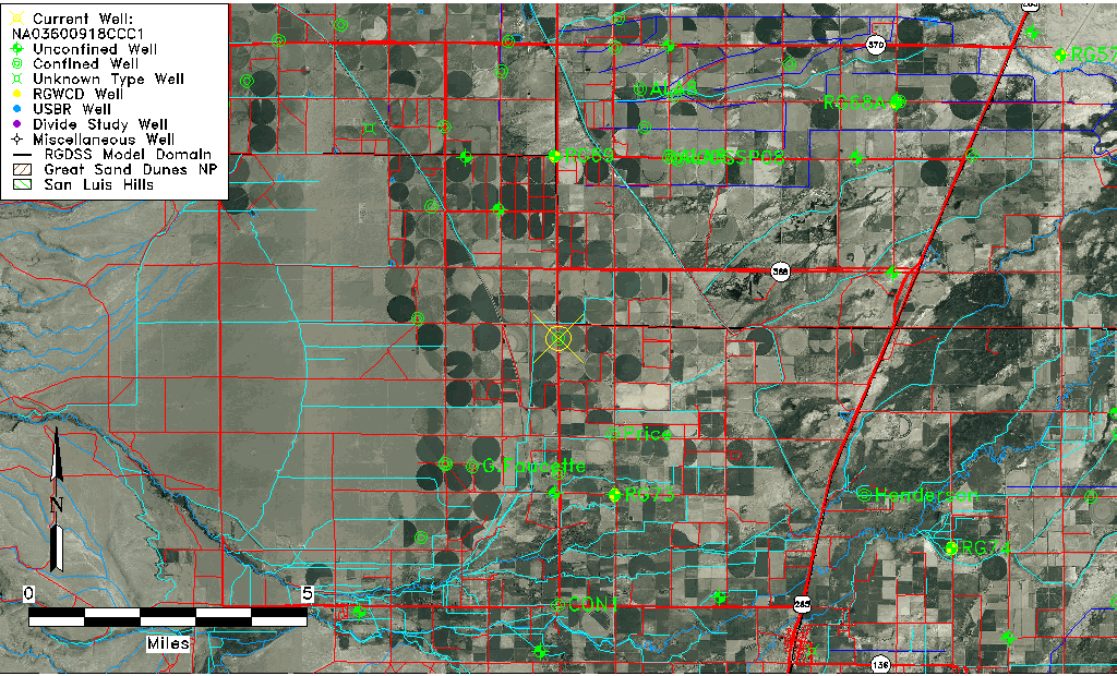
| Common Well ID | NA03600918CCC1 |
| USGS Well ID | 372112106021501 |
| USGS Station Name | NA03600918CCC1 |
| USGS Site Type | Well |
| USGS Site Use Information | Unused |
| USGS Groundwater Use Information | Unused |
| Data Source(s) | USGS |
| Location Data |
|---|
| TRS | NA03600918CCC1 |
| USGS TRS 1 | NA03600918CCC1 |
| USGS TRS | SWSWSWS018T0036NR0009EN |
| Longitude/Latitude (NAD83) | -106.03808100 , 37.35333960 |
| Longitude/Latitude Data Source | GWSI decimal LAT/LONG field |
| USGS Longitude/Latitude (NAD83) | -106.0380810 , 37.35333960 |
| Easting, Northing RGDSS-NAD83 (US ft) | 94227.61 , 130332.91 |
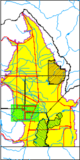
| USGS County | Alamosa County |
| Elevation and Depth Data |
|---|
| Ground Elevation (ft NAVD88) | 7650.18000000000 |
| Elevation Data Source | USGS GWSI database |
| USGS Ground Elevation (ft NGVD29) | 7646.00 |
| 1/3-Arc Second NED Ground Elevation (ft NAVD88) | 7653.05 |
| 1-Arc Second NED Ground Elevation (ft NAVD88) | 7653.15 |
| SRTM Ground Elevation (ft NAVD88) | 7650.92 |
| Total Depth (ft) | 234.00 |
| USGS Well Depth (ft) | 234.00 |
| Model Layer | 2 |
| Model Layer Source | Well Depth |
| Depth of Bottom of Layer 1 | 31 |
| Depth of Bottom of Layer 2 | 270 |
| Depth of Bottom of Layer 3 | 430 |
| Depth of Bottom of Layer 4 | 2054 |
| Additional Well Information | Geohydrology, Construction |
| Aquifer Information |
|---|
| Aquifer Type | Confined |
| Aquifer Type Source | TD Elevation/Model Layer |
| USGS Primary Aquifer | Cenozoic Erathem |
| USGS Hydrologic Unit | Alamosa-Trinchera |
| USGS Data Available | Water-level (GW.LEV) |
| Water-level Database Information |
|---|
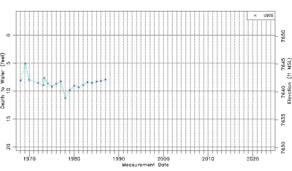
| Water-level Count | 20 |
| Water-level Date Range | 01/15/1968 thru 01/21/1987 |
| Monitored within the last 18 months | No, most recently on 01/21/1987 |
| Depth-to-Water Range (ft) | 5.11 to 11.25 |
| Water Table Elevation Range (ft NAVD88) | 7638.93 to 7645.07 |
| Water-Level-Source:Number-of-Measurements | USGS:20 |