| Well Information Table |
|---|
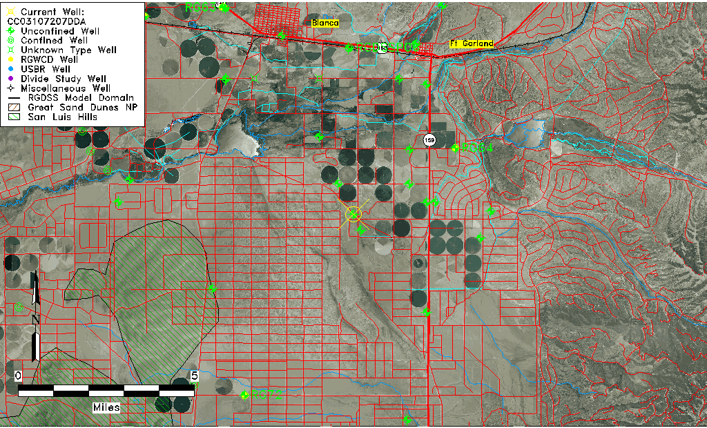
| Common Well ID | CC03107207DDA |
| USGS Well ID | 372141105281101 |
| USGS Station Name | CC03107207DDA |
| USGS Construction Date | 01/01/1944 |
| USGS Site Type | Well |
| USGS Site Use Information | Observation |
| USGS Groundwater Use Information | Unused |
| Data Source(s) | USGS |
| Location Data |
|---|
| TRS | CC03107207DDA |
| USGS TRS 1 | CC03107207DDA |
| USGS TRS | NESESES007T0031NR0072WC |
| Longitude/Latitude (NAD83) | -105.47101230 , 37.36156557 |
| Longitude/Latitude Data Source | GWSI decimal LAT/LONG field |
| USGS Longitude/Latitude (NAD83) | -105.4710123 , 37.36156557 |
| Easting, Northing RGDSS-NAD83 (US ft) | 258997.51 , 133183.93 |
| USGS Topography | Valley flat |
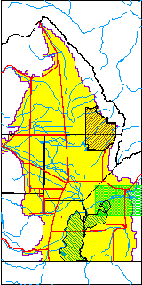
| USGS County | Costilla County |
| USGS Map Name | FT GARLAND S W |
| USGS Map Scale | 24000 |
| Elevation and Depth Data |
|---|
| Ground Elevation (ft NAVD88) | 7825.37000000000 |
| Elevation Data Source | USGS GWSI database |
| USGS Ground Elevation (ft NGVD29) | 7821.00 |
| 1/3-Arc Second NED Ground Elevation (ft NAVD88) | 7828.39 |
| 1-Arc Second NED Ground Elevation (ft NAVD88) | 7827.47 |
| SRTM Ground Elevation (ft NAVD88) | 7833.18 |
| Total Depth (ft) | 225.00 |
| USGS Well Depth (ft) | 225.00 |
| Model Layer | 1 |
| Model Layer Source | Well Depth |
| Depth of Bottom of Layer 1 | 421 |
| Depth of Bottom of Layer 2 | 521 |
| Depth of Bottom of Layer 3 | 711 |
| Depth of Bottom of Layer 4 | 1212 |
| Additional Well Information | Production |
| Aquifer Information |
|---|
| Aquifer Type | Unconfined |
| Aquifer Type Source | TD Elevation/Model Layer |
| USGS Hydrologic Unit | Alamosa-Trinchera |
| USGS Data Available | Water-level (GW.LEV) |
| Water-level Database Information |
|---|
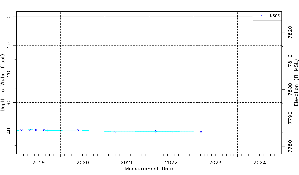
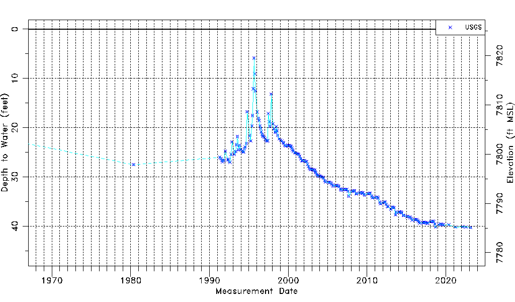
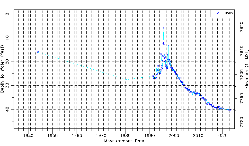
| Water-level Count | 206 |
| Water-level Date Range | 01/01/1944 thru 03/06/2023 |
| Monitored within the last 18 months | Yes, most recently on 03/06/2023 |
| Depth-to-Water Range (ft) | 5.87 to 40.28 |
| Water Table Elevation Range (ft NAVD88) | 7785.09 to 7819.50 |
| Water-Level-Source:Number-of-Measurements | USGS:206 |