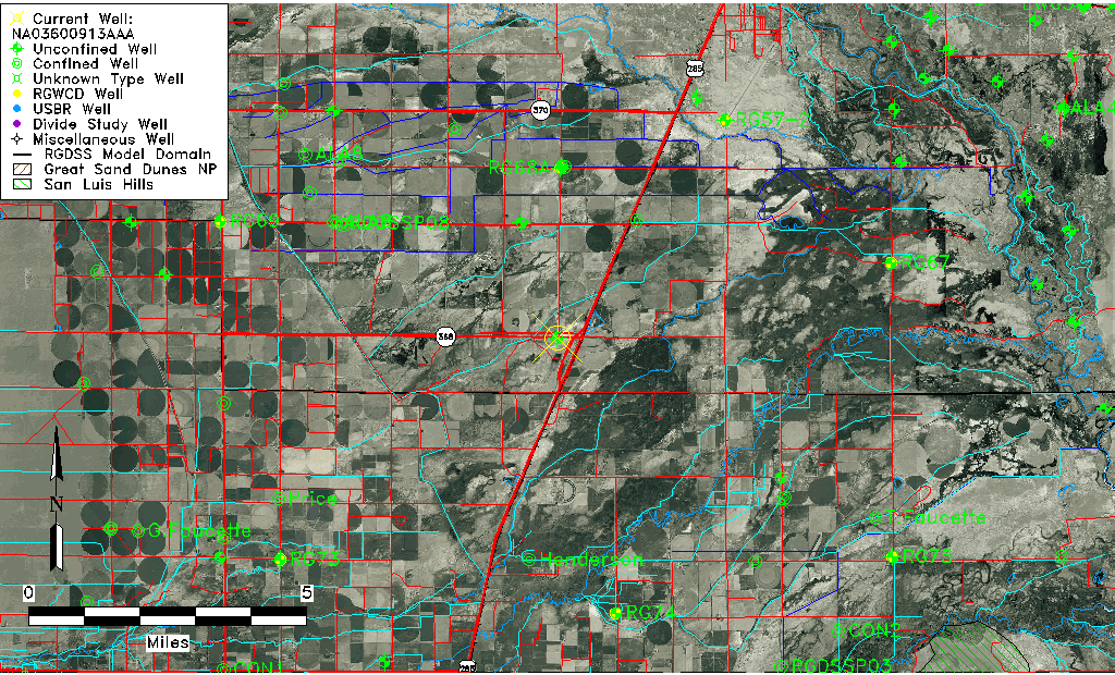
| Well Information Table |
|---|
| Common Well ID | NA03600913AAA |
| USGS Well ID | 372154105555401 |
| USGS Station Name | NA03600913AAA |
| USGS Construction Date | 01/01/1936 |
| USGS Site Type | Well |
| USGS Site Use Information | Observation |
| USGS Groundwater Use Information | Unused |
| Data Source(s) | USGS |
| Location Data |
|---|
| TRS | NA03600913AAA |
| USGS TRS 1 | NA03600913AAA |
| USGS TRS | NENENES013T0036NR0009EN |
| Longitude/Latitude (NAD83) | -105.92923385 , 37.37067323 |
| Longitude/Latitude Data Source | Davis Engineering Survey |
| USGS Longitude/Latitude (NAD83) | -105.9316895 , 37.37000656 |
| Easting, Northing RGDSS-NAD83 (US ft) | 125874.12 , 136538.22 |
| USGS Topography | Valley flat |
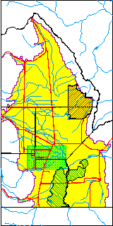
| USGS County | Alamosa County |
| USGS Map Name | LA JARA |
| USGS Map Scale | 24000 |
| Elevation and Depth Data |
|---|
| Ground Elevation (ft NAVD88) | 7562.07000000000 |
| Elevation Data Source | Davis Engineering Survey |
| USGS Ground Elevation (ft NGVD29) | 7558.00 |
| 1/3-Arc Second NED Ground Elevation (ft NAVD88) | 7563.96 |
| 1-Arc Second NED Ground Elevation (ft NAVD88) | 7562.11 |
| SRTM Ground Elevation (ft NAVD88) | 7566.41 |
| Total Depth (ft) | 10.00 |
| USGS Well Depth (ft) | 10.00 |
| Model Layer | 1 |
| Model Layer Source | Well Depth |
| Depth of Bottom of Layer 1 | 39 |
| Depth of Bottom of Layer 2 | 383 |
| Depth of Bottom of Layer 3 | 722 |
| Depth of Bottom of Layer 4 | 2207 |
| Additional Well Information | Geohydrology, Construction |
| Aquifer Information |
|---|
| Aquifer Type | Unconfined |
| Aquifer Type Source | TD Elevation/Model Layer |
| USGS Primary Aquifer | Cenozoic Erathem |
| USGS Hydrologic Unit | Alamosa-Trinchera |
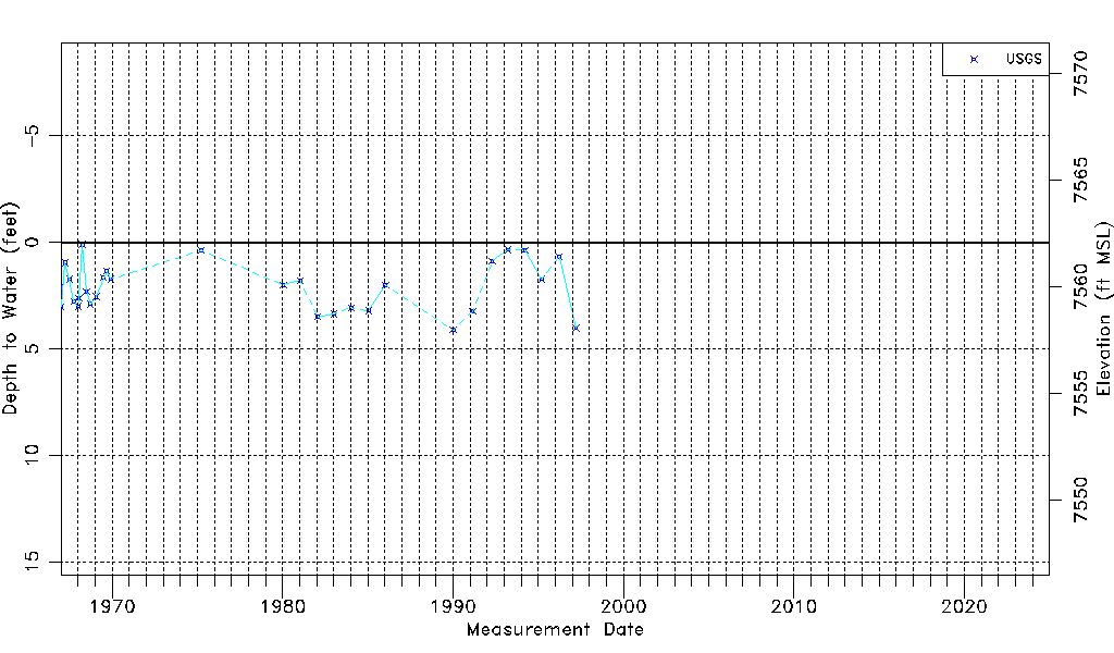
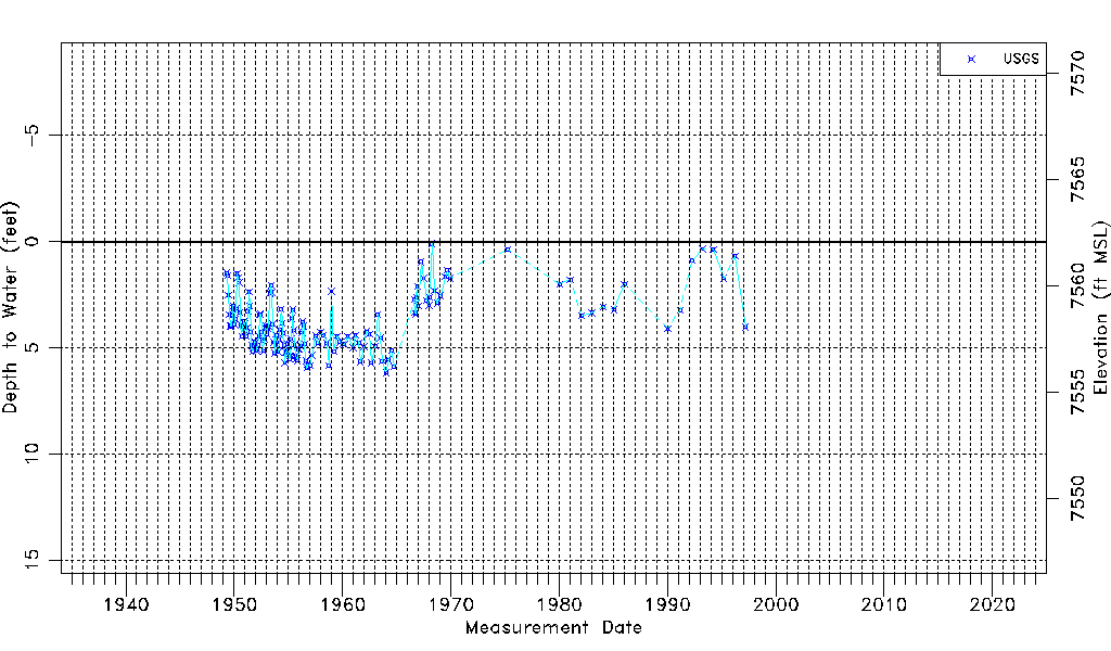
| USGS Data Available | Water-level (GW.LEV) |
| Water-level Database Information |
|---|
| Water-level Count | 156 |
| Water-level Date Range | 04/21/1949 thru 03/20/1997 |
| Monitored within the last 18 months | No, most recently on 03/20/1997 |
| Depth-to-Water Range (ft) | 0.10 to 6.17 |
| Water Table Elevation Range (ft NAVD88) | 7555.90 to 7561.97 |
| Water-Level-Source:Number-of-Measurements | USGS:156 |