| Well Information Table |
|---|
| Common Well ID | NA03601110CAC-ANWR-P6 |
| USGS Well ID | 372230105453801 |
| USGS Station Name | NA03601110CAC-ANWR-P6 |
| USGS Construction Date | 02/21/1994 |
| USGS Site Type | Well |
| USGS Site Use Information | Observation |
| USGS Groundwater Use Information | Unused |
| Data Source(s) | USGS |
| Location Data |
|---|
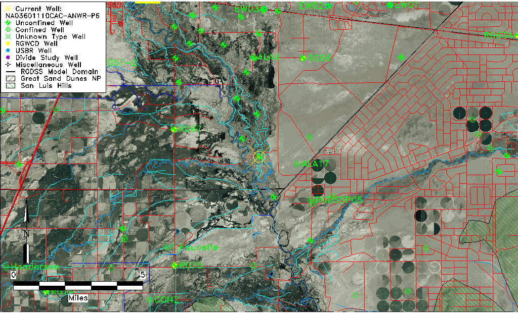
| TRS | NA03601110CAC-ANWR-P6 |
| USGS TRS 1 | NA03601110CAC-ANWR-P6 |
| USGS TRS | SWNESWS010TO36N R011E N |
| Longitude/Latitude (NAD83) | -105.76057430 , 37.37500780 |
| Longitude/Latitude Data Source | GWSI decimal LAT/LONG field |
| USGS Longitude/Latitude (NAD83) | -105.7605743 , 37.37500780 |
| Easting, Northing RGDSS-NAD83 (US ft) | 174873.23 , 138026.38 |
| USGS Topography | Alluvial or Marine Terrace |
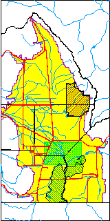
| USGS County | Alamosa County |
| USGS Map Name | ALAMOSA EAST |
| USGS Map Scale | 24000 |
| Elevation and Depth Data |
|---|
| Ground Elevation (ft NAVD88) | 7518.68000000000 |
| Elevation Data Source | USGS GWSI database |
| USGS Ground Elevation (ft NGVD29) | 7514.70 |
| 1/3-Arc Second NED Ground Elevation (ft NAVD88) | 7513.92 |
| 1-Arc Second NED Ground Elevation (ft NAVD88) | 7515.09 |
| SRTM Ground Elevation (ft NAVD88) | 7519.68 |
| Total Depth (ft) | 15.00 |
| USGS Hole Depth (ft) | 15.00 |
| USGS Well Depth (ft) | 15.00 |
| Model Layer | 1 |
| Model Layer Source | Well Depth |
| Depth of Bottom of Layer 1 | 31 |
| Depth of Bottom of Layer 2 | 204 |
| Depth of Bottom of Layer 3 | 589 |
| Depth of Bottom of Layer 4 | 2050 |
| Additional Well Information | Geohydrology, Construction |
| Aquifer Information |
|---|
| Aquifer Type | Unconfined |
| Aquifer Type Source | TD Elevation/Model Layer |
| USGS Primary Aquifer | Cenozoic Erathem |
| USGS Aquifer Type | Unconfined Single Aquifer |
| USGS Hydrologic Unit | Alamosa-Trinchera |
| USGS Data Available | Water-level (GW.LEV) |
| Water-level Database Information |
|---|
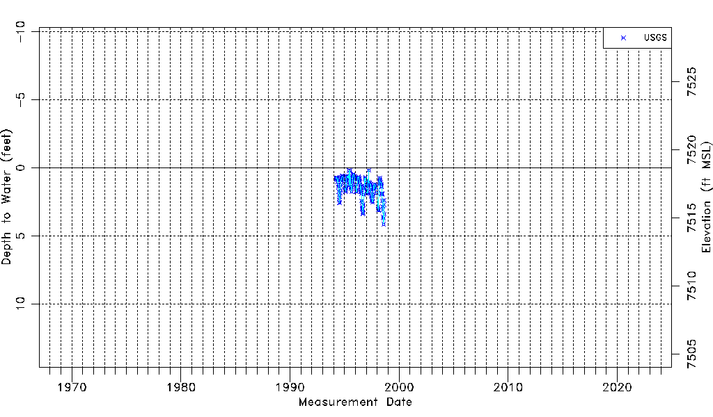
| Water-level Count | 192 |
| Water-level Date Range | 03/15/1994 thru 08/27/1998 |
| Monitored within the last 18 months | No, most recently on 08/27/1998 |
| Depth-to-Water Range (ft) | 0.17 to 4.15 |
| Water Table Elevation Range (ft NAVD88) | 7514.53 to 7518.51 |
| Water-Level-Source:Number-of-Measurements | USGSaguache Creek:192 |