| Well Information Table |
|---|
| Common Well ID | 'NA03107306DCB ON TRINCHERA CRK ABV SMITH RES ALAM |
| USGS Well ID | 372233105351101 |
| USGS Station Name | 'NA03107306DCB ON TRINCHERA CRK ABV SMITH RES ALAM |
| USGS Construction Date | 08/14/1993 |
| USGS Site Type | Well |
| USGS Site Use Information | Observation |
| USGS Groundwater Use Information | Unused |
| Data Source(s) | USGS |
| Location Data |
|---|
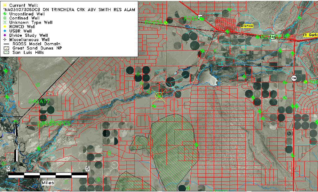
| TRS | 'NA03107306DCB ON TRINCHERA CRK ABV SMITH RES ALAM |
| USGS TRS 1 | 'NA03107306DCB ON TRINCHERA CRK ABV SMITH RES ALAM |
| USGS TRS | NWSWSES 6T 31SR 73W |
| Longitude/Latitude (NAD83) | -105.58638890 , 37.37583330 |
| Longitude/Latitude Data Source | GWSI decimal LAT/LONG field |
| USGS Longitude/Latitude (NAD83) | -105.5863889 , 37.37583330 |
| Easting, Northing RGDSS-NAD83 (US ft) | 225471.82 , 138326.18 |
| USGS Topography | Valley flat |
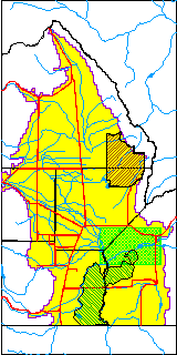
| USGS County | Costilla County |
| USGS Map Name | BLANCA |
| USGS Map Scale | 2400 |
| Elevation and Depth Data |
|---|
| Ground Elevation (ft NAVD88) | 7648.00000000000 |
| Elevation Data Source | USGS GWSI database |
| USGS Ground Elevation (ft NAVD88) | 7648.00 |
| 1/3-Arc Second NED Ground Elevation (ft NAVD88) | 7654.14 |
| 1-Arc Second NED Ground Elevation (ft NAVD88) | 7652.56 |
| SRTM Ground Elevation (ft NAVD88) | 7647.64 |
| Total Depth (ft) | 19.90 |
| USGS Hole Depth (ft) | 20.00 |
| USGS Well Depth (ft) | 19.90 |
| Model Layer | 1 |
| Model Layer Source | Well Depth |
| Depth of Bottom of Layer 1 | 194 |
| Depth of Bottom of Layer 2 | 294 |
| Depth of Bottom of Layer 3 | 576 |
| Depth of Bottom of Layer 4 | 1659 |
| Additional Well Information | Logs, Geohydrology, Construction, Aquifer |
| Aquifer Information |
|---|
| Aquifer Type | Unconfined |
| Aquifer Type Source | TD Elevation/Model Layer |
| USGS Primary Aquifer | Cenozoic Erathem |
| USGS Aquifer Type | Unconfined Single Aquifer |
| USGS Hydrologic Unit | Alamosa-Trinchera |
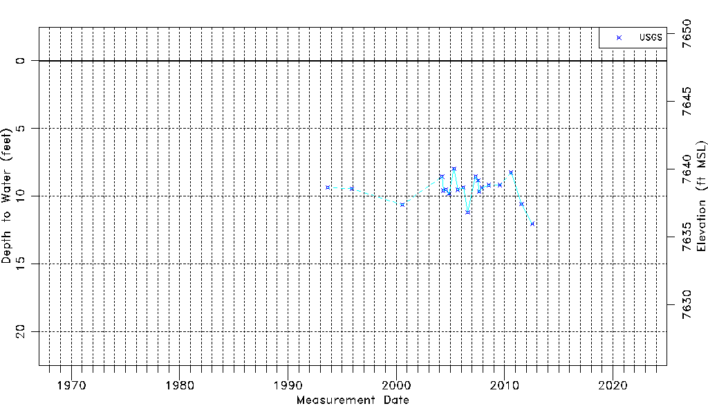
| USGS Data Available | Water-level (GW.LEV) |
| Water-level Database Information |
|---|
| Water-level Count | 20 |
| Water-level Date Range | 09/12/1993 thru 07/27/2012 |
| Monitored within the last 18 months | No, most recently on 07/27/2012 |
| Depth-to-Water Range (ft) | 7.97 to 12.03 |
| Water Table Elevation Range (ft NAVD88) | 7635.97 to 7640.03 |
| Water-Level-Source:Number-of-Measurements | USGS:20 |