| Well Information Table |
|---|
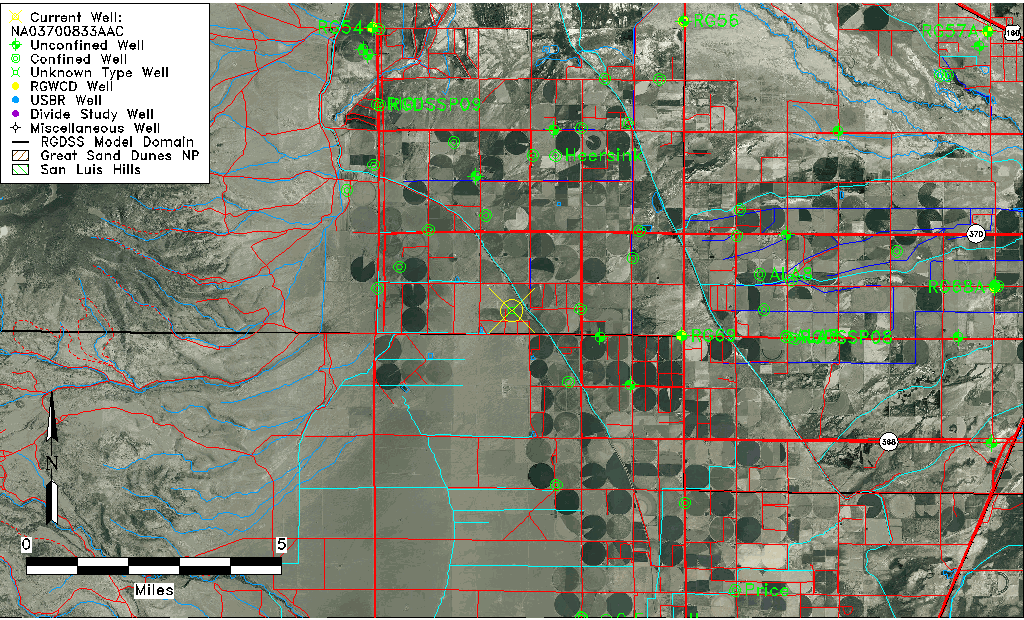
| Common Well ID | NA03700833AAC |
| USGS Well ID | 372428106055801 |
| USGS Station Name | NA03700833AAC |
| USGS Site Type | Well |
| USGS Site Use Information | Withdrawal of Water |
| USGS Groundwater Use Information | Irrigation |
| Data Source(s) | USGS |
| Location Data |
|---|
| TRS | NA03700833AAC |
| USGS TRS 1 | NA03700833AAC |
| Longitude/Latitude (NAD83) | -106.10002750 , 37.40778295 |
| Longitude/Latitude Data Source | GWSI decimal LAT/LONG field |
| USGS Longitude/Latitude (NAD83) | -106.1000275 , 37.40778295 |
| Easting, Northing RGDSS-NAD83 (US ft) | 76316.52 , 150226.74 |
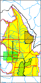
| USGS County | Rio Grande County |
| Elevation and Depth Data |
|---|
| Ground Elevation (ft NAVD88) | 7683.10000000000 |
| Elevation Data Source | USGS GWSI database |
| USGS Ground Elevation (ft NGVD29) | 7678.80 |
| 1/3-Arc Second NED Ground Elevation (ft NAVD88) | 7695.39 |
| 1-Arc Second NED Ground Elevation (ft NAVD88) | 7695.20 |
| SRTM Ground Elevation (ft NAVD88) | 7700.13 |
| Depth of Bottom of Layer 1 | 24 |
| Depth of Bottom of Layer 2 | 160 |
| Depth of Bottom of Layer 3 | 293 |
| Depth of Bottom of Layer 4 | 1822 |
| Additional Well Information | NONE |
| Aquifer Information |
|---|
| Aquifer Type | Unknown |
| Aquifer Type Source | None |
| USGS Hydrologic Unit | Alamosa-Trinchera |
| USGS Data Available | Miscellaneous (GW.MISC) |
| Water-level Database Information |
|---|
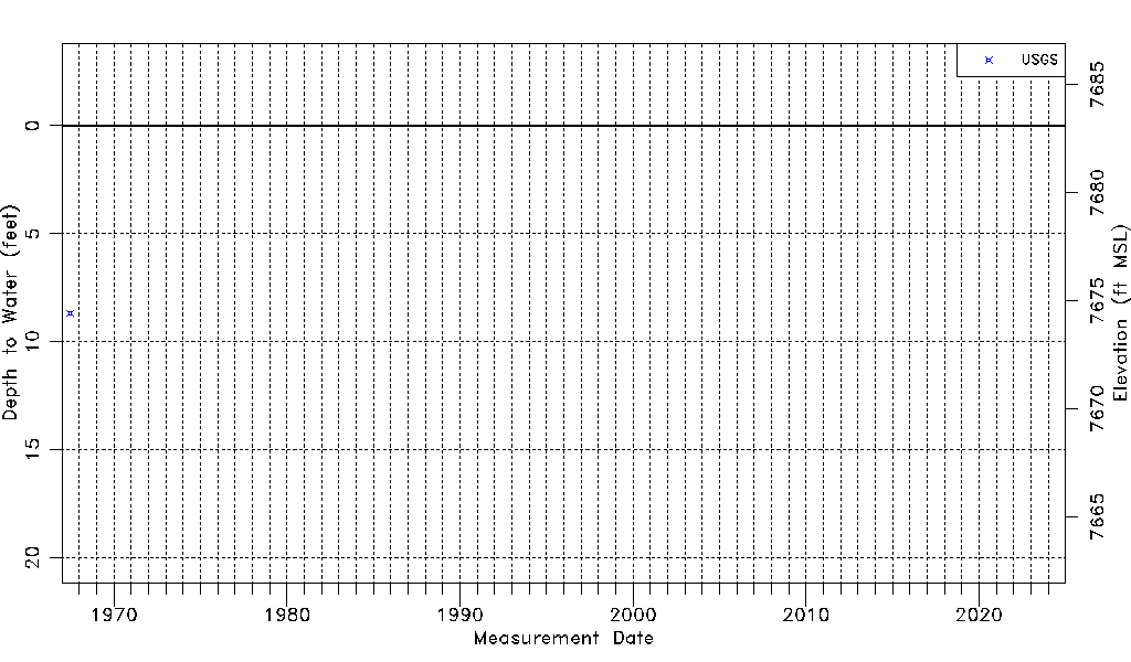
| Water-level Count | 1 |
| Water-level Date Range | 06/23/1967 thru 06/23/1967 |
| Monitored within the last 18 months | No, most recently on 06/23/1967 |
| Depth-to-Water Range (ft) | 8.67 to 8.67 |
| Water Table Elevation Range (ft NAVD88) | 7674.43 to 7674.43 |
| Water-Level-Source:Number-of-Measurements | USGSaguache Creek:1 |