| Well Information Table |
|---|
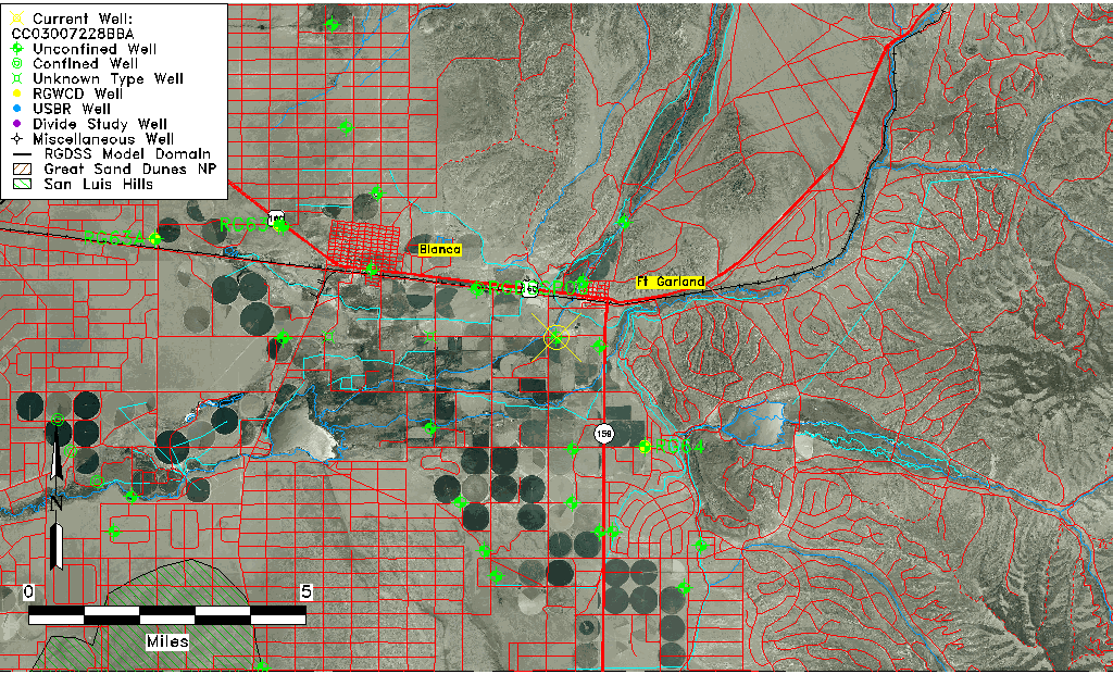
| Common Well ID | CC03007228BBA |
| USGS Well ID | 372435105263501 |
| USGS Station Name | CC03007228BBA |
| USGS Construction Date | 01/01/1964 |
| USGS Site Type | Well |
| USGS Site Use Information | Withdrawal of Water |
| USGS Groundwater Use Information | Irrigation |
| Data Source(s) | USGS |
| Location Data |
|---|
| TRS | CC03007228BBA |
| USGS TRS 1 | CC03007228BBA |
| USGS TRS | NENWNWS028T0030SR0072WS |
| Longitude/Latitude (NAD83) | -105.44728920 , 37.41720317 |
| Longitude/Latitude Data Source | GWSI decimal LAT/LONG field |
| USGS Longitude/Latitude (NAD83) | -105.4472892 , 37.41720317 |
| Easting, Northing RGDSS-NAD83 (US ft) | 265841.62 , 153450.67 |
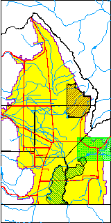
| USGS County | Costilla County |
| Elevation and Depth Data |
|---|
| Ground Elevation (ft NAVD88) | 7848.46000000000 |
| Elevation Data Source | USGS GWSI database |
| USGS Ground Elevation (ft NGVD29) | 7844.00 |
| 1/3-Arc Second NED Ground Elevation (ft NAVD88) | 7848.82 |
| 1-Arc Second NED Ground Elevation (ft NAVD88) | 7848.56 |
| SRTM Ground Elevation (ft NAVD88) | 7864.17 |
| Total Depth (ft) | 160.00 |
| USGS Well Depth (ft) | 160.00 |
| Model Layer | 1 |
| Model Layer Source | Well Depth |
| Depth of Bottom of Layer 1 | 533 |
| Depth of Bottom of Layer 2 | 633 |
| Depth of Bottom of Layer 3 | 703 |
| Depth of Bottom of Layer 4 | 1479 |
| Additional Well Information | Geohydrology, Construction |
| Aquifer Information |
|---|
| Aquifer Type | Unconfined |
| Aquifer Type Source | TD Elevation/Model Layer |
| USGS Primary Aquifer | Cenozoic Erathem |
| USGS Aquifer Type | Unconfined Single Aquifer |
| USGS Hydrologic Unit | Alamosa-Trinchera |
| USGS Data Available | Water-level (GW.LEV) |
| Water-level Database Information |
|---|
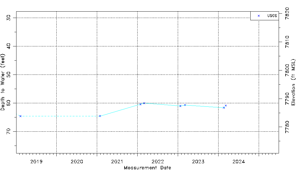
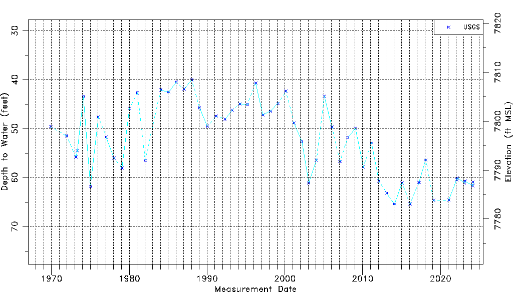
| Water-level Count | 54 |
| Water-level Date Range | 12/01/1969 thru 03/06/2023 |
| Monitored within the last 18 months | Yes, most recently on 03/06/2023 |
| Depth-to-Water Range (ft) | 40.00 to 65.40 |
| Water Table Elevation Range (ft NAVD88) | 7783.06 to 7808.46 |
| Water-Level-Source:Number-of-Measurements | USGS:54 |