| Well Information Table |
|---|
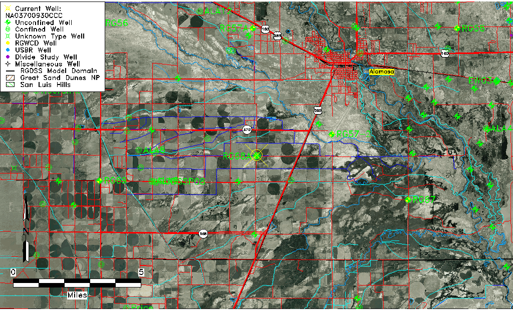
| Common Well ID | NA03700930CCC |
| USGS Well ID | 372456105553901 |
| USGS Station Name | NA03700930CCC |
| USGS Site Type | Well |
| USGS Site Use Information | Unused |
| USGS Groundwater Use Information | Unused |
| Data Source(s) | USGS |
| Location Data |
|---|
| TRS | NA03700930CCC |
| USGS TRS 1 | NA03700930CCC |
| USGS TRS | SWSWSWS030T0037NR0009EN |
| Longitude/Latitude (NAD83) | -105.92807840 , 37.41556110 |
| Longitude/Latitude Data Source | GWSI decimal LAT/LONG field |
| USGS Longitude/Latitude (NAD83) | -105.9280784 , 37.41556110 |
| Easting, Northing RGDSS-NAD83 (US ft) | 126254.16 , 152876.80 |
| USGS Topography | Valley flat |
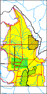
| USGS County | Alamosa County |
| Elevation and Depth Data |
|---|
| Ground Elevation (ft NAVD88) | 7557.96000000000 |
| Elevation Data Source | USGS GWSI database |
| USGS Ground Elevation (ft NGVD29) | 7554.00 |
| 1/3-Arc Second NED Ground Elevation (ft NAVD88) | 7552.80 |
| 1-Arc Second NED Ground Elevation (ft NAVD88) | 7549.83 |
| SRTM Ground Elevation (ft NAVD88) | 7552.49 |
| Total Depth (ft) | 7.00 |
| USGS Well Depth (ft) | 7.00 |
| Model Layer | 1 |
| Model Layer Source | Well Depth |
| Depth of Bottom of Layer 1 | 40 |
| Depth of Bottom of Layer 2 | 300 |
| Depth of Bottom of Layer 3 | 641 |
| Depth of Bottom of Layer 4 | 2234 |
| Additional Well Information | Geohydrology, Construction |
| Aquifer Information |
|---|
| Aquifer Type | Unconfined |
| Aquifer Type Source | TD Elevation/Model Layer |
| USGS Primary Aquifer | Cenozoic Erathem |
| USGS Hydrologic Unit | Alamosa-Trinchera |
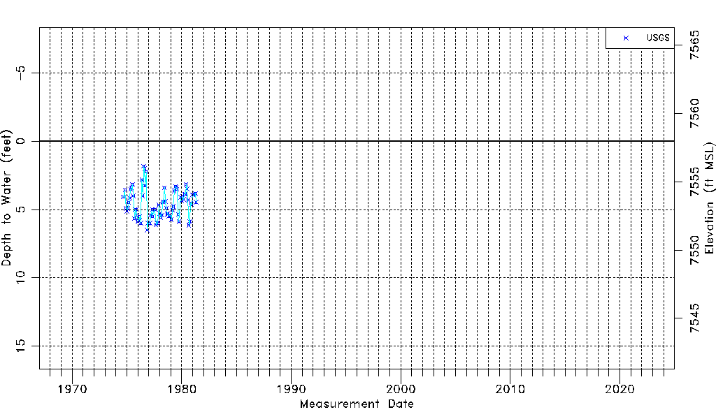
| USGS Data Available | Water-level (GW.LEV) |
| Water-level Database Information |
|---|
| Water-level Count | 75 |
| Water-level Date Range | 09/05/1974 thru 05/01/1981 |
| Monitored within the last 18 months | No, most recently on 05/01/1981 |
| Depth-to-Water Range (ft) | 1.83 to 6.50 |
| Water Table Elevation Range (ft NAVD88) | 7551.46 to 7556.13 |
| Water-Level-Source:Number-of-Measurements | USGS:75 |