| Well Information Table |
|---|
| Common Well ID | NA03701025AA |
| USGS Well ID | 372500105490001 |
| USGS Station Name | NA03701025AA |
| USGS Construction Date | 01/01/1949 |
| USGS Site Type | Well |
| USGS Site Use Information | Observation |
| USGS Groundwater Use Information | Unused |
| Data Source(s) | USGS |
| Location Data |
|---|
| TRS | NA03701025AA |
| USGS TRS 1 | NA03701025AA |
| USGS TRS | NENES025T0037NR0010EN |
| Longitude/Latitude (NAD83) | -105.81724240 , 37.41667300 |
| Longitude/Latitude Data Source | GWSI decimal LAT/LONG field |
| USGS Longitude/Latitude (NAD83) | -105.8172424 , 37.41667300 |
| Easting, Northing RGDSS-NAD83 (US ft) | 158434.91 , 153212.91 |
| USGS Topography | Flat Surface |
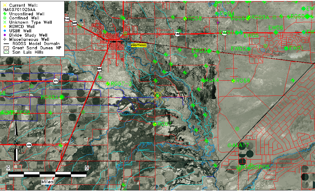
| USGS County | Alamosa County |
| Elevation and Depth Data |
|---|
| Ground Elevation (ft NAVD88) | 7528.94000000000 |
| Elevation Data Source | USGS GWSI database |
| USGS Ground Elevation (ft NGVD29) | 7525.00 |
| 1/3-Arc Second NED Ground Elevation (ft NAVD88) | 7524.95 |
| 1-Arc Second NED Ground Elevation (ft NAVD88) | 7526.03 |
| SRTM Ground Elevation (ft NAVD88) | 7529.52 |
| Total Depth (ft) | 10.00 |
| USGS Well Depth (ft) | 10.00 |
| Model Layer | 1 |
| Model Layer Source | Well Depth |
| Depth of Bottom of Layer 1 | 39 |
| Depth of Bottom of Layer 2 | 320 |
| Depth of Bottom of Layer 3 | 601 |
| Depth of Bottom of Layer 4 | 2313 |
| Additional Well Information | Geohydrology, Construction |
| Aquifer Information |
|---|
| Aquifer Type | Unconfined |
| Aquifer Type Source | TD Elevation/Model Layer |
| USGS Primary Aquifer | Cenozoic Erathem |
| USGS Hydrologic Unit | Alamosa-Trinchera |
| USGS Data Available | Water-level (GW.LEV) |
| Water-level Database Information |
|---|
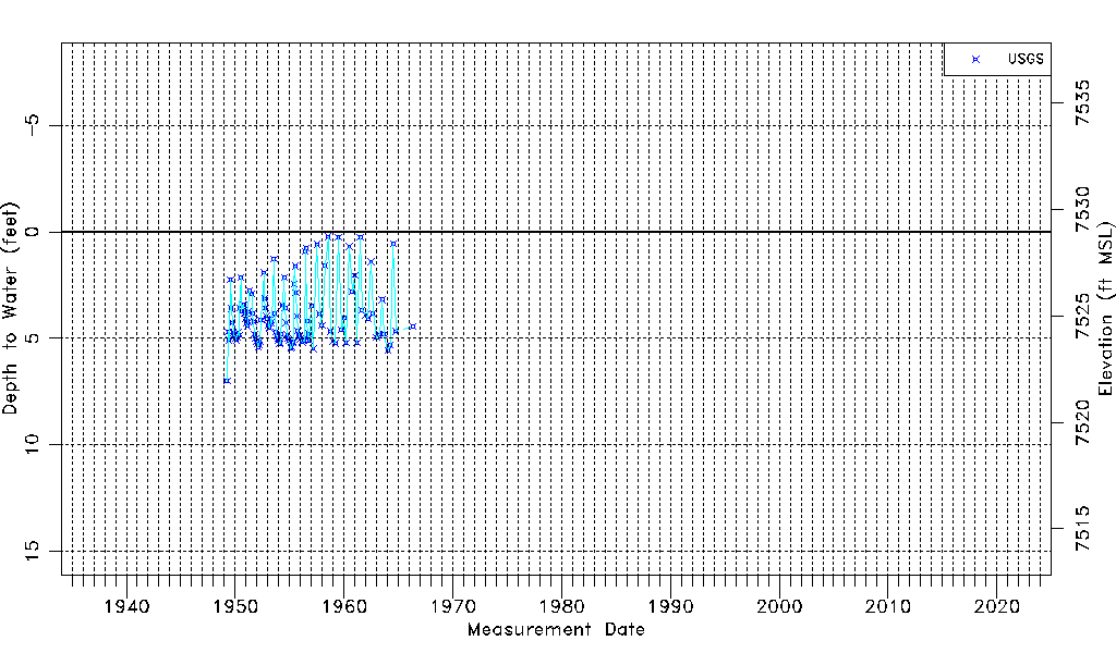
| Water-level Count | 117 |
| Water-level Date Range | 04/01/1949 thru 05/11/1966 |
| Monitored within the last 18 months | No, most recently on 05/11/1966 |
| Depth-to-Water Range (ft) | 0.22 to 7.00 |
| Water Table Elevation Range (ft NAVD88) | 7521.94 to 7528.72 |
| Water-Level-Source:Number-of-Measurements | USGSaguache Creek:117 |