| Well Information Table |
|---|
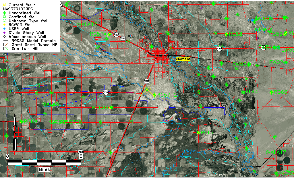
| Common Well ID | NA03701020DD |
| USGS Well ID | 372600105530001 |
| USGS Station Name | NA03701020DD |
| USGS Construction Date | 01/01/1949 |
| USGS Site Type | Well |
| USGS Site Use Information | Observation |
| USGS Groundwater Use Information | Unused |
| Data Source(s) | USGS |
| Location Data |
|---|
| TRS | NA03701020DD |
| USGS TRS 1 | NA03701020DD |
| USGS TRS | SESES020T0037NR0010EN |
| Longitude/Latitude (NAD83) | -105.88391070 , 37.43333880 |
| Longitude/Latitude Data Source | GWSI decimal LAT/LONG field |
| USGS Longitude/Latitude (NAD83) | -105.8839107 , 37.43333880 |
| Easting, Northing RGDSS-NAD83 (US ft) | 139092.46 , 159316.11 |
| USGS Topography | Flat Surface |
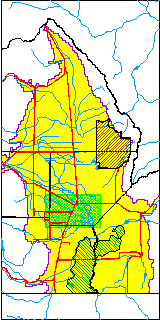
| USGS County | Alamosa County |
| Elevation and Depth Data |
|---|
| Ground Elevation (ft NAVD88) | 7539.91000000000 |
| Elevation Data Source | USGS GWSI database |
| USGS Ground Elevation (ft NGVD29) | 7536.00 |
| 1/3-Arc Second NED Ground Elevation (ft NAVD88) | 7539.11 |
| 1-Arc Second NED Ground Elevation (ft NAVD88) | 7539.24 |
| SRTM Ground Elevation (ft NAVD88) | 7539.24 |
| Total Depth (ft) | 8.00 |
| USGS Well Depth (ft) | 8.00 |
| Model Layer | 1 |
| Model Layer Source | Well Depth |
| Depth of Bottom of Layer 1 | 37 |
| Depth of Bottom of Layer 2 | 404 |
| Depth of Bottom of Layer 3 | 681 |
| Depth of Bottom of Layer 4 | 2327 |
| Additional Well Information | Geohydrology, Construction |
| Aquifer Information |
|---|
| Aquifer Type | Unconfined |
| Aquifer Type Source | TD Elevation/Model Layer |
| USGS Primary Aquifer | Cenozoic Erathem |
| USGS Hydrologic Unit | Alamosa-Trinchera |
| USGS Data Available | Water-level (GW.LEV) |
| Water-level Database Information |
|---|
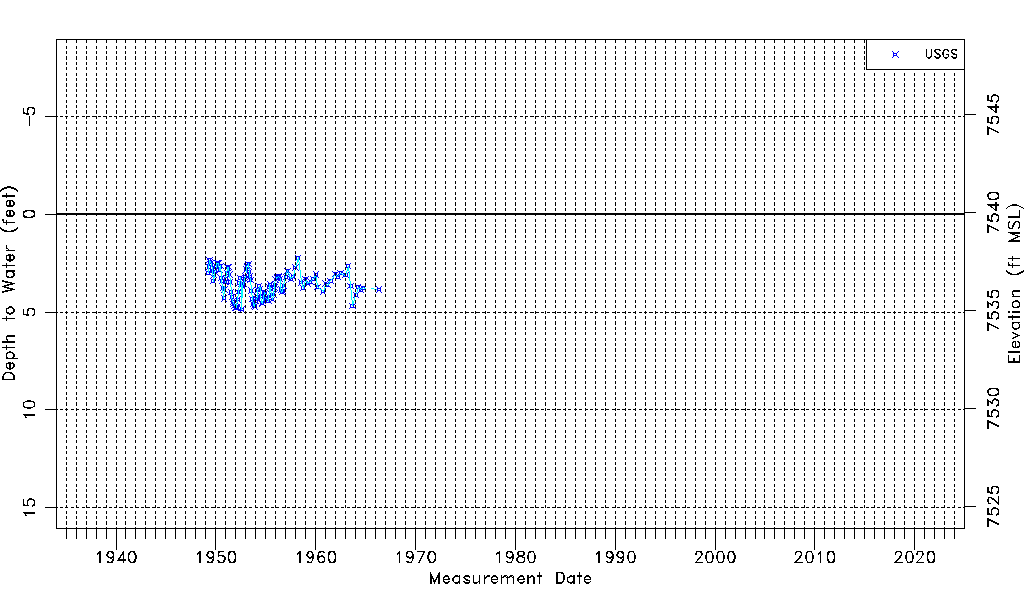
| Water-level Count | 121 |
| Water-level Date Range | 04/01/1949 thru 05/11/1966 |
| Monitored within the last 18 months | No, most recently on 05/11/1966 |
| Depth-to-Water Range (ft) | 2.24 to 4.87 |
| Water Table Elevation Range (ft NAVD88) | 7535.04 to 7537.67 |
| Water-Level-Source:Number-of-Measurements | USGS:121 |