| Well Information Table |
|---|
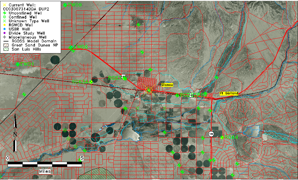
| Common Well ID | CC03007314DDA DUP2 |
| USGS Well ID | 372606105302701 |
| USGS Station Name | CC03007314DDA DUP2 |
| USGS Site Type | Well |
| USGS Site Use Information | Observation |
| USGS Groundwater Use Information | Unused |
| Data Source(s) | USGS |
| Location Data |
|---|
| TRS | CC03007314DDA DUP2 |
| USGS TRS 1 | CC03007314DDA DUP2 |
| Longitude/Latitude (NAD83) | -105.50779020 , 37.43500780 |
| Longitude/Latitude Data Source | GWSI decimal LAT/LONG field |
| USGS Longitude/Latitude (NAD83) | -105.5077902 , 37.43500780 |
| Easting, Northing RGDSS-NAD83 (US ft) | 248265.79 , 159895.20 |
| USGS Topography | Valley flat |
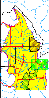
| USGS County | Costilla County |
| Elevation and Depth Data |
|---|
| Ground Elevation (ft NAVD88) | 7766.43000000000 |
| Elevation Data Source | USGS GWSI database |
| USGS Ground Elevation (ft NGVD29) | 7762.00 |
| 1/3-Arc Second NED Ground Elevation (ft NAVD88) | 7759.85 |
| 1-Arc Second NED Ground Elevation (ft NAVD88) | 7764.54 |
| SRTM Ground Elevation (ft NAVD88) | 7769.26 |
| Total Depth (ft) | 14.50 |
| USGS Well Depth (ft) | 14.50 |
| Model Layer | 1 |
| Model Layer Source | Well Depth |
| Depth of Bottom of Layer 1 | 486 |
| Depth of Bottom of Layer 2 | 586 |
| Depth of Bottom of Layer 3 | 783 |
| Depth of Bottom of Layer 4 | 1999 |
| Additional Well Information | Construction |
| Aquifer Information |
|---|
| Aquifer Type | Unconfined |
| Aquifer Type Source | TD Elevation/Model Layer |
| USGS Hydrologic Unit | Alamosa-Trinchera |
| USGS Data Available | Miscellaneous (GW.MISC) |
| Water-level Database Information |
|---|
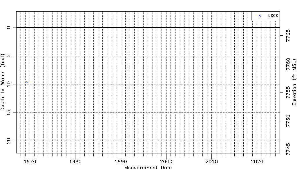
| Water-level Count | 1 |
| Water-level Date Range | 06/01/1969 thru 06/01/1969 |
| Monitored within the last 18 months | No, most recently on 06/01/1969 |
| Depth-to-Water Range (ft) | 9.64 to 9.64 |
| Water Table Elevation Range (ft NAVD88) | 7756.79 to 7756.79 |
| Water-Level-Source:Number-of-Measurements | USGSaguache Creek:1 |