| Well Information Table |
|---|
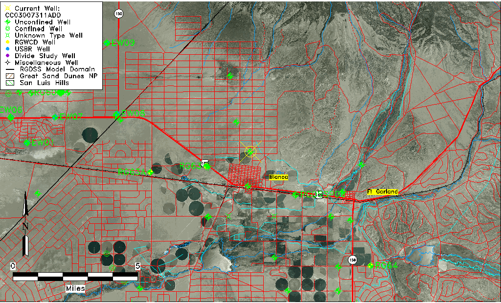
| Common Well ID | CC03007311ADD |
| USGS Well ID | 372718105301901 |
| USGS Station Name | CC03007311ADD |
| USGS Site Type | Well |
| USGS Site Use Information | Withdrawal of Water |
| USGS Groundwater Use Information | Unknown |
| Data Source(s) | USGS |
| Location Data |
|---|
| TRS | CC03007311ADD |
| USGS TRS 1 | CC03007311ADD |
| Longitude/Latitude (NAD83) | -105.50584560 , 37.45500728 |
| Longitude/Latitude Data Source | GWSI decimal LAT/LONG field |
| USGS Longitude/Latitude (NAD83) | -105.5058456 , 37.45500728 |
| Easting, Northing RGDSS-NAD83 (US ft) | 248817.44 , 167175.78 |
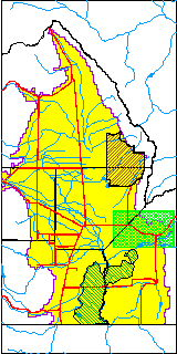
| USGS County | Costilla County |
| USGS Map Name | BLANCA |
| USGS Map Scale | 24000 |
| Elevation and Depth Data |
|---|
| Ground Elevation (ft NAVD88) | 7844.46000000000 |
| Elevation Data Source | USGS GWSI database |
| USGS Ground Elevation (ft NGVD29) | 7840.00 |
| 1/3-Arc Second NED Ground Elevation (ft NAVD88) | 7840.75 |
| 1-Arc Second NED Ground Elevation (ft NAVD88) | 7839.86 |
| SRTM Ground Elevation (ft NAVD88) | 7844.35 |
| Total Depth (ft) | 310.00 |
| USGS Well Depth (ft) | 310.00 |
| Model Layer | 1 |
| Model Layer Source | Well Depth |
| Depth of Bottom of Layer 1 | 509 |
| Depth of Bottom of Layer 2 | 609 |
| Depth of Bottom of Layer 3 | 799 |
| Depth of Bottom of Layer 4 | 1734 |
| Additional Well Information | NONE |
| Aquifer Information |
|---|
| Aquifer Type | Unconfined |
| Aquifer Type Source | TD Elevation/Model Layer |
| USGS Hydrologic Unit | Alamosa-Trinchera |
| USGS Data Available | Water-level (GW.LEV) |
| Water-level Database Information |
|---|
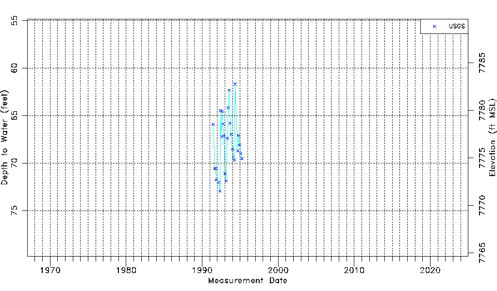
| Water-level Count | 27 |
| Water-level Date Range | 06/20/1991 thru 03/31/1995 |
| Monitored within the last 18 months | No, most recently on 03/31/1995 |
| Depth-to-Water Range (ft) | 61.68 to 72.96 |
| Water Table Elevation Range (ft NAVD88) | 7771.50 to 7782.78 |
| Water-Level-Source:Number-of-Measurements | USGS:27 |