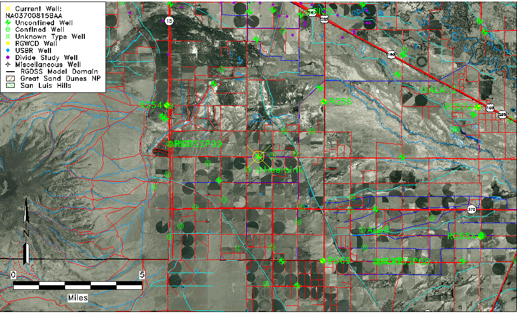
| Well Information Table |
|---|
| Common Well ID | NA03700815BAA |
| USGS Well ID | 372732106050401 |
| USGS Station Name | NA03700815BAA |
| USGS Construction Date | 08/13/1993 |
| USGS Site Type | Well |
| USGS Site Use Information | Observation |
| USGS Groundwater Use Information | Unused |
| Data Source(s) | USGS |
| Location Data |
|---|
| TRS | NA03700815BAA |
| USGS TRS 1 | NA03700815BAA |
| USGS TRS | NENENWS 15T 37NR 8E |
| Longitude/Latitude (NAD83) | -106.08539380 , 37.45919590 |
| Longitude/Latitude Data Source | GWSI decimal LAT/LONG field |
| USGS Longitude/Latitude (NAD83) | -106.0853938 , 37.45919590 |
| Easting, Northing RGDSS-NAD83 (US ft) | 80648.08 , 168923.01 |
| USGS Topography | Valley flat |
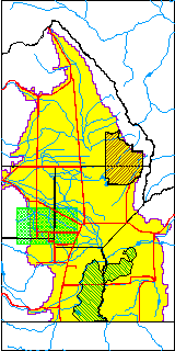
| USGS County | Rio Grande County |
| USGS Map Name | WAVERLY |
| USGS Map Scale | 24000 |
| Elevation and Depth Data |
|---|
| Ground Elevation (ft NAVD88) | 7627.28000000000 |
| Elevation Data Source | USGS GWSI database |
| USGS Ground Elevation (ft NGVD29) | 7623.00 |
| 1/3-Arc Second NED Ground Elevation (ft NAVD88) | 7627.11 |
| 1-Arc Second NED Ground Elevation (ft NAVD88) | 7628.71 |
| SRTM Ground Elevation (ft NAVD88) | 7627.07 |
| Total Depth (ft) | 14.00 |
| USGS Hole Depth (ft) | 15.00 |
| USGS Well Depth (ft) | 14.00 |
| Model Layer | 1 |
| Model Layer Source | Well Depth |
| Depth of Bottom of Layer 1 | 35 |
| Depth of Bottom of Layer 2 | 202 |
| Depth of Bottom of Layer 3 | 362 |
| Depth of Bottom of Layer 4 | 2128 |
| Additional Well Information | Logs, Geohydrology, Construction, Aquifer |
| Aquifer Information |
|---|
| Aquifer Type | Unconfined |
| Aquifer Type Source | TD Elevation/Model Layer |
| USGS Primary Aquifer | 112ALMS |
| USGS Aquifer Type | Unconfined Single Aquifer |
| USGS Hydrologic Unit | Alamosa-Trinchera |
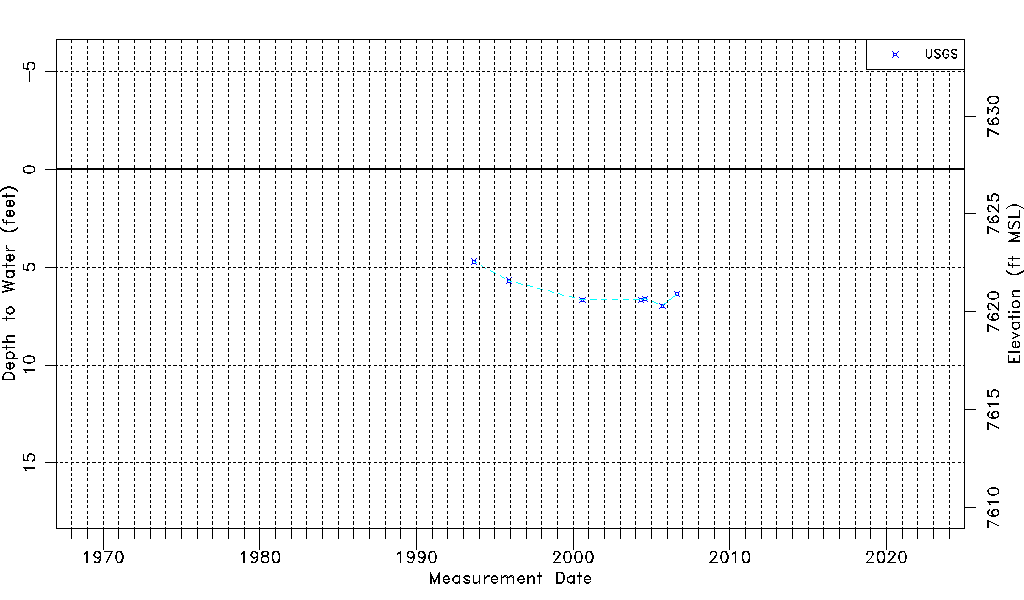
| USGS Data Available | Water-level (GW.LEV) |
| Water-level Database Information |
|---|
| Water-level Count | 7 |
| Water-level Date Range | 09/08/1993 thru 08/15/2006 |
| Monitored within the last 18 months | No, most recently on 08/15/2006 |
| Depth-to-Water Range (ft) | 4.72 to 6.97 |
| Water Table Elevation Range (ft NAVD88) | 7620.31 to 7622.56 |
| Water-Level-Source:Number-of-Measurements | USGSaguache Creek:7 |