| Well Information Table |
|---|
| Common Well ID | NA03701216BAA1 EW-1U |
| USBR Well ID | EW01U |
| USGS Well ID | 372737105400401 |
| USGS Station Name | NA03701216BAA1 EW-1U |
| USGS Construction Date | 06/27/1980 |
| USGS Site Type | Well |
| USGS Site Use Information | Observation |
| USGS Groundwater Use Information | Unused |
| Data Source(s) | USGS, USBR |
| Location Data |
|---|
| TRS | NA03701216BAA1 EW-1U |
| USBR TRS | NA03701216BAA1 |
| USGS TRS 1 | NA03701216BAA1 EW-1U |
| Longitude/Latitude (NAD83) | -105.66840801 , 37.46037821 |
| Longitude/Latitude Data Source | USBOR EW well locations |
| USGS Longitude/Latitude (NAD83) | -105.6683499 , 37.46028400 |
| USBR Longitude/Latitude (NAD27) | -105.667835917791 , 37.4603719677205 |
| Easting, Northing RGDSS-NAD83 (US ft) | 201645.59 , 169088.79 |
| USGS Topography | Valley flat |
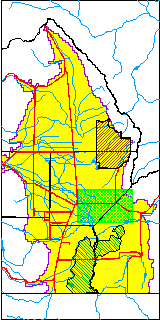
| USGS County | Alamosa County |
| USGS Map Name | BALDY |
| USGS Map Scale | 24000 |
| Elevation and Depth Data |
|---|
| Ground Elevation (ft NAVD88) | 7602.07000000000 |
| Elevation Data Source | USBOR EW well database |
| USBR Ground Elevation (ft NGVD29) | 7597.9 |
| USGS Ground Elevation (ft NGVD29) | 7597.90 |
| 1/3-Arc Second NED Ground Elevation (ft NAVD88) | 7604.02 |
| 1-Arc Second NED Ground Elevation (ft NAVD88) | 7603.39 |
| SRTM Ground Elevation (ft NAVD88) | 7600.52 |
| Total Depth (ft) | 35.00 |
| USBR Total Depth (ft) | 35 |
| USGS Hole Depth (ft) | 190.00 |
| USGS Well Depth (ft) | 35.00 |
| Model Layer | 1 |
| Model Layer Source | Aquifer Type |
| Depth of Bottom of Layer 1 | 113 |
| Depth of Bottom of Layer 2 | 213 |
| Depth of Bottom of Layer 3 | 601 |
| Depth of Bottom of Layer 4 | 1927 |
| Additional Well Information | Logs, Construction |
| Aquifer Information |
|---|
| Aquifer Type | Unconfined |
| Aquifer Type Source | EW_AQFR |
| USGS Hydrologic Unit | San Luis |
| USGS Data Available | Water-level (GW.LEV) |
| Water-level Database Information |
|---|
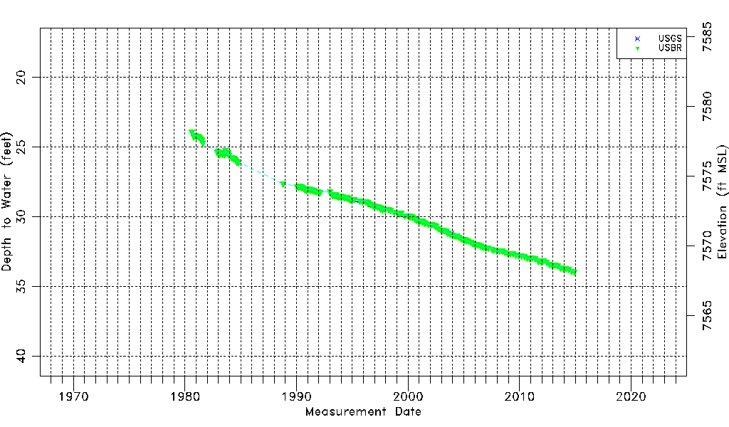
| Water-level Count | 193 |
| Water-level Date Range | 08/14/1980 thru 12/01/2014 |
| Monitored within the last 18 months | No, most recently on 12/01/2014 |
| Depth-to-Water Range (ft) | 23.91 to 33.94 |
| Water Table Elevation Range (ft NAVD88) | 7568.13 to 7578.16 |
| Water-Level-Source:Number-of-Measurements | USGS:22 USBR:189 |