| Well Information Table |
|---|
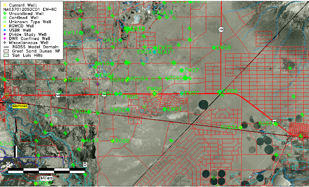
| Common Well ID | NA03701205DCD1 EW-6C |
| USBR Well ID | EW06C |
| USGS Well ID | 372830105404601 |
| USGS Station Name | NA03701205DCD1 EW-6C |
| USGS Construction Date | 09/08/1977 |
| USGS Site Type | Well |
| USGS Site Use Information | Observation |
| USGS Groundwater Use Information | Unknown |
| Data Source(s) | USGS, USBR |
| Location Data |
|---|
| TRS | NA03701205DCD1 EW-6C |
| USBR TRS | NA03701205DCD1 |
| USGS TRS 1 | NA03701205DCD1 EW-6C |
| Longitude/Latitude (NAD83) | -105.68035718 , 37.47502333 |
| Longitude/Latitude Data Source | USBOR EW well locations |
| USGS Longitude/Latitude (NAD83) | -105.6800168 , 37.47500580 |
| USBR Longitude/Latitude (NAD27) | -105.679784761606 , 37.4750175315086 |
| Easting, Northing RGDSS-NAD83 (US ft) | 198178.97 , 174419.72 |
| USGS Topography | Valley flat |
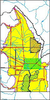
| USGS County | Alamosa County |
| USGS Map Name | BALDY |
| USGS Map Scale | 24000 |
| Elevation and Depth Data |
|---|
| Ground Elevation (ft NAVD88) | 7575.15000000000 |
| Elevation Data Source | USBOR EW well database |
| USBR Ground Elevation (ft NGVD29) | 7571.0 |
| USGS Ground Elevation (ft NGVD29) | 7570.70 |
| 1/3-Arc Second NED Ground Elevation (ft NAVD88) | 7574.72 |
| 1-Arc Second NED Ground Elevation (ft NAVD88) | 7575.82 |
| SRTM Ground Elevation (ft NAVD88) | 7580.89 |
| Total Depth (ft) | 168.00 |
| USBR Total Depth (ft) | 168 |
| USGS Hole Depth (ft) | 168.00 |
| USGS Well Depth (ft) | 165.00 |
| Model Layer | 2 |
| Model Layer Source | Well Depth |
| Depth of Bottom of Layer 1 | 79 |
| Depth of Bottom of Layer 2 | 208 |
| Depth of Bottom of Layer 3 | 653 |
| Depth of Bottom of Layer 4 | 2129 |
| Additional Well Information | Logs, Construction |
| Aquifer Information |
|---|
| Aquifer Type | Confined |
| Aquifer Type Source | EW_AQFR |
| USGS Hydrologic Unit | San Luis |
| USGS Data Available | Water-level (GW.LEV) |
| Water-level Database Information |
|---|
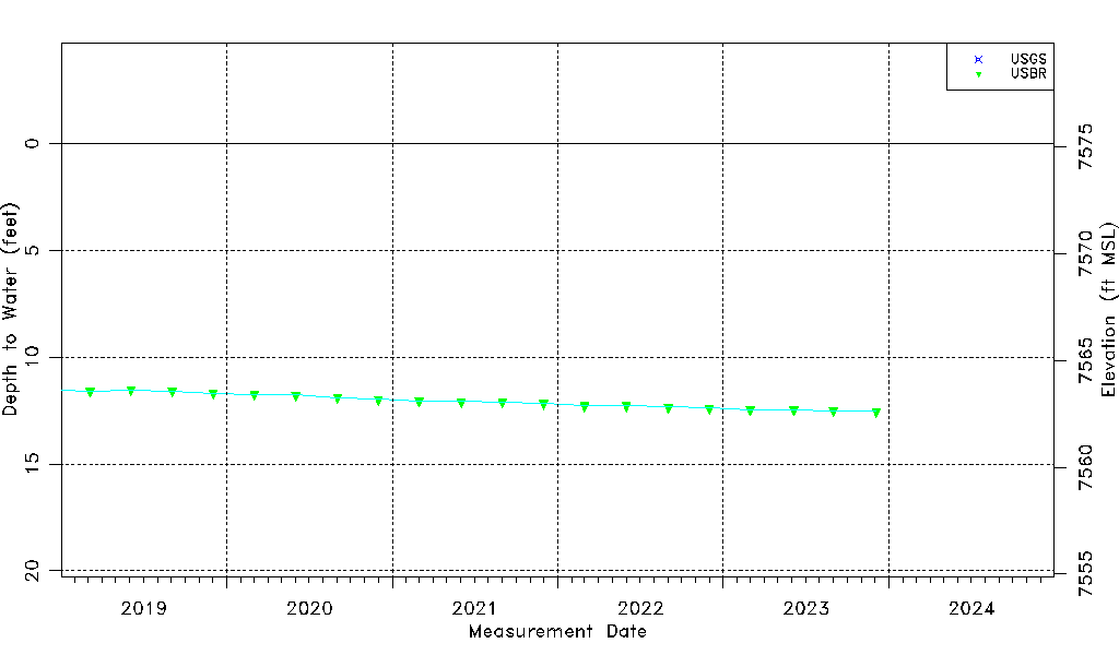
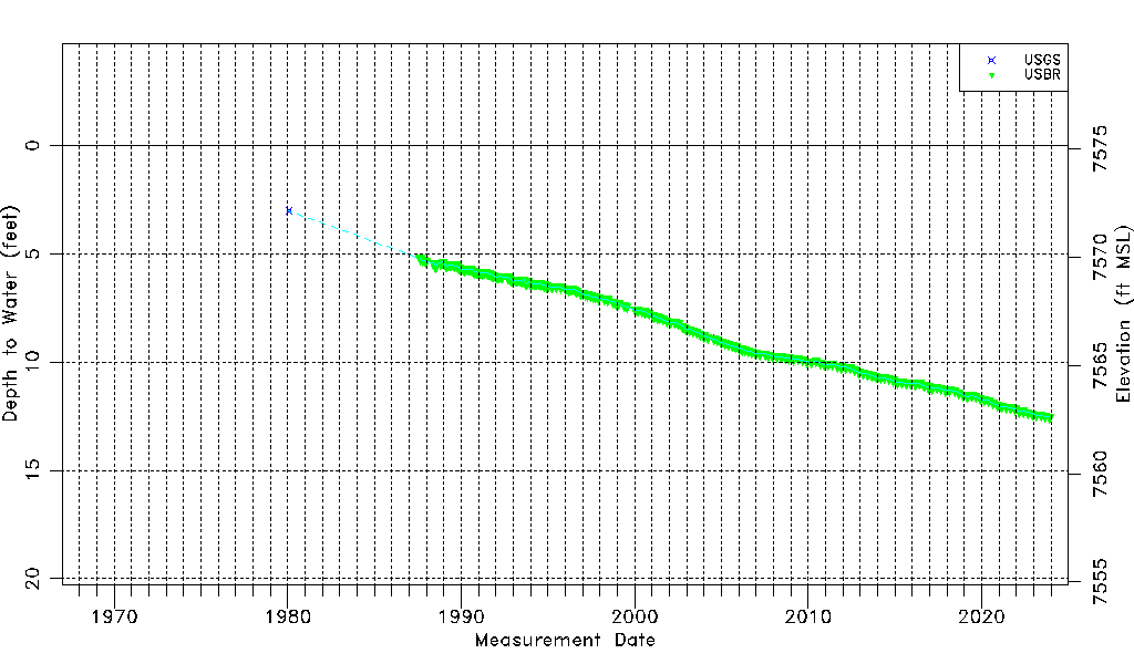
| Water-level Count | 216 |
| Water-level Date Range | 01/29/1980 thru 12/04/2023 |
| Monitored within the last 18 months | Yes, most recently on 12/04/2023 |
| Depth-to-Water Range (ft) | 3.02 to 12.54 |
| Water Table Elevation Range (ft NAVD88) | 7562.61 to 7572.13 |
| Water-Level-Source:Number-of-Measurements | USGS:5 USBR:212 |