| Well Information Table |
|---|
| Common Well ID | NA03701004DDC |
| USGS Well ID | 372832105524001 |
| USGS Station Name | NA03701004DDC |
| USGS Construction Date | 01/01/1966 |
| USGS Site Type | Well |
| USGS Site Use Information | Observation |
| USGS Groundwater Use Information | Unused |
| Data Source(s) | USGS |
| Location Data |
|---|
| TRS | NA03701004DDC |
| USGS TRS 1 | NA03701004DDC |
| USGS TRS | SWSESES004T0037NR0010EN |
| Longitude/Latitude (NAD83) | -105.87835500 , 37.47556010 |
| Longitude/Latitude Data Source | GWSI decimal LAT/LONG field |
| USGS Longitude/Latitude (NAD83) | -105.8783550 , 37.47556010 |
| Easting, Northing RGDSS-NAD83 (US ft) | 140738.95 , 174681.40 |
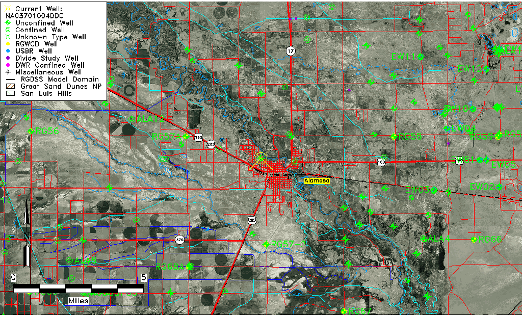
| USGS County | Alamosa County |
| Elevation and Depth Data |
|---|
| Ground Elevation (ft NAVD88) | 7545.83000000000 |
| Elevation Data Source | USGS GWSI database |
| USGS Ground Elevation (ft NGVD29) | 7542.00 |
| 1/3-Arc Second NED Ground Elevation (ft NAVD88) | 7540.09 |
| 1-Arc Second NED Ground Elevation (ft NAVD88) | 7544.39 |
| SRTM Ground Elevation (ft NAVD88) | 7548.96 |
| Total Depth (ft) | 14.00 |
| USGS Well Depth (ft) | 14.00 |
| Model Layer | 1 |
| Model Layer Source | Well Depth |
| Depth of Bottom of Layer 1 | 44 |
| Depth of Bottom of Layer 2 | 411 |
| Depth of Bottom of Layer 3 | 696 |
| Depth of Bottom of Layer 4 | 2275 |
| Additional Well Information | Geohydrology, Construction |
| Aquifer Information |
|---|
| Aquifer Type | Unconfined |
| Aquifer Type Source | TD Elevation/Model Layer |
| USGS Primary Aquifer | Cenozoic Erathem |
| USGS Hydrologic Unit | Alamosa-Trinchera |
| USGS Data Available | Water-level (GW.LEV) |
| Water-level Database Information |
|---|
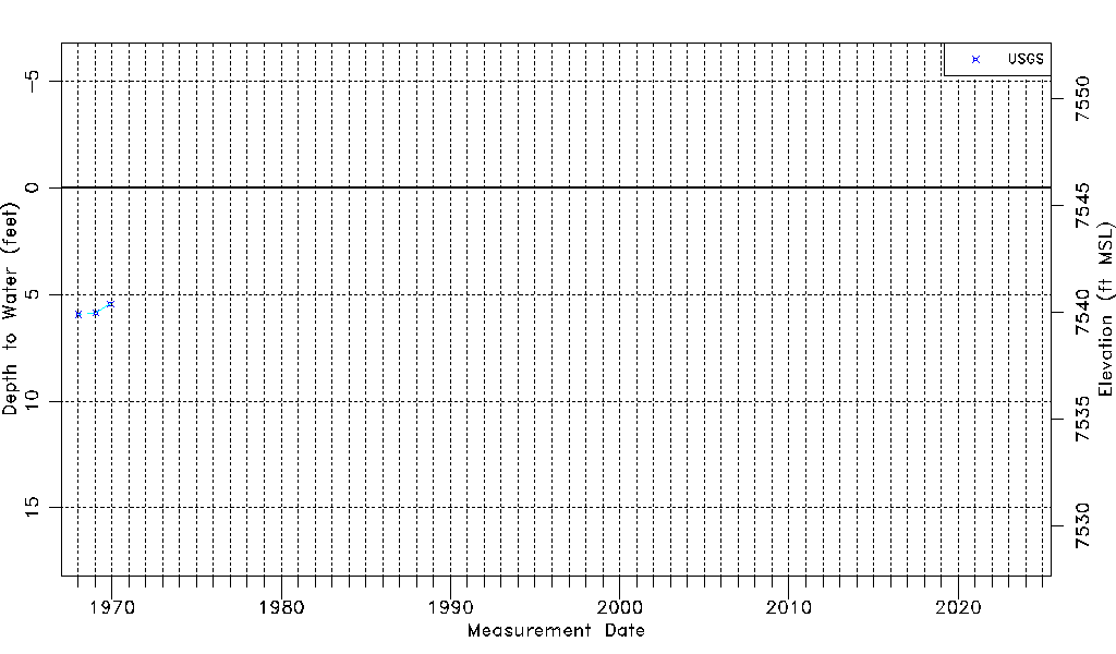
| Water-level Count | 3 |
| Water-level Date Range | 01/15/1968 thru 11/30/1969 |
| Monitored within the last 18 months | No, most recently on 11/30/1969 |
| Depth-to-Water Range (ft) | 5.45 to 5.94 |
| Water Table Elevation Range (ft NAVD88) | 7539.89 to 7540.38 |
| Water-Level-Source:Number-of-Measurements | USGS:3 |