| Well Information Table |
|---|
| Common Well ID | NA03701204ABB1 |
| USGS Well ID | 372921105395402 |
| USGS Station Name | NA03701204ABB1 |
| USGS Construction Date | 08/24/1977 |
| USGS Site Type | Well |
| USGS Site Use Information | Observation |
| USGS Groundwater Use Information | Unknown |
| Data Source(s) | USGS |
| Location Data |
|---|
| TRS | NA03701204ABB1 |
| USGS TRS 1 | NA03701204ABB1 |
| Longitude/Latitude (NAD83) | -105.66557200 , 37.48917219 |
| Longitude/Latitude Data Source | GWSI decimal LAT/LONG field |
| USGS Longitude/Latitude (NAD83) | -105.6655720 , 37.48917219 |
| Easting, Northing RGDSS-NAD83 (US ft) | 202467.91 , 179569.78 |
| USGS Topography | Valley flat |
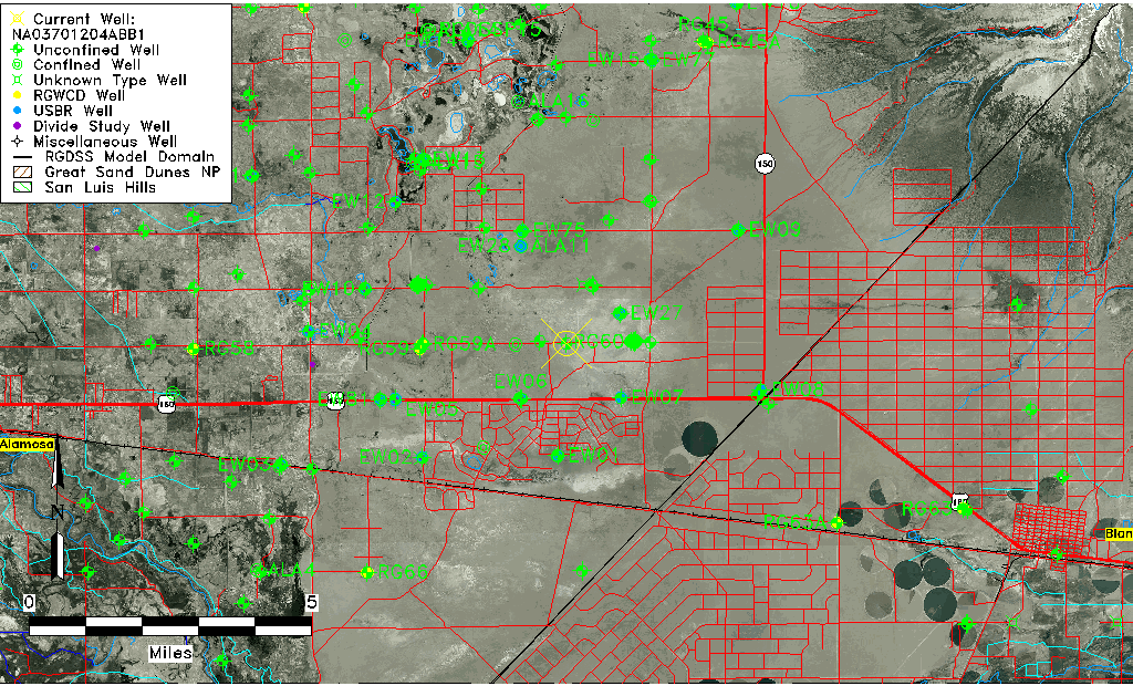
| USGS County | Alamosa County |
| USGS Map Name | BALDY |
| USGS Map Scale | 24000 |
| Elevation and Depth Data |
|---|
| Ground Elevation (ft NAVD88) | 7575.25000000000 |
| Elevation Data Source | USGS GWSI database |
| USGS Ground Elevation (ft NGVD29) | 7571.10 |
| 1/3-Arc Second NED Ground Elevation (ft NAVD88) | 7579.07 |
| 1-Arc Second NED Ground Elevation (ft NAVD88) | 7578.66 |
| SRTM Ground Elevation (ft NAVD88) | 7572.11 |
| Total Depth (ft) | 10.00 |
| USGS Hole Depth (ft) | 10.00 |
| USGS Well Depth (ft) | 10.00 |
| Model Layer | 1 |
| Model Layer Source | Well Depth |
| Depth of Bottom of Layer 1 | 84 |
| Depth of Bottom of Layer 2 | 229 |
| Depth of Bottom of Layer 3 | 669 |
| Depth of Bottom of Layer 4 | 2070 |
| Additional Well Information | Construction |
| Aquifer Information |
|---|
| Aquifer Type | Unconfined |
| Aquifer Type Source | TD Elevation/Model Layer |
| USGS Hydrologic Unit | San Luis |
| USGS Data Available | Water-level (GW.LEV) |
| Water-level Database Information |
|---|
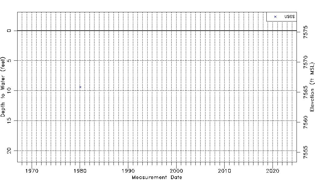
| Water-level Count | 1 |
| Water-level Date Range | 01/30/1980 thru 01/30/1980 |
| Monitored within the last 18 months | No, most recently on 01/30/1980 |
| Depth-to-Water Range (ft) | 9.38 to 9.38 |
| Water Table Elevation Range (ft NAVD88) | 7565.87 to 7565.87 |
| Water-Level-Source:Number-of-Measurements | USGSaguache Creek:1 |