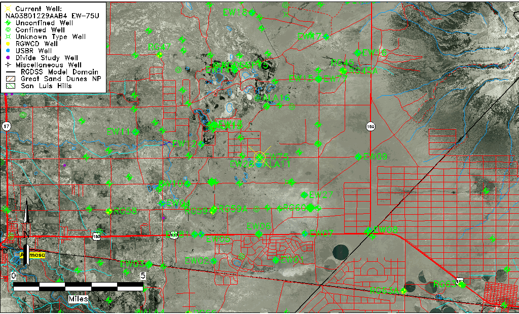
| Well Information Table |
|---|
| Common Well ID | NA03801229AAB4 EW-75U |
| USBR Well ID | EW75U |
| USGS Well ID | 373104105403804 |
| USGS Station Name | NA03801229AAB4 EW-75U |
| USGS Construction Date | 09/13/2002 |
| USGS Site Type | Well |
| USGS Site Use Information | Observation |
| USGS Groundwater Use Information | Unused |
| Data Source(s) | USGS, USBR |
| Location Data |
|---|
| TRS | NA03801229AAB4 EW-75U |
| USBR TRS | NA03801229AAB4 |
| USGS TRS 1 | NA03801229AAB4 EW-75U |
| Longitude/Latitude (NAD83) | -105.67973904 , 37.51803256 |
| Longitude/Latitude Data Source | USBOR EW well locations |
| USGS Longitude/Latitude (NAD83) | -105.6797390 , 37.51778259 |
| USBR Longitude/Latitude (NAD27) | -105.679166666878 , 37.5180277502275 |
| Easting, Northing RGDSS-NAD83 (US ft) | 198359.85 , 190075.07 |
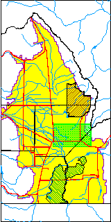
| USGS County | Alamosa County |
| USGS Map Name | DRY LAKES |
| USGS Map Scale | 24000 |
| Elevation and Depth Data |
|---|
| Ground Elevation (ft NAVD88) | 7549.62000000000 |
| Elevation Data Source | USBOR EW well database |
| USBR Ground Elevation (ft NGVD29) | 7545.5 |
| USGS Ground Elevation (ft NGVD29) | 7545.50 |
| 1/3-Arc Second NED Ground Elevation (ft NAVD88) | 7547.93 |
| 1-Arc Second NED Ground Elevation (ft NAVD88) | 7549.04 |
| SRTM Ground Elevation (ft NAVD88) | 7546.40 |
| Total Depth (ft) | 30.00 |
| USBR Total Depth (ft) | 30 |
| USGS Well Depth (ft) | 30.20 |
| Model Layer | 1 |
| Model Layer Source | Aquifer Type |
| Depth of Bottom of Layer 1 | 63 |
| Depth of Bottom of Layer 2 | 283 |
| Depth of Bottom of Layer 3 | 790 |
| Depth of Bottom of Layer 4 | 2422 |
| Additional Well Information | NONE |
| Aquifer Information |
|---|
| Aquifer Type | Unconfined |
| Aquifer Type Source | EW_AQFR |
| USGS Hydrologic Unit | San Luis |
| USGS Data Available | Discharge (GW.DISC) |
| Water-level Database Information |
|---|
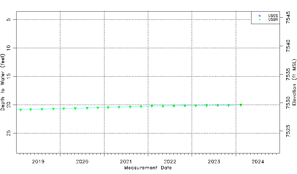
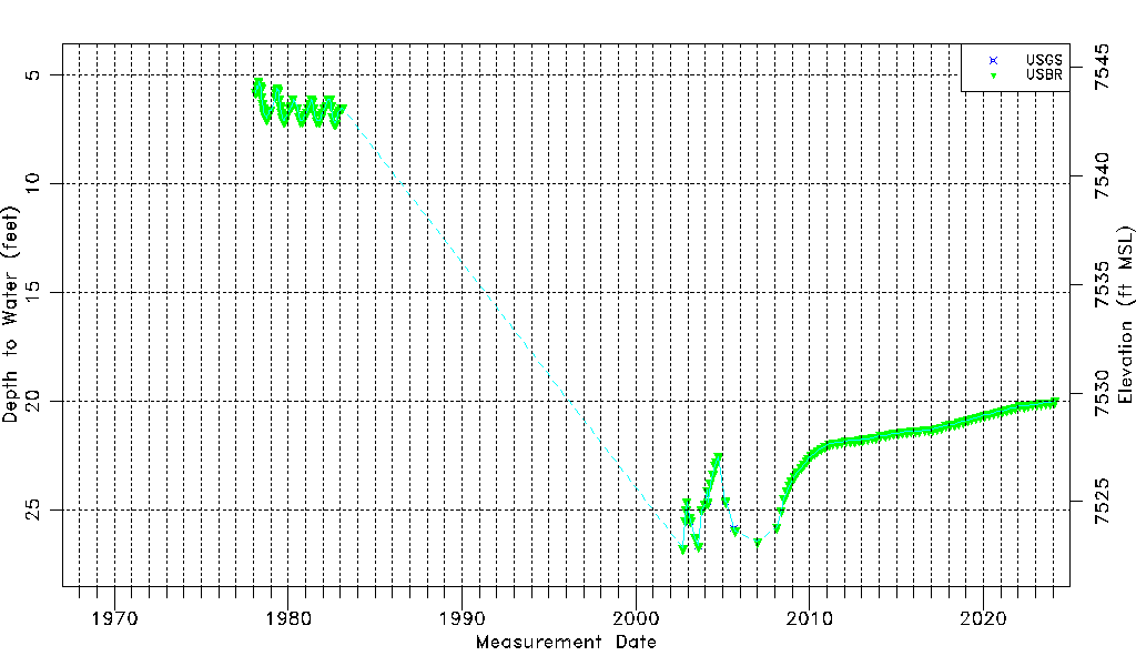
| Water-level Count | 166 |
| Water-level Date Range | 02/18/1978 thru 10/31/2023 |
| Monitored within the last 18 months | Yes, most recently on 10/31/2023 |
| Depth-to-Water Range (ft) | 5.30 to 26.76 |
| Water Table Elevation Range (ft NAVD88) | 7522.86 to 7544.32 |
| Water-Level-Source:Number-of-Measurements | USGS:6 USBR:163 |