| Well Information Table |
|---|
| Common Well ID | NA03801021BCB |
| USGS Well ID | 373110105533401 |
| USGS Station Name | NA03801021BCB |
| USGS Construction Date | 01/01/1964 |
| USGS Site Type | Well |
| USGS Site Use Information | Withdrawal of Water |
| USGS Groundwater Use Information | Irrigation |
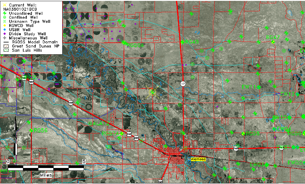
| Data Source(s) | USGS, Divide Study |
| Location Data |
|---|
| TRS | NA03801021BCB |
| USGS TRS 1 | NA03801021BCB |
| USGS TRS | NWSWNWS021T0038NR0010EN |
| Longitude/Latitude (NAD83) | -105.89420968 , 37.52724414 |
| Longitude/Latitude Data Source | Divide Study |
| USGS Longitude/Latitude (NAD83) | -105.8942166 , 37.52725340 |
| Easting, Northing RGDSS-NAD83 (US ft) | 136184.13 , 193505.51 |
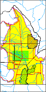
| USGS County | Alamosa County |
| Elevation and Depth Data |
|---|
| Ground Elevation (ft NAVD88) | 7557.46000000000 |
| Elevation Data Source | Divide study surveying by Davis Engineering |
| USGS Ground Elevation (ft NGVD29) | 7554.00 |
| 1/3-Arc Second NED Ground Elevation (ft NAVD88) | 7558.86 |
| 1-Arc Second NED Ground Elevation (ft NAVD88) | 7561.10 |
| SRTM Ground Elevation (ft NAVD88) | 7565.07 |
| Total Depth (ft) | 45.00 |
| USGS Well Depth (ft) | 45.00 |
| Model Layer | 1 |
| Model Layer Source | Aquifer Type |
| Depth of Bottom of Layer 1 | 64 |
| Depth of Bottom of Layer 2 | 532 |
| Depth of Bottom of Layer 3 | 831 |
| Depth of Bottom of Layer 4 | 2199 |
| Additional Well Information | Geohydrology, Construction |
| Aquifer Information |
|---|
| Aquifer Type | Unconfined |
| Aquifer Type Source | DIV_AQ |
| USGS Primary Aquifer | Cenozoic Erathem |
| USGS Aquifer Type | Unconfined Single Aquifer |
| USGS Hydrologic Unit | Alamosa-Trinchera |
| USGS Data Available | Water-level (GW.LEV) |
| Water-level Database Information |
|---|
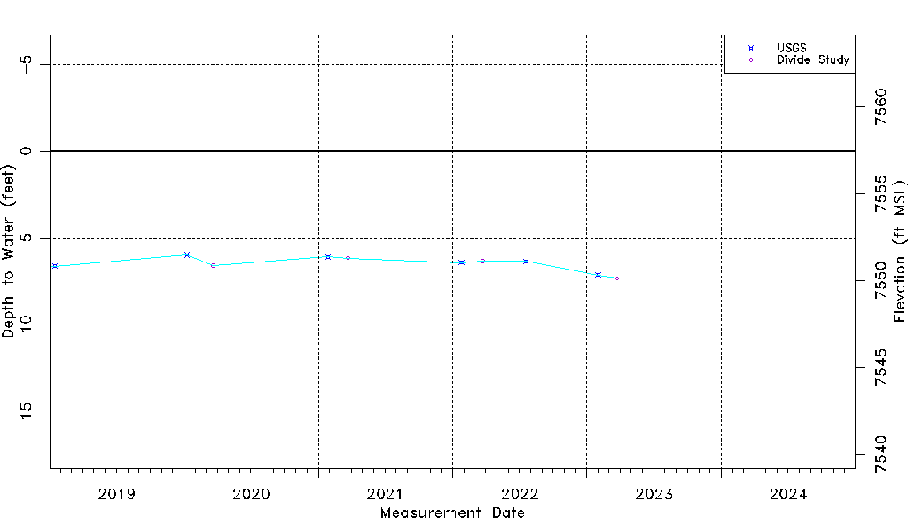
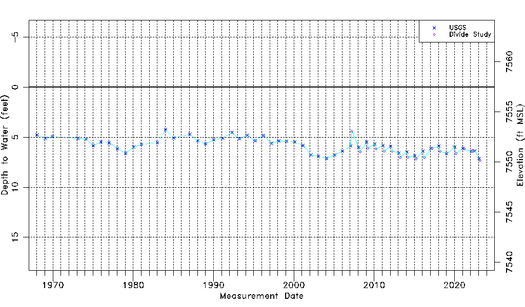
| Water-level Count | 69 |
| Water-level Date Range | 01/15/1968 thru 03/24/2023 |
| Monitored within the last 18 months | Yes, most recently on 03/24/2023 |
| Depth-to-Water Range (ft) | 4.25 to 7.34 |
| Water Table Elevation Range (ft NAVD88) | 7550.12 to 7553.21 |
| Water-Level-Source:Number-of-Measurements | USGS:53 Divide Study:16 |