| Well Information Table |
|---|
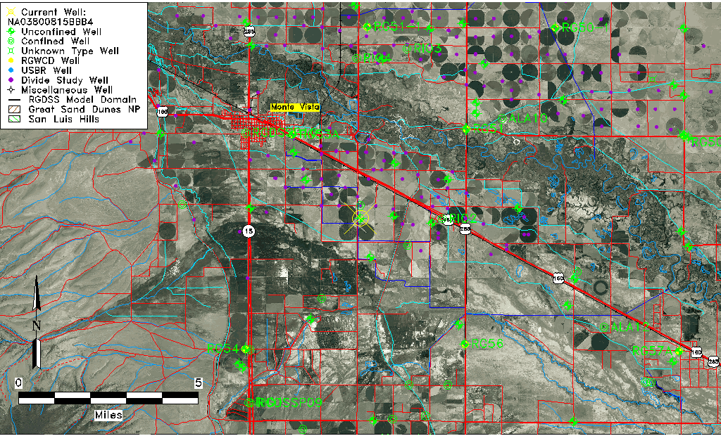
| Common Well ID | NA03800815BBB4 |
| USGS Well ID | 373220106053004 |
| USGS Station Name | NA03800815BBB4 |
| USGS Construction Date | 01/01/1963 |
| USGS Site Type | Well |
| USGS Site Use Information | Unused |
| USGS Groundwater Use Information | Unused |
| Data Source(s) | USGS |
| Location Data |
|---|
| TRS | NA03800815BBB4 |
| USGS TRS 1 | NA03800815BBB4 |
| USGS TRS | NWNWNWS015T0038NR0008EN |
| Longitude/Latitude (NAD83) | -106.09226058 , 37.54073085 |
| Longitude/Latitude Data Source | Davis Engineering Survey |
| USGS Longitude/Latitude (NAD83) | -106.0939717 , 37.54555858 |
| Easting, Northing RGDSS-NAD83 (US ft) | 78788.55 , 198612.41 |
| USGS Topography | Valley flat |
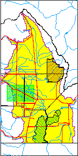
| USGS County | Rio Grande County |
| Elevation and Depth Data |
|---|
| Ground Elevation (ft NAVD88) | 7628.34000000000 |
| Elevation Data Source | USGS GWSI database |
| USGS Ground Elevation (ft NGVD29) | 7624.00 |
| 1/3-Arc Second NED Ground Elevation (ft NAVD88) | 7626.72 |
| 1-Arc Second NED Ground Elevation (ft NAVD88) | 7626.95 |
| SRTM Ground Elevation (ft NAVD88) | 7630.31 |
| Total Depth (ft) | 45.00 |
| USGS Well Depth (ft) | 45.00 |
| Model Layer | 1 |
| Model Layer Source | Well Depth |
| Depth of Bottom of Layer 1 | 51 |
| Depth of Bottom of Layer 2 | 157 |
| Depth of Bottom of Layer 3 | 431 |
| Depth of Bottom of Layer 4 | 2161 |
| Additional Well Information | Geohydrology, Construction |
| Aquifer Information |
|---|
| Aquifer Type | Unconfined |
| Aquifer Type Source | TD Elevation/Model Layer |
| USGS Primary Aquifer | Cenozoic Erathem |
| USGS Aquifer Type | Unconfined Single Aquifer |
| USGS Hydrologic Unit | Alamosa-Trinchera |
| USGS Data Available | Water-level (GW.LEV) |
| Water-level Database Information |
|---|
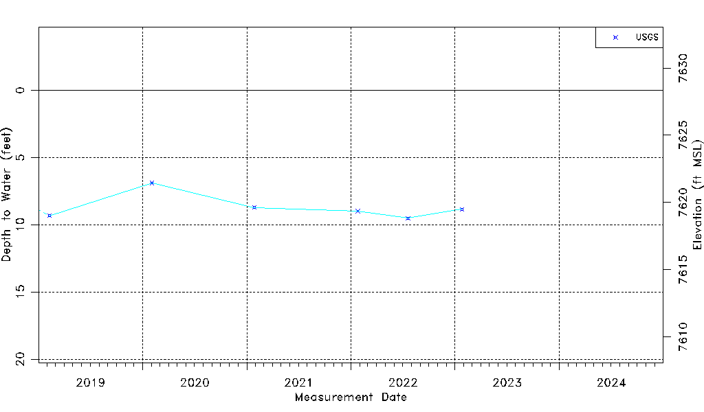
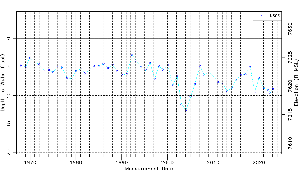
| Water-level Count | 55 |
| Water-level Date Range | 01/15/1968 thru 01/25/2023 |
| Monitored within the last 18 months | Yes, most recently on 01/25/2023 |
| Depth-to-Water Range (ft) | 2.93 to 12.62 |
| Water Table Elevation Range (ft NAVD88) | 7615.72 to 7625.41 |
| Water-Level-Source:Number-of-Measurements | USGS:55 |