| Well Information Table |
|---|
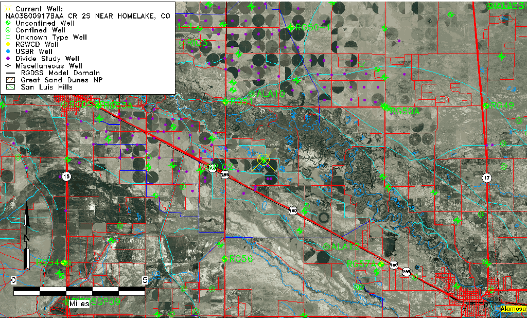
| Common Well ID | NA03800917BAA CR 2S NEAR HOMELAKE, CO |
| USGS Well ID | 373242106004501 |
| USGS Station Name | NA03800917BAA CR 2S NEAR HOMELAKE, CO |
| USGS Construction Date | 08/09/1993 |
| USGS Site Type | Well |
| USGS Site Use Information | Observation |
| USGS Groundwater Use Information | Unused |
| Data Source(s) | USGS |
| Location Data |
|---|
| TRS | NA03800917BAA CR 2S NEAR HOMELAKE, CO |
| USGS TRS 1 | NA03800917BAA CR 2S NEAR HOMELAKE, CO |
| USGS TRS | NENENWS 17T 38NR 9E |
| Longitude/Latitude (NAD83) | -106.01250000 , 37.54500000 |
| Longitude/Latitude Data Source | GWSI decimal LAT/LONG field |
| USGS Longitude/Latitude (NAD83) | -106.0125000 , 37.54500000 |
| Easting, Northing RGDSS-NAD83 (US ft) | 101913.94 , 200072.36 |
| USGS Topography | Valley flat |
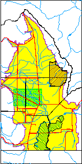
| USGS County | Alamosa County |
| USGS Map Name | HOMELAKE |
| USGS Map Scale | 2400 |
| Elevation and Depth Data |
|---|
| Ground Elevation (ft NAVD88) | 7598.15000000000 |
| Elevation Data Source | USGS GWSI database |
| USGS Ground Elevation (ft NGVD29) | 7594.00 |
| 1/3-Arc Second NED Ground Elevation (ft NAVD88) | 7596.90 |
| 1-Arc Second NED Ground Elevation (ft NAVD88) | 7596.56 |
| SRTM Ground Elevation (ft NAVD88) | 7601.71 |
| Total Depth (ft) | 18.45 |
| USGS Hole Depth (ft) | 20.00 |
| USGS Well Depth (ft) | 18.45 |
| Model Layer | 1 |
| Model Layer Source | Well Depth |
| Depth of Bottom of Layer 1 | 59 |
| Depth of Bottom of Layer 2 | 244 |
| Depth of Bottom of Layer 3 | 770 |
| Depth of Bottom of Layer 4 | 2110 |
| Additional Well Information | Logs, Geohydrology, Construction, Aquifer |
| Aquifer Information |
|---|
| Aquifer Type | Unconfined |
| Aquifer Type Source | TD Elevation/Model Layer |
| USGS Primary Aquifer | Cenozoic Erathem |
| USGS Aquifer Type | Unconfined Single Aquifer |
| USGS Hydrologic Unit | Alamosa-Trinchera |
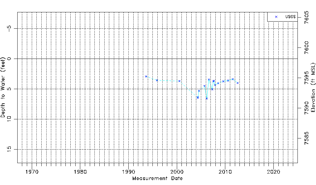
| USGS Data Available | Water-level (GW.LEV) |
| Water-level Database Information |
|---|
| Water-level Count | 19 |
| Water-level Date Range | 08/26/1993 thru 07/27/2012 |
| Monitored within the last 18 months | No, most recently on 07/27/2012 |
| Depth-to-Water Range (ft) | 2.93 to 6.58 |
| Water Table Elevation Range (ft NAVD88) | 7591.57 to 7595.22 |
| Water-Level-Source:Number-of-Measurements | USGSaguache Creek:19 |