| Well Information Table |
|---|
| Common Well ID | NA03800802CBB2 |
| USGS Well ID | 373340106042802 |
| USGS Station Name | NA03800802CBB2 |
| USGS Construction Date | 01/01/1955 |
| USGS Site Type | Well |
| USGS Site Use Information | Unused |
| USGS Groundwater Use Information | Unused |
| Data Source(s) | USGS |
| Location Data |
|---|
| TRS | NA03800802CBB2 |
| USGS TRS 1 | NA03800802CBB2 |
| USGS TRS | NWNWSWS002T0038NR0008EN |
| Longitude/Latitude (NAD83) | -106.07503497 , 37.56295270 |
| Longitude/Latitude Data Source | Davis Engineering Survey |
| USGS Longitude/Latitude (NAD83) | -106.0762210 , 37.56555820 |
| Easting, Northing RGDSS-NAD83 (US ft) | 83816.56 , 206679.72 |
| USGS Topography | Valley flat |
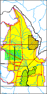
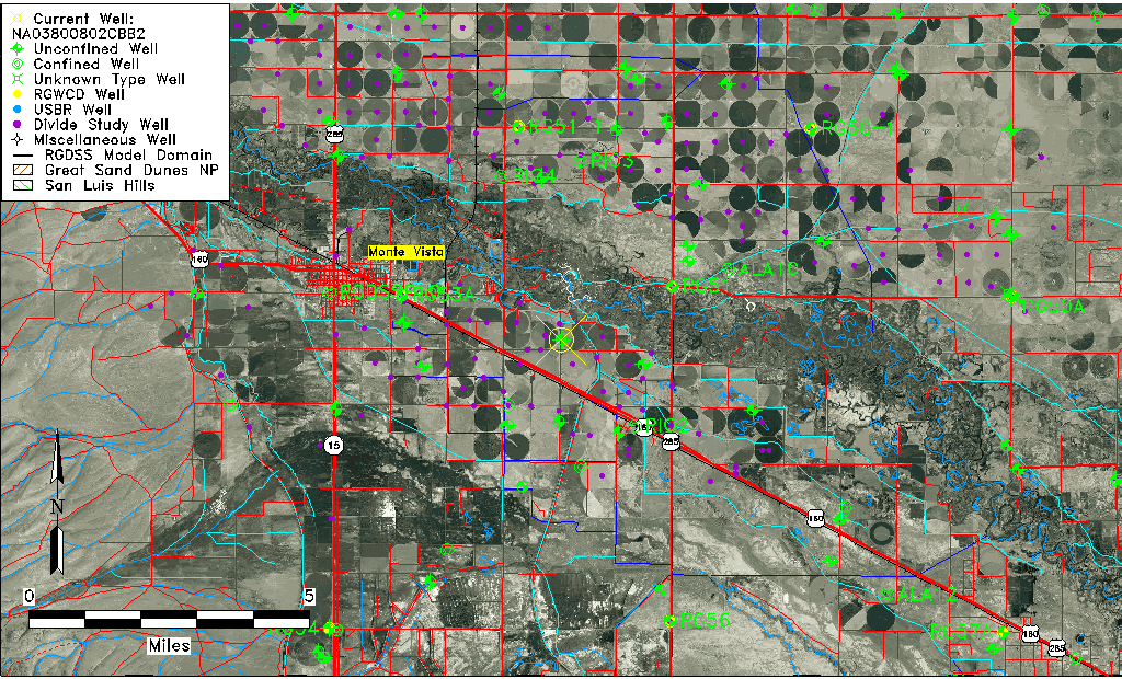
| USGS County | Rio Grande County |
| Elevation and Depth Data |
|---|
| Ground Elevation (ft NAVD88) | 7627.33000000000 |
| Elevation Data Source | USGS GWSI database |
| USGS Ground Elevation (ft NGVD29) | 7623.00 |
| 1/3-Arc Second NED Ground Elevation (ft NAVD88) | 7626.35 |
| 1-Arc Second NED Ground Elevation (ft NAVD88) | 7626.28 |
| SRTM Ground Elevation (ft NAVD88) | 7645.21 |
| Total Depth (ft) | 45.00 |
| USGS Well Depth (ft) | 45.00 |
| Model Layer | 1 |
| Model Layer Source | Well Depth |
| Depth of Bottom of Layer 1 | 55 |
| Depth of Bottom of Layer 2 | 157 |
| Depth of Bottom of Layer 3 | 537 |
| Depth of Bottom of Layer 4 | 2198 |
| Additional Well Information | Geohydrology, Construction |
| Aquifer Information |
|---|
| Aquifer Type | Unconfined |
| Aquifer Type Source | TD Elevation/Model Layer |
| USGS Primary Aquifer | Cenozoic Erathem |
| USGS Aquifer Type | Unconfined Single Aquifer |
| USGS Hydrologic Unit | Alamosa-Trinchera |
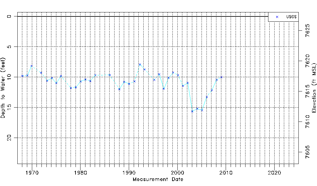
| USGS Data Available | Water-level (GW.LEV) |
| Water-level Database Information |
|---|
| Water-level Count | 36 |
| Water-level Date Range | 01/15/1968 thru 02/05/2009 |
| Monitored within the last 18 months | No, most recently on 02/05/2009 |
| Depth-to-Water Range (ft) | 7.91 to 15.67 |
| Water Table Elevation Range (ft NAVD88) | 7611.66 to 7619.42 |
| Water-Level-Source:Number-of-Measurements | USGSaguache Creek:36 |